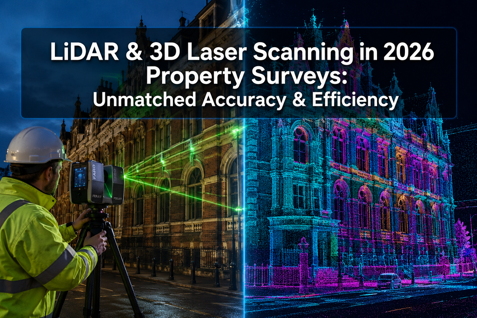

A single terrestrial laser scanner can now capture over two million data points per second — producing a complete 3D model of a building with accuracy down to ±1–2 mm [1]. That level of precision, once reserved for aerospace engineering, is now standard practice in property surveying. LiDAR and 3D Laser Scanning in 2026 Property Surveys: Achieving Unmatched Accuracy and Efficiency is not a future ambition — it is the current benchmark that separates leading surveyors from the rest.
This article compares the three dominant spatial data capture technologies — terrestrial LiDAR, GNSS RTK positioning, and drone-based laser scanning — and explains how combining them delivers results that traditional methods simply cannot match. Whether the project involves a listed building, a commercial development, or a complex residential site, understanding these tools is essential for anyone commissioning or delivering a high-precision survey in 2026.
Key Takeaways 📌
- Terrestrial laser scanners achieve point cloud accuracies of ±1.9 mm at 10 metres, far exceeding mobile alternatives [6]
- GNSS RTK integration anchors scan data to national coordinate systems with horizontal accuracy of ±10–20 mm [1]
- UAV-mounted LiDAR reduces survey time by 60–80% on large or complex sites [1]
- Real-time point cloud processing eliminates costly return visits by enabling on-site quality checks [1]
- Combining LiDAR with photogrammetry produces richer, more verifiable datasets than either method alone [7]
How LiDAR and GNSS RTK Compare for Spatial Data Capture
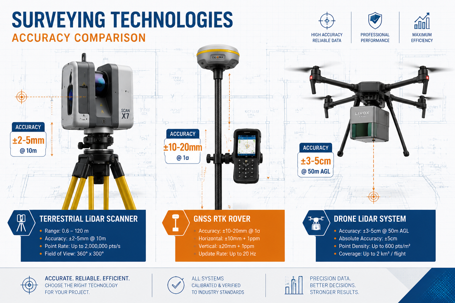
Choosing the right spatial data capture method depends on the project's accuracy requirements, site conditions, and budget. The three leading technologies each have distinct strengths.
Terrestrial Laser Scanning (TLS)
Terrestrial laser scanners work by emitting rapid pulses of laser light and measuring the time each pulse takes to return. In 2026, high-end TLS units achieve:
- Scan speeds exceeding 2,000,000 points per second [1]
- Range accuracies of ±1–2 mm at distances up to 350 metres [1]
- Point cloud accuracies of ±1.9 mm at 10 metres [6]
When multiple scan positions are registered together, global accuracy across an entire building reaches ±5 mm, verified through closed-loop traverse calculations [2]. This makes TLS the gold standard for detailed as-built surveys, heritage recording, and structural surveys where millimetre-level data matters.
💡 Pull Quote: "Terrestrial laser scanning delivers point cloud accuracy of ±1.9 mm at 10 metres — more than ten times more precise than consumer-grade mobile LiDAR systems." [6]
GNSS RTK Positioning
Global Navigation Satellite System Real-Time Kinematic (GNSS RTK) positioning provides the geographic anchor for scan data. Without it, a point cloud is a precise but locationless model. With it, every data point is tied to a national coordinate system.
| Metric | GNSS RTK Performance |
|---|---|
| Horizontal accuracy | ±10–20 mm |
| Vertical accuracy | ±20–30 mm |
| Real-time output | ✅ Yes |
| Works indoors | ❌ No |
Combining GNSS RTK with LiDAR is particularly powerful for boundary surveys and large-scale site mapping, where scan data must align precisely with legal title plans and Ordnance Survey coordinates [1].
Drone-Based LiDAR (UAV LiDAR)
UAV-mounted LiDAR sensors have transformed surveys of large, inaccessible, or complex sites. Key performance metrics in 2026:
- Vertical accuracy: ±3–5 cm [3]
- Horizontal accuracy: 2–5 cm [3]
- Time savings: 60–80% compared to ground-only methods [1]
While drone LiDAR is less precise than TLS at close range, it excels at capturing rooflines, large commercial estates, and sites with restricted ground access. It is especially valuable for roof surveys where physical access would otherwise require scaffolding.
Accuracy at a Glance 📊
| Technology | Best-Case Accuracy | Typical Use Case |
|---|---|---|
| Terrestrial LiDAR | ±1–2 mm | As-built, heritage, structural |
| GNSS RTK (standalone) | ±10–20 mm | Site control, boundary setting |
| Drone LiDAR | ±3–5 cm | Roofs, large sites, topography |
| Mobile LiDAR (e.g. Matterport) | ±20 mm at 10 m | Residential walkthroughs |
Automation Benefits: Why 2026 Is a Turning Point for LiDAR and 3D Laser Scanning in Property Surveys
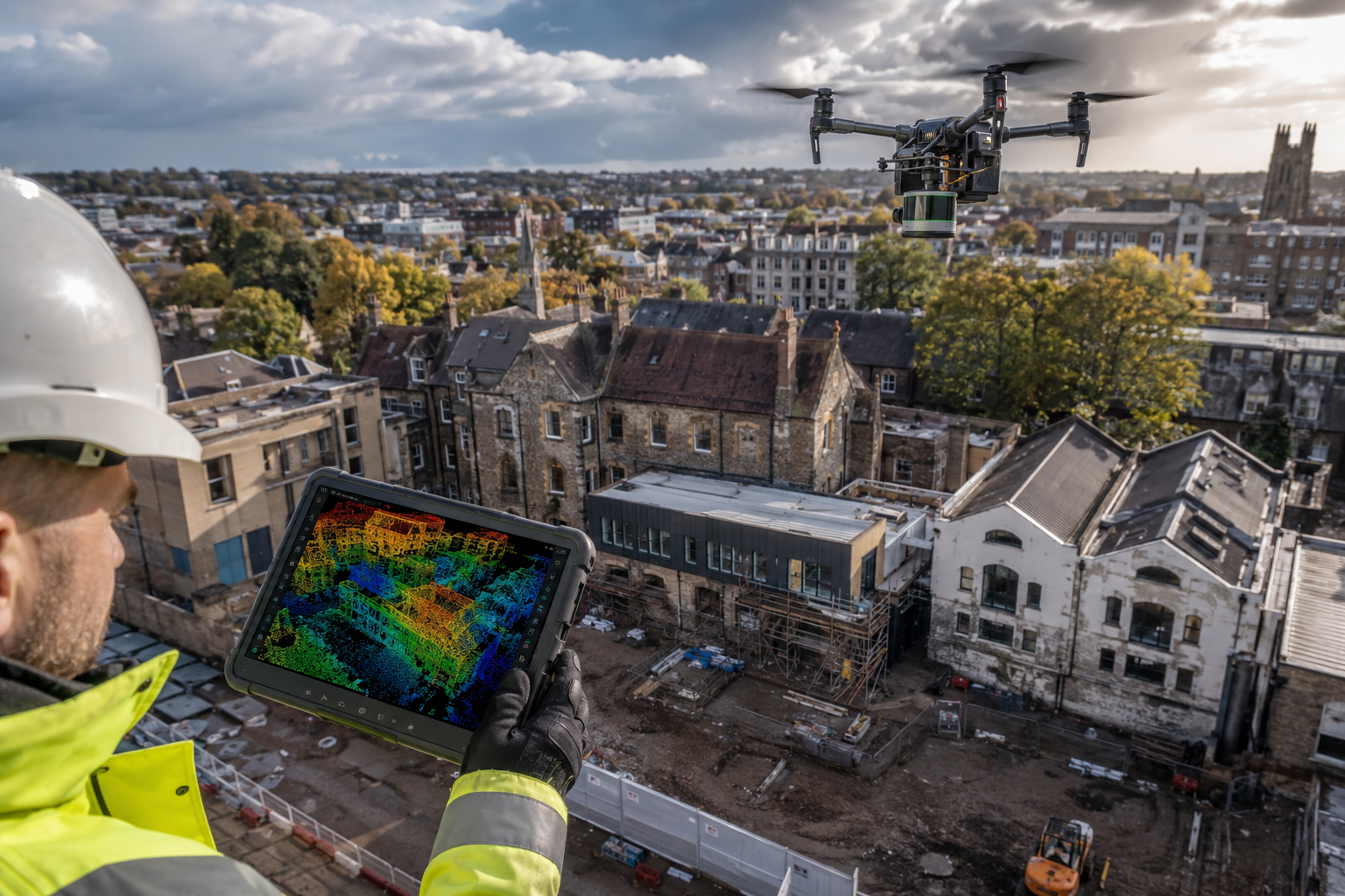
The hardware improvements in LiDAR equipment are significant — but the bigger story in 2026 is automation. Processing, registering, and delivering point cloud data has historically been time-consuming. That is changing fast.
Real-Time Point Cloud Processing
Modern field software now processes scan data on-site, as the survey progresses. Surveyors can check registration quality, identify gaps in coverage, and make decisions without returning to the office [1]. This eliminates one of the most expensive problems in traditional surveying: discovering a data gap after the equipment has been packed away.
Benefits of real-time processing include:
- ✅ Immediate quality assurance on-site
- ✅ Fewer return visits and associated costs
- ✅ Faster project delivery timelines
- ✅ Reduced risk of survey disputes
Combining LiDAR with Photogrammetry
Integrating LiDAR with photogrammetry — particularly using smartphone-based RTK systems — enhances both accuracy and efficiency [7]. Photogrammetry adds colour and texture to point clouds, making the final 3D model far more interpretable for clients, architects, and engineers. The combination is increasingly standard on commercial building surveys where detailed visual records are required alongside dimensional data.
Recent developments in 3D surveying methods confirm that this multi-sensor approach consistently outperforms single-technology workflows in both accuracy and completeness [8].
Mobile LiDAR: Convenient but Caveated
Mobile terrestrial LiDAR scanners — including handheld and trolley-mounted systems — have achieved vertical accuracies of approximately 4 mm in research settings [5]. This makes them useful for rapid data collection in complex indoor environments. However, they remain significantly less accurate than fixed TLS at equivalent distances [6].
⚠️ Important distinction: Consumer-grade mobile LiDAR (such as Matterport Pro3) achieves ±20 mm at 10 metres. Professional fixed TLS achieves ±1.9 mm at the same distance [6]. For surveys where accuracy underpins legal or structural decisions, this difference is critical.
Cost and Time Efficiency in Practice
The adoption of 3D laser scanning has enabled surveyors to complete large and complex projects more efficiently, reducing fieldwork time and associated costs [4]. On major commercial projects, the reduction in return visits alone can represent thousands of pounds in saved time.
For clients considering a building survey, understanding how LiDAR-enhanced workflows affect pricing and timelines is increasingly relevant. It is worth reviewing structural survey pricing to understand how technology investment is reflected in modern survey costs.
Best Practices for High-Precision LiDAR Projects in 2026
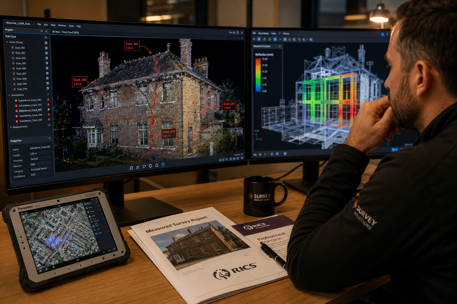
Achieving the accuracy figures cited above is not automatic. It requires careful planning, the right equipment combination, and rigorous quality control. The following best practices reflect current professional standards.
1. 🗺️ Establish a Robust Control Network First
Every high-precision LiDAR survey should begin with a GNSS RTK control network. This provides the coordinate framework that ties all scan positions together. Without it, even the most accurate point cloud is difficult to integrate with existing drawings, title plans, or BIM models.
2. 🔄 Use Closed-Loop Registration
When registering multiple scan positions, always close the loop — meaning the final scan position should overlap with the first. This allows any accumulated registration error to be detected and distributed evenly across the dataset. Global registration accuracy of ±5 mm is achievable with this approach [2].
3. 🚁 Deploy UAV LiDAR for Inaccessible Elements
For rooflines, high facades, and large site areas, drone-based LiDAR is both safer and faster than ground-based alternatives. Vertical accuracies of ±3–5 cm are sufficient for most topographic and roof condition assessments [3]. This is particularly relevant for monitoring surveys tracking structural movement over time.
4. 🔍 Validate with Independent Check Points
After registration, verify the point cloud against independently measured check points. This step confirms that the data meets the project's accuracy specification before it leaves the field. It is a non-negotiable step on any survey that will inform structural or legal decisions.
5. 📐 Match Technology to Purpose
Not every survey requires ±1 mm accuracy. A dilapidation survey documenting pre-existing defects may be well-served by mobile LiDAR, while a heritage recording or subsidence investigation demands the highest-precision TLS workflow. Matching the technology to the purpose avoids both under-specification and unnecessary cost.
6. 📁 Deliver Structured, Interoperable Data
Point cloud data should be delivered in formats compatible with the client's downstream workflows — typically .e57, .las, or .rcp for BIM integration. Structured delivery reduces processing time for architects and engineers and increases the survey's long-term value.
Technology Selection Summary
| Project Type | Recommended Technology |
|---|---|
| Heritage/as-built recording | Fixed TLS + GNSS RTK |
| Large commercial site | UAV LiDAR + TLS for detail areas |
| Roof condition assessment | UAV LiDAR |
| Boundary dispute | TLS + GNSS RTK |
| Structural monitoring | Fixed TLS (repeat surveys) |
| Rapid residential walkthrough | Mobile LiDAR (with caveats) |
The Broader Impact on Property Survey Practice
LiDAR and 3D Laser Scanning in 2026 Property Surveys: Achieving Unmatched Accuracy and Efficiency is reshaping not just how data is captured, but how surveys are used. Clients, solicitors, and engineers increasingly expect 3D deliverables — not just flat drawings. Point clouds can be revisited, re-measured, and interrogated long after the fieldwork is complete, reducing the need for repeat site visits.
This shift has direct implications for several survey types:
- RICS Home Surveys — LiDAR-enhanced surveys provide more defensible evidence of defects
- Expert witness work — 3D point clouds provide court-admissible spatial evidence
- Drainage surveys — Combined with CCTV, LiDAR maps drainage in full 3D context
The integration of LiDAR data with Building Information Modelling (BIM) platforms is also accelerating. A single high-quality scan campaign can feed structural analysis, energy modelling, planning applications, and facilities management — multiplying the return on the original survey investment.
Conclusion: Actionable Next Steps for Commissioners and Surveyors
The evidence is clear: LiDAR and 3D Laser Scanning in 2026 Property Surveys: Achieving Unmatched Accuracy and Efficiency is not marketing language — it is a measurable reality. Terrestrial laser scanning delivers millimetre-level accuracy. GNSS RTK anchors that data to the real world. UAV LiDAR cuts survey time dramatically on complex sites. And real-time processing means fewer delays and lower costs.
For property owners and developers:
- Ask surveyors specifically whether LiDAR or 3D scanning will be used, and what accuracy specification the survey will meet
- Request deliverables in interoperable formats (
.las,.e57,.rcp) to maximise long-term value - Consider LiDAR-enhanced surveys for any project involving structural decisions, heritage assets, or legal disputes
For surveyors and surveying practices:
- Invest in GNSS RTK integration to anchor all scan data to national coordinate systems
- Adopt real-time point cloud processing software to eliminate costly return visits
- Develop clear technology selection criteria matched to project type and accuracy requirements
- Explore how LiDAR data can enhance existing service lines, from RICS commercial building surveys to local chartered surveyor practice
The surveyors who master these tools in 2026 will not just deliver better data — they will deliver faster, safer, and more defensible surveys that clients cannot get anywhere else. That is a competitive advantage worth investing in.
References
[1] Lidar And 3d Laser Scanning Advanced Techniques For Precise Property Surveys – https://wimbledonsurveyors.com/lidar-and-3d-laser-scanning-advanced-techniques-for-precise-property-surveys/?utm_source=openai
[2] Technology – https://lidarasbuiltdrawings.com/technology/?utm_source=openai
[3] How Lidar Drone Mapping Works – https://scanm2.com/post/how-lidar-drone-mapping-works/?utm_source=openai
[4] Surveyor Shares Secrets To Cutting Costs Boosting Data Capture And Contracts – https://geospatial.trimble.com/blog/geospatial/en-US/article/surveyor-shares-secrets-to-cutting-costs-boosting-data-capture-and-contracts?utm_source=openai
[5] arxiv – https://arxiv.org/abs/2312.03254?utm_source=openai
[6] Matterport Vs Lidar Accuracy – https://iscano.com/real-world-applications-laser-scanning-lidar/matterport-vs-lidar-accuracy/?utm_source=openai
[7] Photogrammetry2 – https://www.lefixea.com/article/photogrammetry2?utm_source=openai
[8] 3d Survey3 – https://www.lefixea.com/article/3d-survey3?utm_source=openai