

By 2026, the construction and land development sectors account for nearly 40% of global carbon emissions — and regulators are responding with unprecedented force. Environmental compliance requirements have tightened across the UK, US, and EU, placing surveyors at the centre of a rapidly evolving landscape where ecological data capture, digital assessment tools, and regulatory alignment are no longer optional extras. They are core professional obligations.
Sustainability in Surveying: Using Tech to Assess Environmental Impacts and Regulations sits at the intersection of these pressures. Modern surveying practice now demands the ability to gather precise environmental data, interpret it through intelligent platforms, and translate findings into development decisions that satisfy both clients and regulators. This article examines the tools, frameworks, and strategies that define best practice in 2026.
Key Takeaways
- Stricter 2026 environmental regulations require surveyors to integrate ecological data capture into standard practice.
- Technologies including LiDAR, drone surveys, AI-powered analytics, and remote sensing are transforming how environmental impacts are assessed.
- RICS introduced a landmark global AI standard effective March 2026, mandating ethical governance of AI tools in surveying.
- Environmental Impact Assessments (EIA), Environmental Assessments (EA), and Best Available Technologies (BAT) requirements are legally binding frameworks surveyors must navigate.
- Sustainable development compliance is achievable through structured workflows that combine digital tools with professional accountability.
Why Environmental Regulations Are Reshaping Surveying in 2026
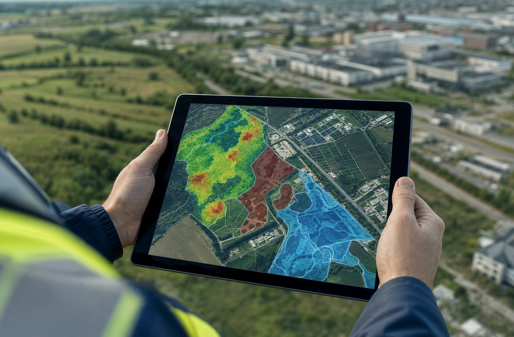
The regulatory environment governing land use, development, and ecological impact has grown significantly more demanding. In the UK, updated planning policy frameworks now require detailed environmental assessments earlier in the development lifecycle. In the US, the National Environmental Policy Act (NEPA) continues to govern federal actions, with the U.S. Geological Survey (USGS) applying categorical exclusions for activities such as aerial topographic and geophysical surveying to streamline compliance without compromising environmental scrutiny [2].
At the federal level, the Code of Federal Regulations mandates the use of Best Available Technologies (BAT) for any activity that could significantly affect safety, health, or the environment [6]. For surveyors, this means that outdated assessment methods are no longer defensible. Choosing the right technology is not just about efficiency — it is a legal and professional requirement.
The regulatory picture is further shaped by Environmental Impact Statements (EIS) and Environmental Assessments (EA). Under federal guidelines, an EIS must fully document the environmental consequences of proposed actions, covering purpose, alternatives, and mitigation measures [7]. An EA, meanwhile, is a shorter but equally rigorous process used to determine whether a full EIS is required, with clear requirements around public involvement and content [8].
For UK-based surveyors, professional conduct standards mirror this emphasis on public protection. Illinois Administrative Code, for example, requires that professional land surveyors sign and seal only documents that conform to accepted professional standards, prioritising public health, safety, and welfare [4]. This principle is universal: surveyors carry direct responsibility for the accuracy and environmental integrity of their assessments.
"Surveyors are no longer just measuring land — they are measuring risk, ecological value, and regulatory compliance simultaneously."
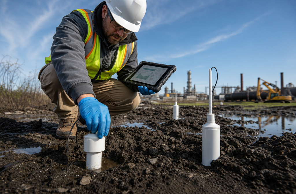
Understanding soil and water contamination is one area where this responsibility is most acute. Contaminated land assessments now feed directly into planning applications and environmental licensing decisions, making accurate data capture a legal necessity rather than a professional courtesy.
Tools for Ecological Data Capture and Environmental Forecasting
The transformation in sustainability in surveying: using tech to assess environmental impacts and regulations is most visible in the tools now available for ecological data capture. These technologies allow surveyors to gather richer datasets faster, with greater accuracy, and at lower environmental cost than traditional methods.
Drone and Aerial Survey Technology
Unmanned aerial vehicles (UAVs) have become indispensable for environmental surveying. Drone surveys can cover large areas of terrain in a fraction of the time required by ground-based teams, capturing high-resolution imagery, thermal data, and multispectral readings in a single flight. This makes them particularly valuable for:
- Mapping vegetation health and biodiversity indicators
- Identifying surface drainage patterns and flood risk zones
- Monitoring erosion and ground movement over time
- Capturing baseline ecological data before development begins
Drone-collected data feeds directly into Geographic Information Systems (GIS), where it can be layered against planning boundaries, protected habitat zones, and contamination records to produce comprehensive environmental profiles.
LiDAR and 3D Point Cloud Mapping
Light Detection and Ranging (LiDAR) technology generates highly detailed three-dimensional models of terrain, structures, and vegetation. In environmental surveying, LiDAR is used to:
- Assess ground subsidence risks — a service closely aligned with surveys for subsidence
- Map tree canopy cover and root protection zones
- Model surface water flow and flood inundation scenarios
- Detect underground voids and unstable ground conditions
The precision of LiDAR data enables environmental forecasting models to simulate the impact of development on drainage, habitat connectivity, and carbon sequestration — outputs that are increasingly required by planning authorities.
AI-Powered Environmental Analytics
The Royal Institution of Chartered Surveyors (RICS) launched a landmark global professional standard for the responsible use of artificial intelligence in surveying, effective March 9, 2026 [1]. This standard requires clear policies on data governance, AI system oversight, and risk management. Its introduction signals that AI is now a mainstream tool in professional surveying — not an experimental one.
AI platforms are being applied to environmental surveying in several ways:
| Application | Function | Benefit |
|---|---|---|
| Predictive contamination modelling | Analyses soil and groundwater data to forecast spread | Reduces remediation costs |
| Automated EIA screening | Flags regulatory triggers in planning data | Speeds up compliance review |
| Satellite change detection | Monitors land use change over time | Supports ongoing compliance monitoring |
| Carbon footprint calculation | Quantifies embodied carbon in development proposals | Supports net-zero planning |
The RICS AI standard mandates that surveyors maintain transparency about how AI tools influence their professional judgements [1]. This is particularly important in environmental assessments, where automated outputs must be verified against field observations and professional expertise.
Remote Sensing and Satellite Data
Satellite-based remote sensing platforms provide temporal datasets that allow surveyors to track environmental change across months and years. This is especially valuable for:
- Monitoring protected ecological sites adjacent to development zones
- Tracking soil moisture and drought stress indicators
- Assessing the cumulative environmental impact of multiple development sites
The European Commission's Interoperable Europe Portal notes that while ICT contributes between 2.1% and 3.9% of total greenhouse gas emissions, digital transformation has the potential to reduce total emissions by 15-20% [9]. For the surveying profession, this means that adopting digital tools carries a dual benefit: improving environmental assessment quality while also reducing the carbon footprint of the assessment process itself.

Strategies for Sustainable Development Compliance
Understanding the tools is only part of the challenge. Translating environmental data into compliant, sustainable development decisions requires structured workflows and a clear grasp of regulatory obligations. Sustainability in surveying: using tech to assess environmental impacts and regulations demands that professionals build compliance into every stage of the project lifecycle.
Integrating Environmental Assessment Early
One of the most effective strategies for sustainable development compliance is front-loading environmental assessment. Waiting until planning submission to identify ecological constraints is costly and often results in significant project delays. A proactive approach involves:
- Pre-application ecological screening using GIS layers and desktop data
- Baseline survey commissioning for protected species, habitats, and contamination
- Regulatory pre-consultation with local planning authorities and statutory consultees
- Environmental risk register development to track and mitigate identified impacts
This approach aligns with the EA procedural requirements under federal regulations, which emphasise early public involvement and iterative assessment [8]. In the UK context, it mirrors the requirements of the Town and Country Planning (Environmental Impact Assessment) Regulations.
For complex sites, a drainage survey forms a critical part of baseline environmental data collection, identifying existing drainage infrastructure, surface water flow paths, and potential contamination pathways before any ground disturbance occurs.
Building Surveys That Capture Environmental Condition
Sustainability considerations are not limited to greenfield or brownfield development. Existing buildings represent a significant portion of the UK's carbon footprint, and surveys that assess their environmental condition are increasingly important for compliance with energy performance regulations and retrofit requirements.
A thorough RICS building survey now routinely considers:
- Insulation levels and thermal performance
- Presence of hazardous materials (asbestos, lead paint)
- Drainage condition and surface water management
- Energy system efficiency and renewable energy potential
The EPA's updated Recommendations of Specifications, Standards, and Ecolabels for Federal Purchasing (October 2023) provide a useful framework for identifying environmentally preferable materials and services during the survey and specification process [3]. While these guidelines are directed at federal purchasers, they offer a practical reference for any surveyor advising on sustainable specification.
Electronic Document Compliance and Digital Workflows
Florida's Administrative Code provides a clear model for electronic document integrity in surveying, requiring that electronically transmitted surveys be signed, dated, and sealed by the responsible surveyor [5]. This standard is increasingly relevant across all jurisdictions as digital workflows replace paper-based processes.
Sustainable surveying practice in 2026 means:
- Maintaining auditable digital records of all environmental data collected
- Using cloud-based platforms that reduce physical document storage and associated carbon costs
- Ensuring data security and professional accountability for all electronically sealed documents
- Adopting standardised data formats that allow environmental data to be shared with planning authorities, ecologists, and engineers without duplication
Firms like Anderson Psomas have demonstrated how customised engineering and surveying solutions — particularly in environmental permitting and reclamation — can streamline the design and permitting process while maintaining full regulatory compliance [10]. Their integrated approach, combining field survey data with digital permitting workflows, offers a replicable model for sustainable practice.
Contamination and Subsidence: High-Risk Environmental Factors
Two environmental factors that consistently trigger regulatory scrutiny in development surveys are ground contamination and subsidence. Both require specialist assessment and both carry significant implications for development viability and environmental compliance.
Ground contamination surveys must assess the risk to human health, controlled waters, and ecological receptors. The results feed directly into planning conditions, remediation strategies, and long-term environmental monitoring requirements. Similarly, subsidence assessments must consider not only structural risk but also the environmental factors — such as tree root activity, clay shrinkage, and groundwater change — that drive ground movement.
A specific defect report can isolate and analyse individual environmental defects within a property or site, providing the targeted data needed to satisfy planning conditions or respond to regulatory queries without commissioning a full-scale assessment.
Professional Standards and Accountability in Environmental Surveying
Sustainability in surveying: using tech to assess environmental impacts and regulations is not purely a technical challenge. It is a professional conduct matter. Surveyors who produce environmental assessments bear legal and ethical responsibility for their accuracy and completeness.
The RICS AI standard introduced in March 2026 is explicit on this point: AI tools must be governed by clear policies, and professional judgement must remain central to all outputs [1]. This means surveyors cannot delegate accountability to algorithms. Every AI-generated environmental assessment must be reviewed, validated, and professionally endorsed by a qualified surveyor.
Professional accountability also extends to the selection of survey methodologies. Using outdated techniques when more accurate alternatives exist — particularly where BAT requirements apply [6] — may constitute professional negligence. Surveyors must stay current with technological developments and regulatory updates to fulfil their duty of care.
Key professional obligations in environmental surveying include:
- Transparency about the limitations of data and assessment methods
- Independence from commercial pressures that might compromise environmental findings
- Continuing professional development in environmental regulation and assessment technology
- Collaboration with ecologists, engineers, and planners to produce holistic assessments
For sites with complex regulatory histories or disputed environmental findings, an expert witness surveyor may be required to provide independent professional opinion in planning appeals or legal proceedings.
Conclusion
The convergence of stricter environmental regulations and powerful new survey technologies has fundamentally changed what it means to practise sustainably in 2026. Surveyors who embrace this shift — adopting drone technology, LiDAR, AI analytics, and structured compliance workflows — are better positioned to serve clients, satisfy regulators, and protect ecological value.
Actionable next steps for surveying professionals:
- Audit your current toolkit against BAT requirements and identify gaps in environmental data capture capability.
- Familiarise your team with the RICS Global AI Standard (effective March 2026) and establish internal governance policies for AI-assisted assessments.
- Build pre-application environmental screening into your standard project workflow to identify regulatory triggers early.
- Invest in digital document management systems that support electronic signing, sealing, and audit trails.
- Develop specialist knowledge in EIA, EA, and contaminated land assessment to meet the growing demand for integrated environmental surveying services.
- Engage with local planning authorities proactively to understand jurisdiction-specific environmental requirements before survey work begins.
Sustainability in surveying is not a future aspiration — it is a present-day professional standard. The tools exist. The regulations are in force. The question is whether surveying practices will adopt them systematically or risk falling behind a regulatory environment that will only become more demanding.
References
[1] Rics Launches Landmark Global Standard On Responsible Use Of Ai In Surveying – https://www.rics.org/news-insights/rics-launches-landmark-global-standard-on-responsible-use-of-ai-in-surveying?utm_source=openai
[2] About – https://www.usgs.gov/nepa/about?utm_source=openai
[3] Recommendations Specifications Standards And Ecolabels Federal Purchasing – https://www.epa.gov/greenerproducts/recommendations-specifications-standards-and-ecolabels-federal-purchasing?utm_source=openai
[4] Ill Admin Code Tit 68 Ss 1270 – https://www.law.cornell.edu/regulations/illinois/Ill-Admin-Code-tit-68-SS-1270.57?utm_source=openai
[5] Fla Admin Code Ann R 5j 17 062 – https://www.law.cornell.edu/regulations/florida/Fla-Admin-Code-Ann-R-5J-17-062?utm_source=openai
[6] law.cornell.edu – https://www.law.cornell.edu/cfr/text/15/971.604?utm_source=openai
[7] Part 1502 – https://www.law.cornell.edu/cfr/text/40/part-1502?utm_source=openai
[8] Section 1501 – https://ecfr.io/Title-40/Section-1501.5?utm_source=openai
[9] Ict Environmental Impact Rp 2026 – https://interoperable-europe.ec.europa.eu/collection/rolling-plan-ict-standardisation/ict-environmental-impact-rp-2026?utm_source=openai
[10] andersoneng – https://www.andersoneng.com/?utm_source=openai