The explosive growth of e-commerce has transformed the logistics landscape, creating unprecedented demand for massive warehouse complexes and strategically positioned last-mile delivery centers. Behind every successful logistics hub lies a critical foundation: comprehensive surveying that maps terrain, assesses flood risks, and designs efficient access routes. As companies race to expand their distribution networks in 2026, the need for rapid, accurate topographic surveys and site optimization has never been more urgent. This article explores the essential surveying tools, workflows, and strategic considerations that enable successful warehouse expansions and last-mile delivery site optimization in today's fast-paced logistics environment.
Key Takeaways
- Micro-fulfillment centers are replacing traditional centralized warehouses, requiring specialized surveying approaches for compact urban sites with unique access and drainage challenges
- Digital twin technology and AI-powered predictive analytics enable risk-free site planning and optimization before committing capital to warehouse expansion projects
- Topographic surveys, flood modeling, and access road alignments form the critical foundation for successful logistics hub development in an era of infrastructure constraints
- Regionalization strategies are driving warehouse network redesign, placing facilities closer to demand centers and requiring precise site selection based on comprehensive surveying data
- Last-mile delivery cost pressures make site optimization essential, with surveying playing a key role in identifying locations that minimize transportation expenses while maximizing service coverage
Understanding the Modern Logistics Landscape and Survey Requirements

The logistics industry has undergone a fundamental transformation driven by e-commerce growth and changing consumer expectations. Traditional centralized warehouse models are giving way to distributed networks of smaller, strategically positioned facilities designed to meet same-day and next-day delivery demands[1].
The Shift to Distributed Fulfillment Networks
Companies are moving away from national-average network designs toward regional sourcing and nearshoring strategies, with warehouses positioned closer to local demand centers[5]. This regionalization reflects efforts to reduce shipping times, lower transport costs, and improve supply chain resilience following recent global disruptions.
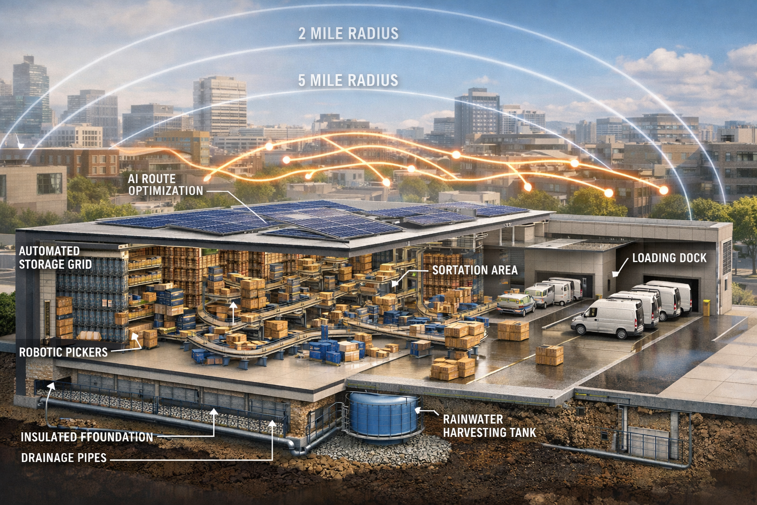
Micro-fulfillment centers are emerging as a primary expansion strategy, with manufacturers deploying small, automated warehouses close to urban customers to speed up delivery, reduce last-mile costs, and increase order flexibility[1]. These compact facilities present unique surveying challenges compared to traditional large-scale distribution centers.
Infrastructure Constraints Driving Survey Precision
Urban logistics expansion is encountering significant infrastructure challenges, particularly in Southeast and Midwest metro corridors, where capacity constraints could limit growth without additional public investment[6]. These bottlenecks make precise site selection and optimization critical.
Last-mile delivery costs continue their upward trajectory in 2026[3], making every aspect of site selection crucial for maintaining competitiveness. Proper surveying ensures that facilities are positioned to minimize transportation expenses while maximizing service coverage and operational efficiency.
Global Expansion Creating New Survey Demands
India, the Middle East, and Africa are experiencing significant warehousing growth in 2026, with developments emphasizing autonomy, sustainability, and multimodal integration capabilities[2]. These emerging markets present unique surveying challenges related to varying terrain conditions, infrastructure availability, and regulatory environments.
Understanding these market forces is essential for surveyors and logistics planners working on warehouse expansion and last-mile delivery site optimization projects. The right surveying approach can mean the difference between a successful facility and costly operational challenges.
Surveying Industrial Logistics Hubs: Essential Topographic Survey Techniques
Topographic surveys form the foundational layer of data for any warehouse expansion or last-mile delivery site development. These surveys capture the three-dimensional characteristics of a site, providing critical information about elevation changes, existing features, and potential challenges.
Core Topographic Survey Methodologies
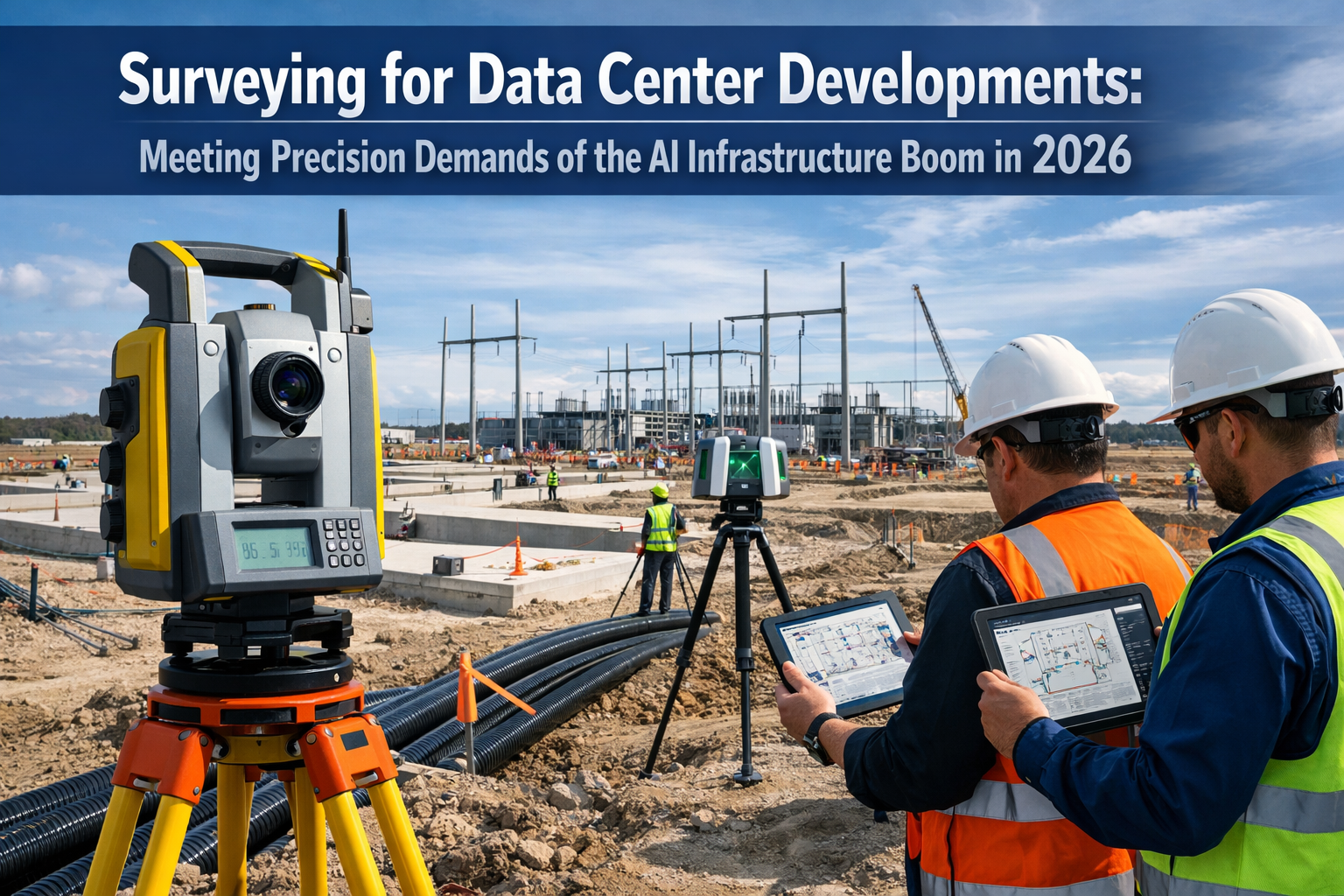
Total station surveying remains a cornerstone technique for logistics site assessment. These instruments combine electronic distance measurement with angular measurement to precisely determine the position of points across a site. For large warehouse complexes spanning dozens of acres, total stations provide the accuracy needed for foundation design and grading plans.
GPS/GNSS surveying has revolutionized large-site topographic mapping. Real-Time Kinematic (RTK) GPS systems can achieve centimeter-level accuracy while covering extensive areas quickly. For logistics parks that may span hundreds of acres, GPS surveying significantly reduces data collection time compared to traditional methods.
Drone-based photogrammetry has emerged as a game-changing technology for logistics site surveys. Unmanned aerial vehicles equipped with high-resolution cameras can capture thousands of overlapping images, which specialized software processes into detailed 3D terrain models, orthophotos, and contour maps. This approach is particularly valuable for:
- Initial site reconnaissance and feasibility studies
- Monitoring construction progress across multiple phases
- Surveying sites with difficult access or safety concerns
- Creating visual presentations for stakeholders
For more information on modern surveying approaches, explore our guide on drone surveys.
LiDAR Technology for Complex Sites
Light Detection and Ranging (LiDAR) technology provides unprecedented detail for logistics hub surveying. Airborne LiDAR can penetrate vegetation to reveal ground surfaces, making it ideal for greenfield sites with existing tree cover. Mobile LiDAR systems mounted on vehicles can rapidly survey access roads and perimeter areas.
LiDAR point clouds typically contain millions of data points, creating highly detailed 3D representations of terrain. This density of information supports:
- Precise volumetric calculations for cut-and-fill operations
- Detailed drainage analysis and watershed modeling
- Identification of subtle elevation changes that affect site grading
- Integration with Building Information Modeling (BIM) workflows
Establishing Survey Control Networks
Large logistics facilities require robust survey control networks to maintain accuracy across the entire site. Permanent control monuments provide reference points for construction layout, as-built surveys, and future expansion phases.
Best practices for control networks include:
- Establishing multiple control points distributed throughout the site
- Using high-accuracy GPS observations to determine monument positions
- Documenting control points with detailed descriptions and photographs
- Protecting monuments from construction damage with appropriate markers
- Maintaining control point databases for long-term reference
Professional surveyors understand that time invested in establishing proper control networks pays dividends throughout the project lifecycle. For those seeking expert surveying services, our team of local chartered surveyors brings extensive experience to logistics projects.
Boundary and Title Surveys
Before any warehouse expansion can proceed, clear understanding of property boundaries is essential. Boundary surveys identify property lines, easements, encroachments, and rights-of-way that may affect site development.
Title research combined with field surveying reveals potential issues such as:
- Utility easements that restrict building placement
- Access easements required for neighboring properties
- Setback requirements from property lines
- Potential boundary disputes requiring resolution
Addressing these issues early in the surveying process prevents costly delays and redesigns during construction.
Flood Modeling and Drainage Design for Warehouse Sites
Water management represents one of the most critical aspects of logistics hub development. Improper drainage can lead to flooding, foundation damage, operational disruptions, and environmental violations. Comprehensive flood modeling and drainage design are essential components of surveying industrial logistics hubs for warehouse expansions and last-mile delivery site optimization.
Hydrologic and Hydraulic Analysis
Hydrologic modeling determines how much stormwater a site will generate under various rainfall scenarios. Factors considered include:
- Watershed delineation: Identifying the total area that drains to and through the site
- Rainfall intensity: Using local precipitation data to model storm events of various return periods (10-year, 25-year, 50-year, 100-year storms)
- Runoff coefficients: Calculating how site development increases impervious surfaces and accelerates runoff
- Time of concentration: Determining how quickly water flows from the most distant point to the outlet
Hydraulic modeling analyzes how water moves across and through the site, including:
- Flow velocities in drainage channels and pipes
- Water surface elevations during peak flow events
- Capacity of existing and proposed drainage infrastructure
- Potential flooding areas and flood depths
Modern surveying workflows integrate topographic data directly into hydraulic modeling software, creating seamless analysis pipelines. Programs like HEC-RAS, SWMM, and various commercial platforms use survey-derived terrain models as the foundation for flood simulations.
Floodplain Mapping and Regulatory Compliance
Many potential warehouse sites lie partially or entirely within designated floodplains. FEMA flood maps provide initial guidance, but site-specific analysis often reveals more detailed flood risks.
Surveying for floodplain compliance includes:
- Determining base flood elevations (BFE) at specific site locations
- Identifying the 100-year floodplain boundaries
- Calculating finished floor elevations to meet or exceed BFE requirements
- Documenting floodway encroachments that may require permits
- Coordinating with local floodplain administrators
Warehouse facilities typically require finished floor elevations well above flood levels to protect valuable inventory and maintain operations during extreme weather events. Survey data provides the elevation benchmarks needed to design compliant facilities.
Stormwater Management System Design
Large warehouse complexes generate substantial stormwater runoff due to extensive roof areas and paved surfaces. Stormwater management systems must capture, treat, and release this runoff in compliance with environmental regulations.
Survey-based design considerations include:
Detention basins: Temporary storage areas that slow peak discharge rates. Surveyors provide topographic data to calculate storage volumes at various water levels and design outlet structures that release water at controlled rates.
Retention ponds: Permanent water features that provide storage, water quality treatment, and aesthetic benefits. Survey data determines pond depths, side slopes, and emergency spillway elevations.
Underground detention: Prefabricated chambers or pipes that store water beneath parking areas or landscaping. Precise elevation data ensures these systems function as designed while maintaining adequate cover.
Green infrastructure: Bioswales, rain gardens, and permeable pavement that manage runoff through infiltration. Topographic surveys identify areas with appropriate slopes and soil conditions for these features.
For sites with specific drainage concerns, specialized drainage surveys can identify existing conditions and inform system design.
Grading Plans and Earthwork Optimization
Efficient grading minimizes earthwork costs while achieving proper drainage. Cut-and-fill analysis based on topographic surveys determines:
- Volume of soil to be excavated (cut)
- Volume of fill material needed to raise areas
- Balance between cut and fill to minimize import/export costs
- Optimal building pad elevations that minimize earthwork
Advanced surveying software creates 3D terrain models of existing and proposed conditions, calculating earthwork quantities with high precision. This analysis often reveals opportunities to:
- Position buildings to balance cut and fill
- Use excavated material for berms or landscaping
- Identify borrow areas within the site
- Minimize hauling distances for earth moving
Positive drainage away from buildings is essential for warehouse facilities. Survey data ensures that finished grades slope away from foundations at appropriate rates, typically 2% minimum for paved areas and 3% minimum for landscaped areas.
Climate Resilience and Future Conditions
In 2026, forward-thinking logistics developers incorporate climate change projections into flood modeling and drainage design. Surveying industrial logistics hubs now includes consideration of:
- Increased rainfall intensity from more severe storm events
- Rising groundwater levels in coastal and low-lying areas
- More frequent flooding exceeding historical patterns
- Long-term facility resilience over 30-50 year operational lifespans
Survey data combined with climate models helps designers create facilities that remain operational under future conditions, protecting investments and maintaining supply chain reliability.
Access Road Design and Transportation Infrastructure Planning
Efficient transportation access is the lifeblood of any logistics facility. Warehouse expansions and last-mile delivery centers require carefully designed access roads that accommodate high volumes of truck traffic while maintaining safety and operational flow.
Traffic Analysis and Capacity Planning
Traffic impact studies begin with understanding existing conditions and projected increases from warehouse operations. Surveying supports this analysis by providing:
- Existing road geometry and intersection layouts
- Sight distance measurements at key decision points
- Turning radius requirements for design vehicles
- Queue storage analysis for truck staging areas
Large distribution centers may generate hundreds of truck trips daily, plus employee vehicle traffic. Survey data helps traffic engineers determine whether existing infrastructure can handle this load or requires expansion.
Geometric Design Standards for Truck Access
Design vehicle selection drives geometric requirements for access roads. Logistics facilities typically use WB-67 (tractor-trailer) or larger design vehicles, requiring:
- Lane widths: 12-14 feet minimum for truck lanes
- Turning radii: 45-50 feet minimum at intersections
- Vertical clearances: 14-16 feet minimum for overhead structures
- Grades: Maximum 8-10% to maintain truck performance
Surveyors provide the topographic foundation for designing roads that meet these standards. Horizontal and vertical alignment design requires precise elevation data to:
- Minimize steep grades that slow truck traffic
- Provide adequate sight distances for safe operations
- Design transitions between grade changes
- Calculate earthwork for road construction
Intersection Design and Traffic Control
Intersection geometry at warehouse entrances requires careful attention to accommodate truck turning movements. Survey data supports design of:
- Channelized right turns: Dedicated lanes with appropriate radii for trucks entering or exiting
- Left-turn storage: Adequate length for trucks waiting to turn without blocking through traffic
- Acceleration/deceleration lanes: Tapered sections allowing trucks to merge safely
- Roundabouts: Modern alternatives to signalized intersections that maintain traffic flow
Traffic signal timing for warehouse access intersections must account for truck acceleration characteristics. Surveying establishes the geometric parameters that traffic engineers use to calculate signal phases and timing.
Pavement Design and Structural Considerations
Heavy truck traffic demands robust pavement structures. Survey data informs pavement design by identifying:
- Subgrade conditions: Soil types and bearing capacity
- Groundwater levels: Potential for pavement damage from saturation
- Existing pavement condition: For expansion projects connecting to existing roads
- Drainage requirements: Subsurface drainage to protect pavement structure
Pavement thickness design accounts for expected truck volumes and weights over the design life. Surveyors provide elevation data for:
- Finished pavement surface grades
- Subgrade elevations
- Cross-slope requirements for drainage (typically 2% minimum)
- Transitions between different pavement sections
Multimodal Integration and Future Flexibility
Modern logistics hubs increasingly incorporate multimodal transportation options. Surveying industrial logistics hubs for warehouse expansions now considers:
- Rail access: Spur lines connecting to main rail corridors
- Autonomous vehicle infrastructure: Dedicated lanes or zones for self-driving delivery vehicles
- Bicycle and pedestrian facilities: Employee access and last-mile delivery integration
- Public transit connections: Bus stops or future transit station sites
Survey data provides the foundation for designing flexible transportation infrastructure that can adapt to evolving logistics technologies and methods. This forward-looking approach protects the long-term value of warehouse investments.
Understanding the broader context of commercial property surveying helps logistics developers appreciate how professional surveying supports successful projects.
Advanced Technologies Transforming Logistics Site Surveying
The convergence of digital technologies is revolutionizing how surveyors approach warehouse expansion and last-mile delivery site optimization. These innovations enable faster data collection, more accurate analysis, and better decision-making throughout project lifecycles.
Digital Twin Technology for Site Planning
Digital twins create virtual replicas of physical sites, allowing companies to simulate disruptions, test new warehouse configurations, and plan capacity without impacting real operations[1]. This capability has become essential for evaluating warehouse expansion sites and last-mile delivery locations before capital commitment.
For surveying applications, digital twins integrate:
- Topographic survey data as the base terrain model
- Existing and proposed building models
- Infrastructure elements (roads, utilities, drainage)
- Operational simulations (traffic flow, material handling)
- Environmental factors (flooding, sun exposure, wind)
Surveyors can test multiple site configurations virtually, comparing earthwork costs, drainage performance, and operational efficiency before finalizing designs. This risk-free experimentation identifies optimal solutions that might not be apparent from traditional 2D plans.
Real-time updates allow digital twins to evolve throughout construction. As-built survey data updates the model, ensuring it accurately reflects constructed conditions. This living model becomes a valuable asset for facility management and future expansion planning.
AI-Driven Demand Prediction and Site Selection
Artificial intelligence and machine learning now predict demand patterns, allowing companies to optimize warehouse locations and last-mile delivery sites with greater precision[1]. Surveying supports this process by providing the site-specific data that AI algorithms need to evaluate location options.
Predictive site selection combines:
- Demographic data and population density maps
- Transportation network analysis
- Delivery time modeling from candidate sites
- Real estate availability and cost data
- Survey-derived site characteristics (topography, constraints, development costs)
AI algorithms process these inputs to identify optimal locations that balance service coverage, delivery speed, and development costs. Surveyors provide critical input data and validate that recommended sites are physically suitable for development.
Demand forecasting helps right-size warehouse facilities. Rather than building excess capacity "just in case," AI-powered predictions enable more precise facility sizing based on projected order volumes. Survey data ensures that sites can accommodate both initial construction and potential future expansion.
Cloud-Based Data Management and Collaboration
Cloud computing enables real-time data access and centralized control for logistics operations, allowing companies to leverage predictive analytics for warehouse expansion planning and last-mile optimization across global operations[4].
For surveying workflows, cloud platforms provide:
- Centralized data repositories: All survey data, models, and deliverables accessible to project teams worldwide
- Version control: Automatic tracking of changes and updates to survey data
- Collaboration tools: Multiple team members working simultaneously on design and analysis
- Mobile access: Field crews uploading data directly from survey sites
- Integration capabilities: Seamless data exchange with design, engineering, and construction software
Survey data management in the cloud eliminates the delays and errors associated with transferring files between team members. Everyone works from the same current data set, reducing coordination problems and improving decision quality.
Automated Data Processing and Machine Learning
Modern surveying generates massive data sets—LiDAR scans may contain billions of points, and drone photogrammetry produces thousands of high-resolution images. Automated processing powered by machine learning accelerates data conversion into usable deliverables.
Machine learning algorithms can:
- Classify point clouds: Automatically identify ground points, vegetation, buildings, and other features
- Extract features: Recognize and map curbs, pavement edges, utility structures, and drainage features
- Generate contours: Create topographic maps from point cloud data
- Detect changes: Compare surveys over time to identify modifications
- Quality control: Flag potential errors or anomalies for human review
These automated workflows reduce the time from data collection to deliverable production, enabling faster project schedules. Surveyors focus their expertise on interpretation, quality assurance, and addressing complex situations rather than repetitive manual processing.
Unified Data Platforms and Supply Chain Visibility
Companies are adopting centralized digital platforms connecting suppliers, carriers, warehouses, and customers, with supply chain control towers providing single dashboards to manage inventory and exceptions across multiple sites[1]. This visibility supports more informed expansion and location optimization decisions.
Surveying data integrates into these platforms as a foundational layer, providing:
- Spatial context: Geographic locations of facilities, distribution zones, and service areas
- Site characteristics: Physical constraints, capacity limitations, and expansion potential
- Infrastructure status: Access routes, utilities, and supporting facilities
- Risk factors: Flood zones, environmental constraints, and regulatory considerations
When site survey data connects to operational data (inventory levels, order volumes, delivery times), logistics planners gain comprehensive insights for network optimization. This integration enables data-driven decisions about where to expand, how to configure facilities, and which sites to prioritize for investment.
For professionals seeking to understand the value of comprehensive surveying, learning about surveyor pricing and rates provides helpful context for budgeting logistics projects.
Sustainability and Environmental Considerations in Logistics Hub Surveying
Environmental stewardship has become a central concern for logistics facility development in 2026. Surveying industrial logistics hubs for warehouse expansions and last-mile delivery site optimization now incorporates sustainability considerations from the earliest planning stages.
Environmental Site Assessments
Phase I Environmental Site Assessments (ESAs) identify potential contamination concerns before property acquisition. While not traditional surveys, these investigations often work hand-in-hand with surveying to:
- Map locations of underground storage tanks
- Identify areas of soil staining or stressed vegetation
- Document historical uses that may have contaminated soil or groundwater
- Guide sampling locations for Phase II investigations
Phase II ESAs involve soil and groundwater sampling to quantify contamination levels. Surveyors provide precise locations for sampling points and establish elevation benchmarks for monitoring well installation. For sites with contamination issues, our soil and water contamination services provide specialized expertise.
Wetland Delineation and Protected Habitat Mapping
Many potential warehouse sites contain wetlands or other environmentally sensitive areas requiring protection. Wetland delineation combines biological, hydrological, and soil science with surveying to:
- Establish precise wetland boundaries
- Calculate wetland areas and buffer zones
- Design site layouts that avoid or minimize impacts
- Support permit applications for unavoidable impacts
Survey-grade GPS equipment provides the accuracy needed for regulatory wetland mapping. Delineated boundaries become permanent features in site plans, ensuring construction activities respect protected areas.
Habitat surveys for protected species may also require precise mapping. Survey data documents:
- Locations of protected trees or vegetation
- Nesting sites or critical habitat areas
- Exclusion zones during sensitive periods
- Mitigation areas for habitat restoration
Sustainable Site Design and Green Infrastructure
Low Impact Development (LID) principles minimize environmental impacts through site design. Surveying supports LID by identifying opportunities for:
- Preserving natural drainage patterns: Maintaining existing flow paths reduces downstream impacts
- Protecting existing vegetation: Surveying high-value trees and vegetation guides site layout
- Minimizing impervious surfaces: Precise grading allows efficient layouts with less pavement
- Incorporating green infrastructure: Topographic analysis identifies locations suitable for bioswales, rain gardens, and infiltration basins
Solar panel installations on warehouse roofs require structural surveys to verify roof capacity. Our engineer calculations for solar panel roofs ensure safe, code-compliant installations that support sustainability goals.
Carbon Footprint Reduction Through Optimal Site Selection
The location of warehouse facilities directly impacts transportation emissions. Sites closer to customers reduce last-mile delivery distances, cutting fuel consumption and carbon emissions. Surveying supports carbon-conscious site selection by providing data for:
- Service area modeling: Calculating delivery distances from candidate sites
- Transportation network analysis: Identifying locations with efficient access to highways and arterials
- Multimodal opportunities: Mapping proximity to rail, ports, or other low-carbon transport options
- Future transit connections: Anticipating public transportation expansion for employee access
Embodied carbon in construction materials represents another consideration. Survey-based earthwork optimization reduces the carbon footprint of site development by:
- Minimizing soil import/export and associated truck trips
- Identifying on-site materials suitable for reuse
- Reducing over-excavation and waste
- Optimizing building placement to minimize foundation requirements
Regulatory Compliance and Permitting
Environmental regulations increasingly shape warehouse development. Surveying provides essential documentation for:
- Stormwater permits: Topographic surveys, drainage plans, and erosion control designs
- Wetland permits: Delineation surveys and impact calculations
- Floodplain development permits: Elevation certificates and hydraulic analysis
- Air quality permits: Site layouts showing equipment locations and setbacks
- Noise assessments: Mapping sensitive receptors and modeling sound propagation
Post-construction monitoring often requires ongoing surveying to verify compliance with permit conditions. As-built surveys document that facilities were constructed as approved, and monitoring surveys track performance of environmental features like stormwater basins and wetland mitigation areas.
Best Practices for Surveying Industrial Logistics Hubs
Successful warehouse expansion and last-mile delivery site optimization projects follow established best practices that maximize efficiency, minimize costs, and reduce risks.
Early Engagement and Feasibility Studies
Pre-acquisition surveys provide critical information for property purchase decisions. Before committing to a site, developers should obtain:
- Preliminary topographic surveys showing major features and constraints
- Boundary surveys confirming property limits and available area
- Utility surveys identifying existing services and connection points
- Environmental reconnaissance identifying potential red flags
This early information allows realistic feasibility assessment and informed negotiation. Discovering major constraints after purchase can derail projects or require expensive redesigns.
Concept-level planning uses preliminary survey data to test development scenarios. Quick analysis determines whether a site can accommodate required building sizes, parking areas, and truck circulation. Sites that fail this initial test can be eliminated before investing in detailed surveys.
Comprehensive Scope Definition
Clear scope of work documents prevent misunderstandings and ensure surveyors deliver needed information. Effective scopes specify:
- Survey area limits and accuracy requirements
- Required deliverables (maps, digital terrain models, cross-sections)
- Coordinate systems and vertical datums
- Feature identification requirements (utilities, vegetation, structures)
- Schedule requirements and milestone dates
- Quality control procedures and acceptance criteria
Involving surveyors in scope development ensures requirements are realistic and complete. Experienced surveyors can suggest additional information that may prove valuable during design and construction.
Quality Control and Verification
Independent checks catch errors before they impact design and construction. Quality control procedures include:
- Redundant measurements: Critical points measured by multiple methods
- Closure checks: Traverse loops and GPS network adjustments verified for acceptable error
- Benchmark verification: Elevations checked against multiple reference points
- Digital model validation: Spot-checking terrain model elevations against field measurements
- Peer review: Senior surveyors reviewing work before delivery
As-built surveys during and after construction verify that facilities match design intent. These surveys document:
- Finished floor elevations
- Drainage structure locations and inverts
- Pavement grades and cross-slopes
- Building locations relative to property lines
- Utility connection points
As-built information becomes the foundation for facility management and future expansion planning.
Technology Integration and Data Standards
Interoperable data formats enable seamless information exchange between project team members. Surveyors should deliver data in formats compatible with:
- Civil engineering design software (AutoCAD Civil 3D, Bentley, etc.)
- Building Information Modeling (BIM) platforms
- Geographic Information Systems (GIS)
- Hydraulic modeling software
- Construction equipment machine control systems
Standardized coordinate systems prevent the errors that occur when different team members work in different reference frames. Projects should establish:
- Horizontal datum (State Plane, UTM, or project-specific)
- Vertical datum (NAVD88, local benchmark network)
- Units (feet or meters)
- Precision requirements for different project elements
Data management protocols define how survey information is stored, accessed, and updated throughout project lifecycles. Cloud-based platforms with version control and access permissions ensure teams work from current, accurate data.
Coordination with Specialized Consultants
Complex logistics projects involve multiple specialized consultants. Surveyors coordinate with:
- Geotechnical engineers: Providing boring locations and elevations for subsurface investigation
- Civil engineers: Supplying topographic data for grading and drainage design
- Structural engineers: Establishing building benchmarks and monitoring settlement
- Environmental consultants: Mapping wetlands, sampling locations, and protected areas
- Traffic engineers: Documenting existing road geometry and sight distances
- Landscape architects: Providing topography for site planning and planting design
Regular coordination meetings ensure all consultants have the information they need and identify data gaps before they delay progress. Surveyors often serve as the foundation for other consultants' work, making early and complete survey delivery critical to project schedules.
For those evaluating different survey types, understanding the difference between Level 2 and Level 3 surveys provides helpful context, though logistics projects typically require specialized commercial surveys.
Case Study Applications: Real-World Logistics Hub Surveying
Examining specific applications illustrates how surveying industrial logistics hubs strategies come together in practice.
Large-Scale Distribution Center Expansion
A major e-commerce retailer needed to expand an existing 500,000 square-foot distribution center by adding 300,000 square feet plus additional truck parking and employee parking.
Survey challenges included:
- Active operations requiring surveys around ongoing truck traffic
- Existing drainage system requiring integration with expansion
- Adjacent wetlands requiring precise delineation and buffer mapping
- Limited site area requiring optimal building placement
Survey approach:
- Boundary survey verified available expansion area and identified utility easements
- Topographic survey using GPS and total station captured existing conditions including pavement, drainage structures, and vegetation
- Wetland delineation established protected areas and buildable zones
- Utility survey using ground-penetrating radar and electromagnetic locating documented underground services
- Control network established permanent monuments for construction layout
Results:
Survey data enabled the design team to position the expansion building to:
- Maximize usable floor area within available space
- Tie into existing drainage system with minimal modifications
- Maintain required wetland buffers
- Preserve mature trees along the property perimeter
- Balance cut and fill earthwork, eliminating the need to import or export soil
The project completed on schedule and within budget, with the facility operational and serving customers throughout construction.
Urban Micro-Fulfillment Center Network
A grocery delivery service needed to establish a network of micro-fulfillment centers across a metropolitan area to enable two-hour delivery windows.
Survey challenges included:
- Multiple small urban sites (1-3 acres each) with existing buildings
- Tight access for delivery vehicles in dense neighborhoods
- Existing utilities requiring careful documentation
- Flood risks in low-lying urban areas
Survey approach:
- Site reconnaissance using drones provided rapid initial assessment of candidate sites
- Measured building surveys documented existing structures for conversion to fulfillment centers
- Topographic surveys captured parking areas, access drives, and drainage features
- Flood elevation certificates determined base flood elevations and first-floor heights
- Traffic sight distance surveys verified safe truck access at street connections
Results:
Survey data allowed the delivery service to:
- Eliminate sites with inadequate truck access or severe flood risks
- Prioritize sites with existing buildings suitable for conversion
- Design efficient loading zones within constrained urban lots
- Obtain necessary permits for change of use and site modifications
- Optimize the geographic distribution of facilities to maximize service coverage
The network launched successfully, meeting delivery time commitments while minimizing real estate and development costs.
Last-Mile Delivery Hub with Autonomous Vehicle Integration
A logistics technology company developed a last-mile delivery hub designed to support both conventional delivery vans and autonomous delivery robots.
Survey challenges included:
- Greenfield site requiring complete infrastructure design
- Integration of charging stations for electric vehicles
- Dedicated zones for autonomous vehicle operations
- Stormwater management for large paved areas
Survey approach:
- Topographic survey using LiDAR captured detailed terrain across the 15-acre site
- Geotechnical boring locations surveyed to support foundation and pavement design
- Drainage basin design based on hydraulic modeling using survey-derived terrain
- Access road design incorporating dedicated autonomous vehicle lanes
- Digital twin development integrating survey data for operational simulation
Results:
The comprehensive survey approach enabled:
- Optimized site grading that balanced cut and fill
- Drainage system design that met regulatory requirements without oversizing
- Safe integration of autonomous and human-driven vehicles
- Infrastructure placement supporting future technology evolution
- Accurate cost estimating and construction bidding
The facility became a showcase for next-generation logistics operations, demonstrating how proper surveying supports innovation.
Future Trends in Logistics Hub Surveying

The surveying profession continues to evolve alongside logistics industry transformations. Several trends will shape surveying industrial logistics hubs strategies in the coming years.
Increased Automation and Robotics
Robotic surveying systems are automating repetitive tasks. Autonomous total stations can track prisms without operator intervention, and robotic rovers can conduct GPS surveys with minimal human supervision. These systems promise:
- Faster data collection with smaller field crews
- Continuous monitoring of construction sites
- Real-time deviation detection during building construction
- Reduced safety risks in hazardous environments
Warehouse robotization is accelerating, with robotic systems automating packing, palletizing, and picking[1]. When connected with AI and machine learning, these systems learn from operational data and continuously improve performance. Surveyors will increasingly provide precise floor flatness specifications and as-built verification to ensure robotic systems function optimally.
Integration with Building Information Modeling
BIM workflows are expanding from building structures to encompass entire sites. Surveyors will increasingly deliver data directly into BIM environments, where it integrates with:
- Architectural models of buildings
- Structural engineering designs
- MEP (mechanical, electrical, plumbing) systems
- Civil infrastructure (roads, utilities, drainage)
Scan-to-BIM processes convert laser scan data into intelligent 3D models. For warehouse renovations and expansions, this technology captures existing conditions with unprecedented detail, enabling precise design integration.
Sustainability Metrics and Carbon Accounting
Environmental impact quantification will become standard in surveying deliverables. Clients will request data supporting:
- Carbon footprint calculations for earthwork operations
- Embodied carbon in construction materials
- Energy efficiency analysis based on building orientation and solar exposure
- Stormwater quality treatment performance predictions
Surveyors will expand their expertise to provide environmental metrics alongside traditional geometric data.
Resilience Planning for Climate Change
Climate adaptation will drive surveying requirements as logistics companies plan for changing conditions. Future surveys will incorporate:
- Sea level rise projections for coastal facilities
- Updated flood frequency analysis reflecting climate trends
- Extreme heat considerations for pavement and building design
- Drought resilience for landscaping and stormwater features
Long-term monitoring programs will track site performance over decades, with periodic surveys documenting changes and informing adaptive management strategies.
Expanded Use of Artificial Intelligence
AI-powered analysis will transform how survey data informs decisions. Machine learning algorithms will:
- Predict optimal warehouse locations based on demographic trends
- Recommend site layouts that maximize operational efficiency
- Identify potential problems in survey data before they impact design
- Automate routine design tasks based on survey inputs
Surveyors will evolve from data collectors to data strategists, focusing on interpreting AI recommendations and applying professional judgment to complex situations.
Conclusion: Building the Foundation for Logistics Success
Surveying industrial logistics hubs for warehouse expansions and last-mile delivery site optimization represents a critical foundation for supply chain success in 2026 and beyond. As e-commerce continues its explosive growth and consumer expectations for rapid delivery intensify, the importance of comprehensive, accurate surveying cannot be overstated.
Professional surveying provides the essential data that enables informed decision-making throughout project lifecycles—from initial site selection through design, construction, and ongoing operations. Topographic surveys, flood modeling, drainage design, and access road planning form interconnected elements of successful logistics facility development.
Technology is transforming surveying workflows, with drones, LiDAR, GPS, and digital twins accelerating data collection and analysis. Cloud-based platforms and AI-powered tools enable surveyors to deliver insights, not just measurements. These innovations make surveying faster, more accurate, and more valuable to logistics developers facing tight schedules and competitive pressures.
Sustainability and resilience have become central considerations, with surveys supporting environmental compliance, carbon reduction, and climate adaptation. The logistics facilities being designed today must perform reliably for decades under changing conditions, making forward-thinking surveying essential.
Actionable Next Steps
For logistics developers, warehouse operators, and supply chain professionals planning facility expansions or new last-mile delivery sites:
- Engage surveyors early in site selection and feasibility analysis to identify constraints and opportunities before committing capital
- Invest in comprehensive surveys that capture topography, boundaries, utilities, environmental features, and access conditions—incomplete data leads to costly surprises
- Embrace digital technologies including digital twins, AI-powered analysis, and cloud-based collaboration platforms that maximize the value of survey data
- Prioritize sustainability by requesting survey deliverables that support environmental compliance, carbon reduction, and long-term resilience
- Plan for the future by ensuring survey data supports potential expansions, technology upgrades, and operational changes over facility lifespans
For those seeking professional surveying expertise, partnering with experienced chartered surveyors ensures projects benefit from industry best practices and cutting-edge capabilities.
The logistics landscape continues evolving at unprecedented speed, driven by e-commerce growth, technological innovation, and changing consumer expectations. Success in this dynamic environment requires solid foundations—and those foundations begin with professional surveying that captures the physical reality of sites and enables data-driven decisions. By understanding and implementing the strategies outlined in this article, logistics professionals can optimize warehouse expansions and last-mile delivery sites for operational excellence, cost efficiency, and long-term success.
The future of logistics belongs to organizations that combine strategic vision with meticulous execution. Comprehensive surveying provides the critical link between ambitious goals and successful implementation, transforming concepts into operational facilities that serve customers, support sustainability, and deliver competitive advantage.
References
[1] Manufacturing Cpg Logistics Trends 2026 – https://ortec.com/en-us/insights/manufacturing-cpg-logistics-trends-2026
[2] Complete Guide To Logistics Trends For 2026 – https://www.maersk.com/insights/integrated-logistics/2026/02/03/complete-guide-to-logistics-trends-for-2026
[3] supplychaindive – https://www.supplychaindive.com/news/2026-logistics-outlook-ai-bankruptcies-ocean-air-last-mile-rail-trucking-operational-volatility/810429/
[4] Global Supply Chain Trends In Logistics – https://www.transvirtual.com/us/blog/global-supply-chain-trends-in-logistics/
[5] 2026 Freight Market Trends – https://www.ryder.com/en-us/insights/blogs/transportation/2026-freight-market-trends
[6] Charting The Course The 2026 Transportation Industry Outlook – https://mynatsa.org/charting-the-course-the-2026-transportation-industry-outlook/