{"cover":"Professional landscape format (1536×1024) hero image featuring bold text overlay 'GIS Integration for Surveyors: Overlaying Data Layers to Optimize Land Use Planning' in extra large 72pt white sans-serif font with dark shadow and semi-transparent navy overlay box, positioned in upper third. Background shows aerial view of urban development with translucent digital GIS data layers overlaying topographic maps, zoning boundaries in different colors, utility lines, and property parcels. Surveyor in high-visibility vest using tablet with GIS interface in foreground. Color scheme: deep blue, green, orange accents representing different data layers. Magazine cover quality, high contrast, editorial style with modern tech aesthetic, photorealistic rendering.","content":["Landscape format (1536×1024) detailed illustration showing multiple translucent GIS data layers stacked vertically in 3D perspective view. Bottom layer displays topographic contour lines and elevation data in earth tones. Middle layers show zoning districts in color-coded polygons (residential green, commercial red, industrial purple), utility infrastructure networks with water pipes in blue and electrical lines in yellow, environmental constraints including wetlands and flood zones in aqua. Top layer displays property boundaries and parcel numbers. Each layer partially transparent to show overlay effect. Side panel shows layer management interface with checkboxes. Clean, technical infographic style with labels and legend. Professional cartographic color palette.","Landscape format (1536×1024) split-screen composition comparing traditional surveying workflow versus GIS-integrated workflow. Left side shows surveyor with theodolite, paper maps, clipboard, filing cabinets, manual calculations, depicted in muted grayscale tones suggesting slower process. Right side shows modern surveyor using laptop with dual monitors displaying colorful GIS software interface with multiple data layers, drone imagery, real-time GPS coordinates, automated analysis tools, cloud storage icons, depicted in vibrant colors suggesting efficiency. Center divider shows timeline arrows indicating 40-50% time reduction. Clock icons and progress bars emphasize speed difference. Professional infographic style with icons and data visualization elements.","Landscape format (1536×1024) detailed dashboard mockup showing comprehensive GIS land use planning interface on large monitor. Screen displays interactive map with housing development pipeline analysis, color-coded parcels showing zoning capacity (green for available, yellow for constrained, red for restricted), infrastructure overlay with water/sewer lines, permitting status indicators with progress bars, environmental compliance zones with pattern fills, transportation corridors highlighted. Side panels show data tables with development metrics, charts displaying housing unit projections, filter controls for different analysis criteria. Surveyor hands on keyboard in foreground. Modern office setting with additional screens showing aerial imagery. Professional software interface design with realistic UI elements, clean typography, data-rich visualization."]

In 2026, land development projects face unprecedented complexity. A single parcel of land might intersect with dozens of regulatory boundaries, utility corridors, environmental zones, and infrastructure constraints. Traditional surveying methods—relying on isolated datasets and manual analysis—can no longer keep pace with the demands of modern planning. GIS Integration for Surveyors: Overlaying Data Layers to Optimize Land Use Planning and Development Decisions has emerged as the solution, transforming how professionals visualize, analyze, and make critical decisions about land use.
Geographic Information Systems (GIS) centralize geospatial data into a single platform where local chartered surveyors can overlay boundaries, utilities, zoning regulations, topography, and environmental features. This integration creates a comprehensive visual framework that reveals relationships and patterns invisible in traditional paper maps or isolated digital files. The result? Faster project timelines, reduced costs, and more informed development decisions that balance economic growth with environmental stewardship.
The U.S. Department of Transportation recently released its GIS Strategic Plan 2026-2030, establishing geospatial technologies as critical infrastructure for "enhancing transportation safety, operational excellence, evidence-based decision making, and crafting innovative solutions to meet transportation challenges."[2] This federal commitment reflects a broader industry shift: GIS is no longer optional—it's essential for competitive surveying practice.
Key Takeaways
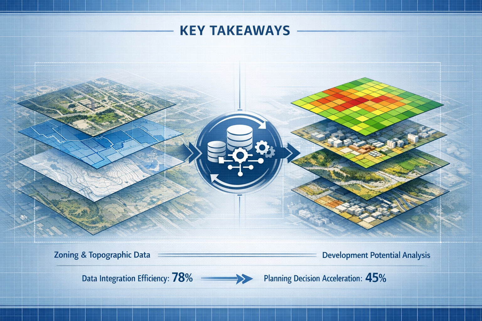
- GIS integration can reduce surveying project timelines by 40-50% by consolidating multiple data sources into visual layers that enable faster analysis and decision-making[4]
- Data layer overlays reveal critical spatial relationships between property boundaries, utilities, zoning districts, environmental constraints, and infrastructure that traditional methods miss
- Federal agencies are prioritizing geospatial data standardization with the National Spatial Reference System (NSRS) updates in 2026 requiring surveyors to modernize workflows and datasets[2]
- Modern planning emphasizes systems approaches where GIS serves as the backbone connecting data, people, and decisions across municipal departments and private stakeholders[1]
- Successful GIS implementation requires investment in hardware, software, training, and qualified staff—barriers that many surveying firms must strategically address[2]
Understanding GIS Integration for Surveyors: The Foundation of Modern Spatial Analysis
What Is GIS Integration and Why Does It Matter?
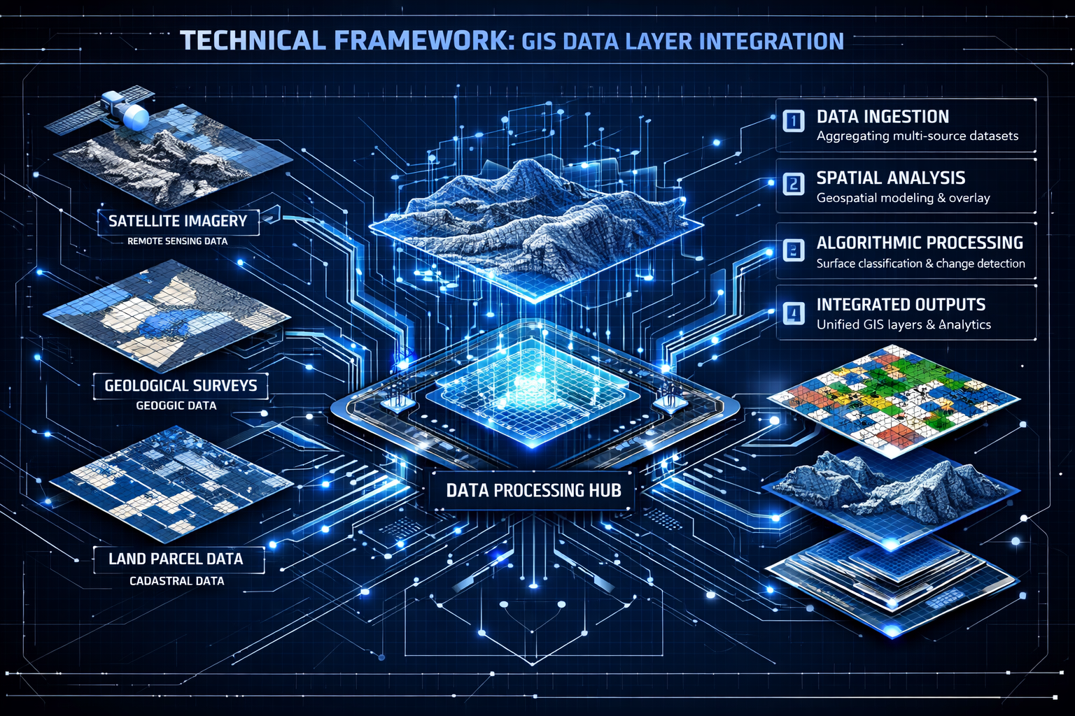
Geographic Information Systems represent far more than digital mapping tools. GIS platforms combine spatial data (where things are located) with attribute data (what those things are and their characteristics) to create dynamic, queryable databases. For surveyors, this means transforming static boundary surveys into living documents that interact with dozens of other information layers.
Consider a typical land development scenario. A commercial property surveyor might need to evaluate:
- 📍 Property boundaries and easements
- 🚰 Utility locations (water, sewer, gas, electric, telecommunications)
- 🏘️ Zoning classifications and overlay districts
- 🌳 Environmental constraints (wetlands, flood zones, protected habitats)
- 🚗 Transportation infrastructure and access points
- 🏛️ Historic preservation districts
- ⛰️ Topographic features and elevation changes
- 🏗️ Existing structures and improvements
Without GIS integration, each dataset exists in isolation. Surveyors must manually compare paper maps, spreadsheets, and separate digital files—a process prone to errors and oversights. GIS integration brings all these layers together in a single visual environment where relationships become immediately apparent.
The Power of Data Layer Overlays
Data layer overlays form the core functionality that makes GIS Integration for Surveyors: Overlaying Data Layers to Optimize Land Use Planning and Development Decisions so transformative. Each layer represents a different category of spatial information, displayed with unique symbology and transparency settings that allow multiple datasets to be viewed simultaneously.
When a surveyor overlays a proposed development boundary with existing utility corridors, zoning boundaries, and environmental constraints, conflicts and opportunities emerge visually. A wetland that might require expensive mitigation becomes obvious. A sewer line running along the property edge suggests optimal building placement. A zoning overlay district requiring additional setbacks appears before preliminary designs are finalized.
This visual integration supports what planning professionals in 2026 call a "systems approach"—recognizing that land use decisions don't occur in isolation but within complex networks of physical, regulatory, and social systems.[1]
Real-World Applications Across Surveying Disciplines
GIS integration delivers value across multiple surveying specializations:
Boundary Surveying: Overlay historical deed descriptions with modern GPS coordinates, adjacent parcel data, and recorded plats to resolve boundary disputes and identify encroachments before they become legal issues.
Topographic Surveying: Combine elevation data with drainage patterns, soil types, and vegetation coverage to inform grading plans and stormwater management strategies.
Construction Surveying: Integrate as-built surveys with design models, utility atlases, and site logistics plans to coordinate complex projects and avoid costly conflicts.
Environmental Surveying: Layer wetland delineations, endangered species habitats, and contamination plumes with proposed disturbance areas to ensure regulatory compliance and minimize ecological impact.
Structural engineering firms increasingly rely on GIS-integrated surveys to understand site conditions before designing foundations, drainage systems, and access routes.
Technical Framework: How Surveyors Implement GIS Data Layer Integration
Essential Data Layers for Land Use Planning
Successful GIS Integration for Surveyors: Overlaying Data Layers to Optimize Land Use Planning and Development Decisions requires assembling comprehensive datasets. The most critical layers include:
| Layer Category | Data Elements | Primary Sources | Update Frequency |
|---|---|---|---|
| Cadastral | Property boundaries, parcel IDs, ownership records | County assessor, recorder's office | Continuous |
| Zoning & Land Use | Zoning districts, overlay zones, future land use | Municipal planning departments | Annual/as amended |
| Utilities | Water, sewer, gas, electric, telecom networks | Utility companies, municipal works | Quarterly/as built |
| Transportation | Roads, highways, transit, bike/pedestrian paths | DOT, regional planning agencies | Semi-annual |
| Environmental | Wetlands, flood zones, soil types, habitats | FEMA, USGS, EPA, state agencies | Variable |
| Topographic | Contours, elevation models, hydrography | USGS, LiDAR surveys | 5-10 years |
| Regulatory | Historic districts, airport zones, easements | Multiple agencies | As designated |
The U.S. Department of Transportation emphasizes that geospatial datasets must be "findable, accessible, interoperable, and reusable" across agencies—a principle known as FAIR data management.[2] Surveyors adopting this standard ensure their GIS layers integrate seamlessly with client systems and regulatory databases.
Coordinate Systems and the 2026 NSRS Update
One of the most significant technical challenges facing surveyors in 2026 is the National Spatial Reference System (NSRS) modernization. The DOT plans to implement NSRS updates that create more accurate earth modeling and account for tectonic plate movement.[2]
This update requires surveyors to:
✅ Transform existing datasets from NAD83 to the new reference frame
✅ Update GPS equipment and processing software
✅ Retrain staff on new coordinate conversion procedures
✅ Communicate changes to clients and regulatory agencies
✅ Maintain dual systems during transition periods
Surveyors who proactively prepare for this transition will maintain competitive advantages, while those who delay may face project delays and accuracy issues when integrating data from different reference systems.
Software Platforms and Tools
Modern GIS integration relies on sophisticated software platforms. The most common include:
Enterprise Solutions: Esri's ArcGIS platform dominates the professional surveying market, offering comprehensive tools for data management, analysis, and visualization. ArcGIS Pro provides advanced 3D modeling capabilities particularly valuable for complex development projects.
Open-Source Alternatives: QGIS offers robust functionality without licensing costs, making it attractive for smaller firms. However, it may require more technical expertise and lacks some specialized surveying extensions.
Cloud-Based Platforms: ArcGIS Online, Mapbox, and similar services enable real-time collaboration and mobile data collection—critical for field surveyors who need to update GIS layers on-site.
Survey-Specific Tools: Trimble Business Center, Leica Infinity, and Topcon MAGNET integrate total station and GPS data directly into GIS-compatible formats, streamlining the transition from field measurements to spatial analysis.
The choice of platform depends on project complexity, budget constraints, client requirements, and existing technology infrastructure. Many chartered surveyors maintain proficiency across multiple platforms to accommodate diverse client needs.
Data Quality and Accuracy Standards
GIS integration amplifies both accurate data and errors. A boundary line plotted 10 feet off its true location might go unnoticed on a paper map but creates obvious conflicts when overlaid with aerial imagery and utility locations.
Surveyors must establish rigorous data quality protocols:
🎯 Positional Accuracy: Define acceptable tolerances for different layer types (survey-grade boundaries versus approximate environmental zones)
🎯 Attribute Completeness: Ensure all features include required metadata (source, date, accuracy, responsible party)
🎯 Topology Rules: Implement automated checks that prevent gaps, overlaps, and logical inconsistencies
🎯 Version Control: Maintain clear documentation of data updates and modifications
🎯 Source Documentation: Record the origin and reliability of each dataset
The DOT's GIS Strategic Plan acknowledges that "funding constraints limit full leverage of geospatial tools," with barriers related to data procurement and quality assurance.[2] Surveyors must balance ideal data standards with practical budget limitations.
Practical Strategies: Leveraging GIS for Faster, Data-Driven Development Insights
Streamlining Zoning and Regulatory Compliance Analysis
Zoning compliance represents one of the most time-consuming aspects of land development. Traditional methods require surveyors to manually reference zoning ordinances, measure setbacks with scale rulers, and cross-reference multiple code sections to determine permitted uses.
GIS Integration for Surveyors: Overlaying Data Layers to Optimize Land Use Planning and Development Decisions transforms this process through automated spatial analysis. Modern GIS platforms can:
- Calculate setbacks automatically by buffering property boundaries according to zoning district requirements
- Identify overlay districts that impose additional restrictions (historic preservation, airport approach zones, environmental protection)
- Determine permitted uses by querying zoning attributes linked to parcel data
- Flag non-conforming structures by comparing building footprints with current regulations
- Model development capacity by analyzing buildable area after applying all constraints
A practical example: A surveyor evaluating a potential residential subdivision can overlay the parcel boundary with zoning districts, wetland buffers, utility easements, and required setbacks. The GIS platform calculates the remaining buildable area and, based on minimum lot size requirements, determines maximum unit density—all within minutes rather than hours of manual calculation.
Planning departments in 2026 increasingly use GIS to analyze housing pipelines, "mapping zoning capacity, infrastructure constraints, permitting backlogs, and preservation opportunities on a single platform to identify specific development sites where regulations and conditions align."[1] Surveyors who provide GIS-integrated deliverables aligned with these municipal systems add significant value to development teams.
Utility Coordination and Infrastructure Planning
Utility conflicts represent a leading cause of construction delays and cost overruns. A water main discovered during excavation can halt work for weeks while engineers redesign foundations and contractors reroute trenches.
GIS integration minimizes these risks through comprehensive utility mapping. By overlaying proposed development plans with existing infrastructure networks, surveyors identify potential conflicts before construction begins:
💧 Water and Sewer: Identify connection points, assess capacity, determine whether line extensions are required
⚡ Electric and Gas: Locate transmission lines, transformers, and distribution networks that may require relocation or easement modifications
📡 Telecommunications: Map fiber optic cables and conduits that could be damaged during grading
🌧️ Stormwater: Analyze drainage patterns and existing infrastructure to inform site design
Professional drainage surveys combined with GIS analysis create comprehensive stormwater management plans that satisfy regulatory requirements while minimizing construction costs.
The visual clarity of overlaid utility data also improves communication with clients, contractors, and regulatory agencies. A single map showing all infrastructure relationships conveys information more effectively than dozens of separate utility atlas pages.
Environmental Compliance and Constraint Mapping
Environmental regulations have grown increasingly complex, with federal, state, and local agencies imposing overlapping requirements. GIS integration helps surveyors navigate this regulatory landscape by consolidating environmental constraints into visual decision-support tools.
Critical environmental layers include:
🌊 FEMA Flood Zones: Identify areas requiring flood elevation certificates, flood-resistant construction, or prohibitions on certain development types
🦆 Wetlands: Delineate jurisdictional wetlands requiring permits from the Army Corps of Engineers and state agencies
🌲 Protected Habitats: Map endangered species habitats subject to consultation requirements under the Endangered Species Act
🏞️ Conservation Easements: Identify voluntary restrictions that limit development intensity or require habitat preservation
⚠️ Contaminated Sites: Overlay brownfield locations and known contamination plumes that may trigger cleanup requirements
By overlaying these constraints with proposed development areas, surveyors can identify "fatal flaws" early in the planning process—before clients invest in detailed engineering and architectural design. A proposed building footprint that encroaches on a protected wetland becomes immediately obvious, allowing designers to adjust plans while changes remain inexpensive.
This proactive approach aligns with the 2026 planning trend toward systems thinking, where environmental considerations integrate with economic development goals rather than functioning as separate regulatory hurdles.[1]
Multi-Scenario Analysis and Development Optimization
One of GIS integration's most powerful capabilities is scenario modeling—the ability to rapidly test multiple development alternatives and compare outcomes.
Consider a mixed-use development on a constrained urban site. The surveyor can create multiple scenarios:
Scenario A: Maximum density development with structured parking, testing compliance with height limits, setbacks, and parking requirements
Scenario B: Moderate density with surface parking, evaluating trade-offs between development intensity and construction costs
Scenario C: Conservation-focused design preserving existing trees and topography, assessing impacts on unit count and project feasibility
For each scenario, GIS analysis calculates:
- Total buildable area
- Required parking spaces and layout feasibility
- Grading quantities and stormwater impacts
- Utility connection costs
- Regulatory compliance status
- Environmental mitigation requirements
This analytical capability transforms surveying from a documentation service into a strategic planning tool. Development teams make informed decisions based on quantitative comparisons rather than intuition or limited analysis.
Building surveys that incorporate GIS-based scenario analysis provide clients with actionable intelligence that directly impacts project feasibility and design decisions.
Advanced Applications: Multi-Sector GIS Integration Strategies

Municipal Planning and Smart Growth Initiatives
Local governments represent some of the most sophisticated users of GIS Integration for Surveyors: Overlaying Data Layers to Optimize Land Use Planning and Development Decisions. Planning departments use integrated geospatial platforms to coordinate land use, transportation, housing, economic development, and environmental protection.
Surveyors working with municipal clients should understand how their deliverables fit into broader planning systems:
Comprehensive Plans: GIS-based future land use maps guide long-term development patterns, with surveyors providing parcel-level data that informs plan updates
Zoning Administration: Digital zoning maps linked to permit systems enable automated compliance checking and reduce processing times
Capital Improvement Planning: Infrastructure needs identified through GIS analysis of development patterns, population growth, and system capacity
Housing Affordability: Spatial analysis identifying areas with zoning capacity, transit access, and infrastructure availability suitable for affordable housing development[1]
Surveyors who format their deliverables to integrate seamlessly with municipal GIS systems—using standardized coordinate systems, attribute schemas, and file formats—become preferred vendors for public sector projects.
Transportation and Corridor Planning
The U.S. Department of Transportation's emphasis on GIS as critical infrastructure reflects transportation planning's heavy reliance on spatial analysis.[2] Surveyors supporting transportation projects must integrate multiple specialized data layers:
🛣️ Right-of-Way Mapping: Precise boundary surveys integrated with ownership records, easements, and access rights
🚦 Traffic Analysis Zones: Demographic and travel pattern data informing transportation demand models
🚌 Transit Networks: Existing and planned transit routes, stops, and service areas
🚴 Active Transportation: Bike lanes, sidewalks, and pedestrian infrastructure
📊 Crash Data: Accident locations and patterns informing safety improvements
By overlaying proposed corridor alignments with these layers, surveyors identify right-of-way acquisition needs, utility conflicts, environmental impacts, and community effects before preliminary engineering advances.
The 2026 NSRS update holds particular importance for transportation projects, where coordinate accuracy directly affects construction stakeout and as-built documentation.[2] Surveyors must ensure transportation datasets transition smoothly to the new reference system.
Agricultural and Rural Land Management
While urban development dominates GIS discussions, rural and agricultural applications offer significant opportunities. Farmers and rural landowners use GIS integration for:
🌾 Precision Agriculture: Soil type mapping, yield monitoring, and variable rate application planning
💧 Water Rights Management: Irrigation district boundaries, water allocation tracking, and conservation compliance
🌲 Forest Management: Timber inventory, harvest planning, and reforestation tracking
🏞️ Conservation Programs: Easement monitoring, habitat restoration, and agricultural preserve compliance
Surveyors providing land valuation services in rural areas can enhance their offerings by integrating agricultural productivity data, water rights, and conservation restrictions into comprehensive property analyses.
Energy Infrastructure and Renewable Development
The renewable energy boom has created new surveying opportunities requiring sophisticated GIS integration:
☀️ Solar Facilities: Site suitability analysis considering solar exposure, grid connection points, environmental constraints, and land use compatibility
💨 Wind Energy: Turbine placement optimization balancing wind resources, setback requirements, viewshed impacts, and wildlife considerations
⚡ Transmission Lines: Corridor routing minimizing environmental impacts, property acquisitions, and construction challenges
🔋 Energy Storage: Battery facility siting near load centers with adequate electrical infrastructure
Each project type requires overlaying dozens of data layers to identify optimal locations. A solar farm site selection might integrate:
- Solar radiation data
- Slope and aspect analysis
- Electrical substation locations and capacity
- Transmission line corridors
- Agricultural land classifications
- Wetlands and protected habitats
- Cultural resource sensitivity zones
- Community separation buffers
GIS integration enables surveyors to screen hundreds of potential sites rapidly, identifying the most promising candidates for detailed field investigation.
Overcoming Implementation Barriers: Practical Guidance for Surveying Firms
Addressing the Qualified Staff Challenge
The DOT's GIS Strategic Plan identifies qualified GIS staff as a critical barrier to full technology leverage.[2] This challenge affects private surveying firms as severely as government agencies.
Recruitment Strategies:
- Partner with universities offering geomatics and GIS programs to recruit recent graduates
- Cross-train experienced surveyors in GIS software and spatial analysis techniques
- Hire GIS specialists and pair them with senior surveyors for mentorship
- Offer competitive compensation recognizing the value of combined surveying and GIS expertise
Professional Development:
- Support staff pursuing GIS certifications (GISP, Esri Technical Certifications)
- Provide access to online training platforms (Esri Academy, Coursera, LinkedIn Learning)
- Attend industry conferences focusing on geospatial technology (Esri User Conference, ASPRS Annual Conference)
- Encourage participation in local GIS user groups and professional organizations
Knowledge Retention:
- Document standard workflows and best practices in accessible formats
- Create internal knowledge bases with solved problems and technical solutions
- Implement mentorship programs pairing experienced and junior staff
- Develop project templates that embed institutional knowledge
The investment in staff development pays dividends through improved efficiency, enhanced service offerings, and competitive differentiation.
Technology Investment and Cost Management
GIS implementation requires significant capital investment in hardware, software, and data. The DOT notes that "funding constraints limit full leverage of geospatial tools," with barriers related to upgraded hardware and data procurement.[2]
Cost-Effective Implementation Strategies:
💻 Phased Hardware Upgrades: Prioritize workstations for staff performing intensive GIS analysis; use cloud-based solutions for occasional users
📊 Software Licensing Options: Evaluate subscription versus perpetual licenses; consider concurrent use licenses for shared access
🗺️ Data Acquisition: Leverage free government datasets (USGS, FEMA, EPA); purchase commercial data only where public sources prove inadequate
☁️ Cloud Computing: Use cloud-based processing for computationally intensive tasks rather than maintaining high-end local hardware
🤝 Data Sharing Agreements: Establish relationships with municipal partners, utility companies, and regional agencies for reciprocal data access
Return on Investment Calculation:
Firms should quantify GIS benefits to justify technology investments:
- Time savings: 40-50% reduction in project timelines[4] translates to increased project capacity
- Error reduction: Fewer field returns and design revisions reduce costs
- Service expansion: New capabilities enable premium pricing and market differentiation
- Client retention: Enhanced deliverables improve satisfaction and repeat business
Data Management and Quality Assurance
As GIS databases grow, data management becomes increasingly critical. Poor organization leads to duplicated efforts, version confusion, and quality degradation.
Essential Data Management Practices:
📁 Organized File Structure: Implement consistent naming conventions and folder hierarchies
🔄 Version Control: Maintain clear records of data updates and modifications
📝 Metadata Standards: Document source, date, accuracy, and responsible party for all datasets
🔒 Access Controls: Restrict editing permissions while allowing broad viewing access
💾 Backup Procedures: Automated backups with offsite storage for disaster recovery
🔍 Quality Checks: Regular audits verifying positional accuracy and attribute completeness
Geodatabase Design:
Modern GIS platforms support enterprise geodatabases that enforce data integrity through:
- Topology rules preventing geometric errors
- Attribute domains restricting values to valid options
- Relationship classes maintaining connections between related features
- Versioning enabling multiple users to edit simultaneously without conflicts
Surveyors should invest time in proper database design upfront rather than attempting to organize chaotic datasets later.
Client Communication and Deliverable Standards
Even the most sophisticated GIS analysis provides limited value if clients cannot understand or use the results. Effective communication requires translating technical spatial analysis into actionable business intelligence.
Effective Deliverable Formats:
🗺️ Static Maps: High-quality PDF maps with clear legends, scale bars, and north arrows for presentations and reports
💻 Interactive Web Maps: Browser-based viewers allowing clients to toggle layers, query features, and measure distances without GIS software
📊 Data Packages: Shapefiles or geodatabases for clients with GIS capabilities, formatted according to their specifications
📱 Mobile Applications: Field-accessible maps for construction crews and site managers
📈 Analysis Reports: Written summaries explaining spatial findings and their implications for project decisions
Surveyors should discuss deliverable requirements during project scoping to ensure final products meet client needs and integrate with their existing systems.
Future Trends: The Evolution of GIS Integration in Surveying Practice
Artificial Intelligence and Machine Learning
Artificial intelligence is beginning to transform GIS analysis, with applications particularly relevant to surveying:
🤖 Automated Feature Extraction: AI algorithms identify buildings, roads, vegetation, and other features from aerial imagery and LiDAR data, reducing manual digitizing
🧠 Predictive Modeling: Machine learning predicts development patterns, infrastructure failures, and environmental changes based on historical spatial data
🔍 Anomaly Detection: AI identifies unusual patterns suggesting data errors, unauthorized development, or emerging problems
🎯 Optimization Algorithms: Advanced analytics determine optimal site layouts, utility routing, and resource allocation
As these technologies mature, surveyors who understand both traditional spatial analysis and AI-enhanced methods will lead the industry.
Digital Twins and 3D Modeling
Digital twins—virtual replicas of physical environments updated in real-time—represent the convergence of GIS, Building Information Modeling (BIM), and Internet of Things (IoT) sensors. Surveyors will increasingly contribute to digital twin development through:
- High-precision 3D surveys capturing existing conditions
- Integration of as-built data with design models
- Ongoing monitoring surveys tracking changes over time
- Coordination between outdoor GIS environments and indoor BIM models
Cities including Singapore, Dubai, and Boston have implemented citywide digital twins for infrastructure management, emergency response, and development planning. This trend will expand to smaller municipalities and private developments throughout the 2020s.
Drone Integration and Automated Data Collection
Drone surveys have revolutionized topographic data collection, and integration with GIS continues to deepen. Emerging capabilities include:
✈️ Automated Flight Planning: GIS-based mission planning ensuring complete coverage and optimal image overlap
📸 Real-Time Processing: Onboard processing generating preliminary orthophotos and elevation models during flight
🔄 Change Detection: Automated comparison of multi-temporal drone surveys identifying modifications since previous visits
🎥 Video Analytics: AI analysis of drone video identifying features and conditions for GIS database updates
Surveyors who master drone-GIS integration workflows will complete projects faster and more cost-effectively than competitors relying on traditional methods.
Blockchain and Data Authenticity
Blockchain technology may address one of GIS's persistent challenges: verifying data authenticity and tracking modifications. Potential applications include:
🔐 Survey Record Authentication: Cryptographic verification that boundary surveys haven't been altered since professional certification
📜 Title and Ownership Tracking: Blockchain-based property registries integrated with GIS parcel layers
✅ Permit and Approval Documentation: Immutable records of regulatory approvals linked to spatial features
⏱️ Temporal Data Management: Secure tracking of feature changes over time with verified timestamps
While still emerging, blockchain-GIS integration could enhance trust in spatial data and streamline property transactions.
Conclusion: Embracing GIS Integration as a Strategic Imperative
GIS Integration for Surveyors: Overlaying Data Layers to Optimize Land Use Planning and Development Decisions has evolved from a competitive advantage to a professional necessity. The ability to consolidate diverse spatial datasets, visualize complex relationships, and perform sophisticated analyses separates modern surveying practices from those struggling to remain relevant.
The evidence is compelling: projects completed 40-50% faster, conflicts identified before expensive construction begins, regulatory compliance verified through automated analysis, and development decisions informed by comprehensive spatial intelligence rather than limited information.[4] Federal agencies, municipal governments, and private developers increasingly expect GIS-integrated deliverables as standard practice, not premium offerings.[2]
Yet implementation challenges remain real. Qualified staff shortages, technology costs, data quality issues, and workflow disruptions during transition periods create legitimate barriers—particularly for smaller firms with limited resources.[2] Success requires strategic planning, phased implementation, and sustained commitment to professional development.
Actionable Next Steps for Surveying Professionals
For Individual Surveyors:
- Develop GIS proficiency through online courses, certifications, or formal education programs
- Experiment with free tools like QGIS to build skills before committing to commercial platforms
- Join professional communities where experienced practitioners share knowledge and solve problems collectively
- Stay informed about industry trends through publications, conferences, and continuing education
For Surveying Firms:
- Assess current capabilities honestly, identifying gaps between existing practices and market expectations
- Develop implementation roadmap with specific milestones, budget allocations, and success metrics
- Invest in staff development through training, mentorship, and recruitment of GIS specialists
- Start with pilot projects demonstrating value before full-scale deployment
- Build data partnerships with municipalities, utilities, and regional agencies for reciprocal access
- Prepare for NSRS transition by updating equipment, software, and training programs[2]
For Clients and Developers:
- Request GIS-integrated deliverables in project specifications to ensure comprehensive spatial analysis
- Evaluate surveying vendors based on technological capabilities, not just price
- Invest in internal GIS capacity to fully leverage surveyor-provided spatial data
- Participate in regional data initiatives that benefit entire development communities
The planning trends of 2026 emphasize systems thinking, where isolated decisions give way to integrated approaches recognizing complex interdependencies.[1] GIS provides the technological foundation for this transformation, and surveyors who master spatial data integration will lead their profession through the next decade of innovation.
The question is no longer whether to adopt GIS integration, but how quickly and effectively firms can implement these essential capabilities. Those who act decisively will thrive in an increasingly data-driven development environment. Those who delay risk obsolescence as clients, regulators, and competitors embrace the power of overlaid spatial intelligence.
The future of surveying is spatial, integrated, and data-rich. The tools exist, the demand is proven, and the benefits are quantified. The only remaining variable is professional commitment to mastering GIS Integration for Surveyors: Overlaying Data Layers to Optimize Land Use Planning and Development Decisions as a core competency for modern practice.
References
[1] 5 Planning Trends 2026 – https://www.esri.com/en-us/industries/blog/articles/5-planning-trends-2026
[2] Us Dot Gis Strategic Plan 2026 30 – https://www.transportation.gov/sites/dot.gov/files/2025-12/US-DOT-GIS-Strategic-Plan-2026-30.pdf
[3] The Importance Of City Planning And Infrastructure Land Surveying – https://www.gissurveyors.com/the-importance-of-city-planning-and-infrastructure-land-surveying/
[4] Gis Integration For Surveyors Overlaying Data For Smarter Land Management Decisions – https://nottinghillsurveyors.com/blog/gis-integration-for-surveyors-overlaying-data-for-smarter-land-management-decisions