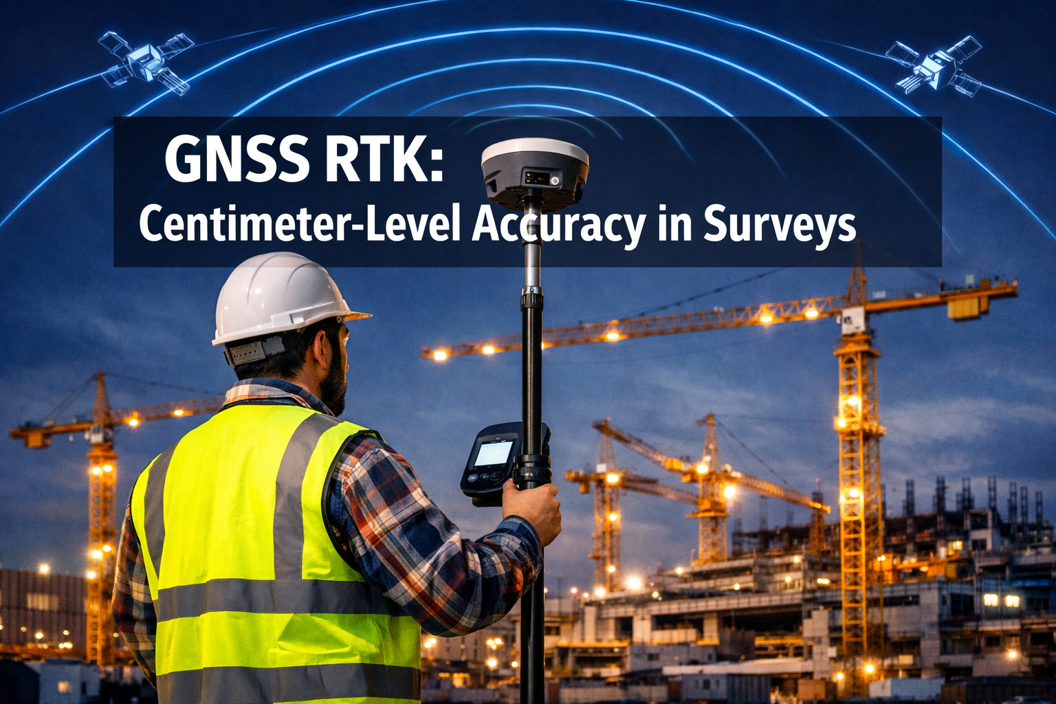
A single centimeter of error in a boundary survey can trigger legal disputes worth hundreds of thousands of pounds. That is not a hypothetical — it is the daily reality that drives the surveying industry's relentless push toward precision. The field of GNSS RTK and GPS Enhancements: Achieving Centimeter-Level Accuracy in Surveys has transformed what was once a multi-day, multi-crew operation into a task achievable by one person with a rover pole and a mobile data connection. In 2026, this transformation is accelerating faster than ever, reshaping infrastructure projects, property boundary work, and construction stakeout from the ground up.
Key Takeaways
- Real-Time Kinematic (RTK) GNSS technology routinely delivers 1-2 cm horizontal accuracy and 2-3 cm vertical accuracy in open-sky conditions, far exceeding standard GPS performance.
- Network RTK services have eliminated the need for local base stations, reducing equipment costs and simplifying field workflows significantly.
- Multi-constellation GNSS — combining GPS, GLONASS, Galileo, and BeiDou — improves reliability, especially in obstructed urban environments.
- Precise Point Positioning (PPP) is maturing as a complementary technique, with convergence times now short enough for practical real-time use.
- Low-cost OEM GNSS receivers are narrowing the accuracy gap with professional-grade equipment, democratizing centimeter-level surveying in 2026.
What Is GNSS RTK and Why Does It Matter for Modern Surveys
Global Navigation Satellite System Real-Time Kinematic (GNSS RTK) is a differential positioning technique that corrects satellite ranging errors in real time. A base station with a known, fixed position broadcasts correction data to a mobile rover. The rover applies those corrections and resolves carrier-phase ambiguities — the precise count of full signal wavelengths between satellite and receiver — to compute its position to within 1-2 centimetres.
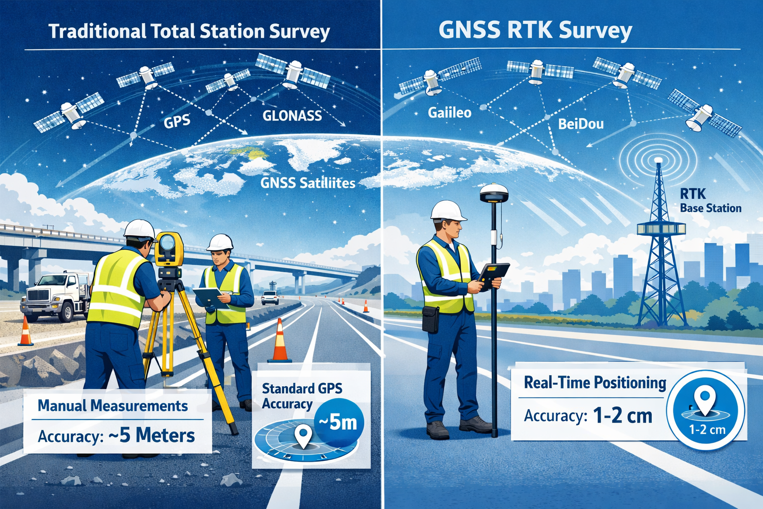
Standard GPS, by contrast, relies on code-phase measurements and atmospheric models that introduce errors of 3-5 metres under ideal conditions and far more in urban canyons or under tree canopy. The gap between these two figures is the commercial and legal reason RTK has become the default standard for professional land surveys, boundary surveys, and infrastructure stakeout.
Why centimetre accuracy matters in practice:
| Application | Acceptable Error | Standard GPS | GNSS RTK |
|---|---|---|---|
| Boundary demarcation | 1-2 cm | Fails | Passes |
| Road design stakeout | 2-5 cm | Fails | Passes |
| Building foundation layout | 1-3 cm | Fails | Passes |
| Topographic mapping | 5-10 cm | Marginal | Passes |
| Navigation / general use | 1-5 m | Passes | Passes |
The technique is not new — RTK has existed since the 1990s — but the ecosystem around it has changed dramatically. Multi-constellation receivers, cloud-based correction networks, and tighter integration with other sensors have made GNSS RTK and GPS Enhancements: Achieving Centimeter-Level Accuracy in Surveys the cornerstone of modern geospatial practice.
How RTK Corrections Are Delivered
Corrections reach the rover through three main channels:
- Radio link (UHF/VHF): Traditional method using a dedicated base station and radio modem. Range is typically 10-15 km in open terrain.
- Mobile internet (NTRIP): Corrections streamed over 4G/5G via the Networked Transport of RTCM via Internet Protocol. No local base station required.
- Satellite-delivered corrections: Services like Galileo's High Accuracy Service (HAS) broadcast corrections directly from orbit, removing any ground infrastructure dependency.
The shift toward internet-delivered corrections has been decisive. Companies such as Lefixea have launched nationwide Network RTK services that provide centimetre-level accuracy without requiring users to own or maintain local base stations, cutting both capital expenditure and field setup time significantly [1].
Core Technologies Driving GPS Enhancements in 2026
The phrase "GPS enhancements" covers a broad family of techniques that push positioning accuracy beyond what a single satellite system can deliver alone. Understanding these technologies is essential for anyone commissioning or conducting a professional survey.
Multi-Constellation GNSS
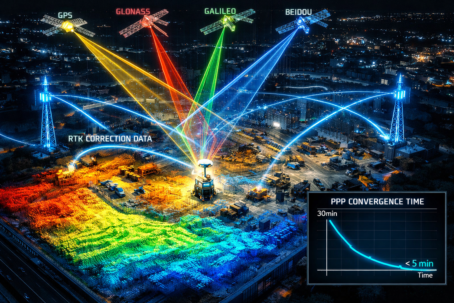
Modern receivers track signals from four major constellations simultaneously:
- GPS (United States) — 31 operational satellites
- GLONASS (Russia) — 24 satellites
- Galileo (European Union) — 30 satellites
- BeiDou (China) — 35+ satellites
Tracking more satellites improves geometry (expressed as Dilution of Precision, or DOP), speeds up ambiguity resolution, and maintains accuracy when individual signals are blocked. In dense urban environments, a receiver tracking 40+ satellites simultaneously is now common.
Precise Point Positioning (PPP)
PPP is a positioning technique that uses precise satellite orbit and clock corrections — distributed globally — rather than a local base station. Historically, PPP required 20-30 minutes of data collection before converging to centimetre accuracy. Advances in error modelling and the integration of multi-GNSS constellations have reduced this convergence time dramatically, making PPP increasingly viable for real-time surveying tasks [3].
"The convergence time barrier for PPP has been the single biggest obstacle to its mainstream adoption. That barrier is now falling."
PPP is particularly valuable in remote areas where Network RTK coverage is unavailable and deploying a base station is impractical.
Galileo High Accuracy Service (HAS)
The European Union's Galileo constellation introduced its High Accuracy Service in 2023, offering free, real-time, centimetre-level positioning corrections broadcast directly from the satellite signal. This removes subscription costs and internet dependency for users within the service area, which covers Europe and expanding global regions [5]. For surveyors working across international borders or in areas with poor mobile coverage, HAS represents a significant operational advantage.
GNSS and LiDAR Integration
One of the most significant developments in the field is the fusion of GNSS RTK with LiDAR (Light Detection and Ranging). Research has demonstrated that this combination can achieve centimetre-level positioning accuracy even in challenging urban environments where satellite signals are frequently blocked or reflected [2]. The GNSS component provides absolute georeferencing while LiDAR fills the gaps during signal outages using scan-matching algorithms.
This integration is directly relevant to structural engineering surveys and large-scale infrastructure assessments where both precise positioning and detailed 3D modelling are required simultaneously.
RTK-SLAM for GNSS-Degraded Environments
Simultaneous Localisation and Mapping (SLAM) algorithms, originally developed for robotics, are now being combined with RTK to maintain positioning accuracy in tunnels, underground structures, and dense urban canyons where GNSS signals are intermittent. New benchmark datasets specifically designed for RTK-SLAM evaluation in GNSS-degraded environments are helping researchers refine these algorithms [7].
Signal Integrity and Security
As RTK systems become more critical to infrastructure decisions, their vulnerability to spoofing — where false satellite signals are broadcast to deceive receivers — has attracted serious research attention. Studies have documented specific attack vectors against RTK systems and proposed countermeasures including signal authentication, multi-antenna detection, and cross-validation with inertial sensors [9]. The U.S. Army Geospatial Center has enhanced its GPS-Survey system to integrate military and civilian GNSS signals with improved integrity monitoring for defence-related applications [8].
Practical Applications and the 2026 Market Landscape
The commercial impact of GNSS RTK and GPS Enhancements: Achieving Centimeter-Level Accuracy in Surveys is reshaping the surveying market in measurable ways. Three trends stand out in 2026.
The Democratisation of Centimetre Accuracy
For most of the technology's history, centimetre-level GNSS required receivers costing £10,000-£30,000 per unit. Research by the Minnesota Department of Transportation evaluated low-cost OEM GNSS receivers and found that affordable devices — some costing under £500 — can achieve accuracy comparable to high-end professional equipment under appropriate conditions [4]. This finding has significant implications for smaller surveying firms, local authorities, and construction companies that previously could not justify the capital outlay.
The caveat is important: low-cost receivers typically require more careful site selection, longer observation times, and more rigorous post-processing to match the reliability of professional-grade units in difficult environments.
Infrastructure Projects: Where RTK Delivers the Most Value
Large infrastructure projects — roads, railways, bridges, utility corridors — represent the highest-value application of RTK surveying. The ability to stake out design coordinates in real time, without waiting for post-processed results, compresses project timelines and reduces costly rework.
For property professionals involved in pre-development surveys, the accuracy of GNSS RTK feeds directly into the quality of building surveys and schedule of condition reports that underpin planning applications and dilapidations assessments. Accurate site positioning data reduces ambiguity in schedule of dilapidations disputes by providing an unambiguous spatial record.
Vertical Accuracy and Datum Establishment
Horizontal accuracy tends to receive more attention, but vertical accuracy is equally critical in drainage design, flood risk assessment, and structural foundation work. The U.S. Geological Survey has published comprehensive guidelines for using survey-grade GNSS to establish vertical datums, standardising practices to ensure consistency in elevation measurements across projects [6]. These guidelines reflect a broader industry move toward GNSS-derived heights replacing traditional spirit levelling for most engineering applications.
Research into millimetre-level accuracy for space geodesy applications — reviewing error budgets for PPP — is pushing the theoretical limits of what GNSS can achieve, with lessons that filter down into commercial surveying practice over time [10].
Comparing RTK with Traditional Survey Methods
Traditional total station surveys remain the gold standard in environments where GNSS signals are unavailable — inside buildings, in tunnels, or under dense tree canopy. However, for open-sky and semi-open environments, RTK offers clear advantages:
| Factor | Total Station | GNSS RTK |
|---|---|---|
| Setup time | 20-45 minutes | 5-10 minutes |
| Crew required | 2 people minimum | 1 person |
| Accuracy (open sky) | 1-3 mm | 10-20 mm |
| Coverage per day | 200-500 points | 1,000-5,000 points |
| Works indoors | Yes | No |
| Real-time results | Yes | Yes |
The practical outcome for most land and engineering surveys is a hybrid workflow: GNSS RTK for control network establishment and open-area detail survey, combined with total station or laser scanning for confined spaces and high-precision structural work.
GNSS RTK in Property and Boundary Surveying
For property professionals, the relevance of centimetre-level GNSS extends beyond large infrastructure. Accurate boundary demarcation relies on the same RTK techniques used in road construction. A boundary survey conducted with RTK equipment provides coordinates that can be independently verified and legally defended, reducing the risk of boundary disputes.
Similarly, subsidence surveys benefit from precise GNSS monitoring. By establishing a network of GNSS monitoring points around a structure and measuring them repeatedly over time, surveyors can detect ground movement of just a few millimetres per month — far below what visual inspection or traditional levelling would reveal at the same cost.
When commissioning any professional survey in 2026, it is worth understanding how to choose the right property survey for the specific task, as the technology used by the surveyor directly affects the precision and legal standing of the results.
2026 Market Outlook
Several forces are converging to accelerate adoption of advanced GNSS techniques this year:
- 5G network expansion improves NTRIP correction delivery reliability in urban and suburban areas.
- Galileo HAS maturity provides a free, satellite-delivered correction alternative that reduces dependence on commercial correction networks.
- Drone survey integration — UAVs equipped with RTK GNSS modules are replacing ground crews for topographic surveys of large sites, with direct geotagging of aerial imagery to centimetre accuracy.
- BIM integration — Building Information Modelling workflows increasingly require GNSS-accurate site data as the foundation for digital twins.
- Low-cost receiver proliferation is expanding the user base beyond traditional surveying firms to construction site managers, utility companies, and local government teams.
The combined effect is a market where centimetre-level accuracy is becoming the expected baseline rather than a premium service.
Conclusion
The progression of GNSS RTK and GPS Enhancements: Achieving Centimeter-Level Accuracy in Surveys from specialist technology to mainstream practice represents one of the most consequential shifts in the history of land measurement. In 2026, the barriers of cost, complexity, and coverage that once limited RTK to well-funded survey firms are falling rapidly.
Actionable next steps for professionals and project owners:
- Specify RTK or PPP accuracy requirements explicitly in survey briefs and contracts. Do not accept "GPS survey" as a specification — require documented accuracy standards and correction methods.
- Evaluate Network RTK subscriptions against the cost of maintaining local base station infrastructure. For most firms, network services now offer better economics and greater flexibility.
- Investigate Galileo HAS as a free correction source for projects in Europe, particularly where mobile data coverage is unreliable.
- Consider GNSS-LiDAR fusion for urban infrastructure surveys where signal obstruction is a known challenge.
- Review monitoring workflows for structures at risk of subsidence or ground movement — GNSS-based monitoring offers continuous, automated data collection at costs that are increasingly competitive with traditional levelling campaigns.
- Engage a qualified chartered surveyor to assess which combination of GNSS techniques, ground control, and post-processing is appropriate for the specific project risk profile and accuracy requirements.
The technology is ready. The question for any project in 2026 is not whether centimetre-level accuracy is achievable — it is whether the survey specification and the chosen professional are set up to deliver it.
References
[1] Networkrtk8 – https://www.lefixea.com/article/networkrtk8?utm_source=openai
[2] arxiv – https://arxiv.org/abs/2204.12103?utm_source=openai
[3] The Evolution Of Precise Point Positioning – https://www.gpsworld.com/the-evolution-of-precise-point-positioning/?utm_source=openai
[4] Evaluation Of Low Cost Centimeter Level Accuracy Oem Gnss Receivers – https://mnltap.umn.edu/research/project/evaluation-of-low-cost-centimeter-level-accuracy-oem-gnss-receivers?utm_source=openai
[5] Pmc9931823 – https://pmc.ncbi.nlm.nih.gov/articles/PMC9931823/?utm_source=openai
[6] Methods Practice And Guidelines Using Survey Grade Global Navigation Satellite Systems – https://www.usgs.gov/publications/methods-practice-and-guidelines-using-survey-grade-global-navigation-satellite-systems?utm_source=openai
[7] arxiv – https://arxiv.org/abs/2604.07151?utm_source=openai
[8] Global Positioning System Survey Gps S – https://www.agc.army.mil/Media/Fact-Sheets/Fact-Sheet-Article-View/Article/4323517/global-positioning-system-survey-gps-s/?utm_source=openai
[9] arxiv – https://arxiv.org/abs/2406.07565?utm_source=openai
[10] S10712 023 09785 W – https://link.springer.com/article/10.1007/s10712-023-09785-w?utm_source=openai