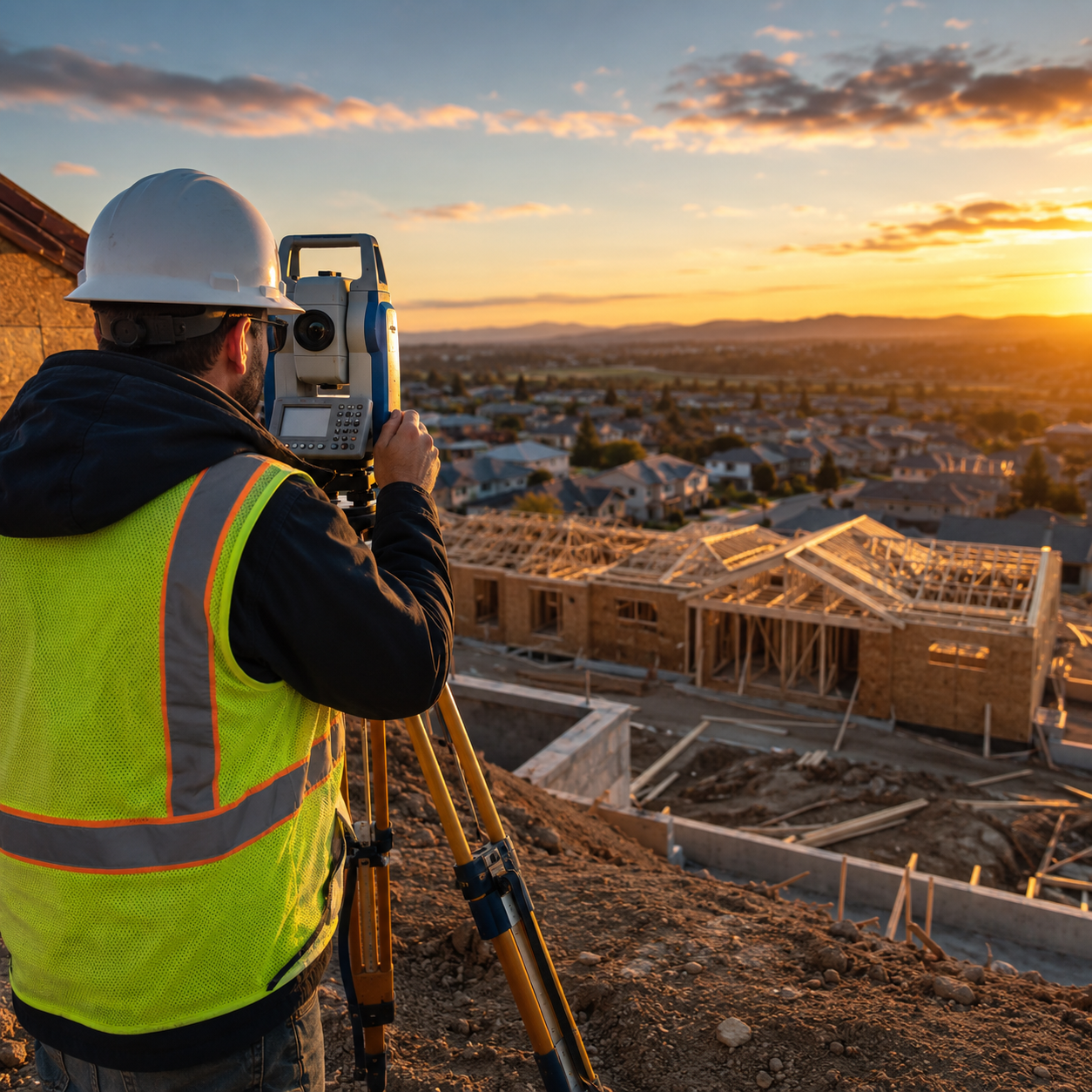
The land surveying industry stands at a technological crossroads in 2026. What once required weeks of manual data collection, countless site visits, and painstaking calculations can now be accomplished in hours—sometimes minutes—thanks to artificial intelligence. AI-Driven Precision in Land Surveying: How Artificial Intelligence is Revolutionizing Workflows in 2026 represents more than incremental improvement; it marks a fundamental transformation in how surveyors approach their work, from initial data capture through final deliverable creation.
Traditional surveying workflows demanded extensive human intervention at every stage. Surveyors spent days in the field collecting measurements, weeks processing data, and additional time manually checking for errors. Today's AI-enhanced systems automate terrain classification, identify survey markers, flag anomalies, and generate preliminary surface models without manual data sorting.[1] This shift allows surveyors to focus their expertise where it matters most: interpreting results, providing strategic guidance, and solving complex spatial challenges.
The revolution extends beyond simple automation. Machine learning algorithms now predict geological changes, autonomous drone swarms conduct coordinated surveys across hundreds of acres in single flights, and real-time 3D digital twins provide interactive models that simulate land behavior under various conditions.[1][2] These capabilities are transforming surveying from a primarily reactive documentation service into a proactive planning and risk-assessment discipline.
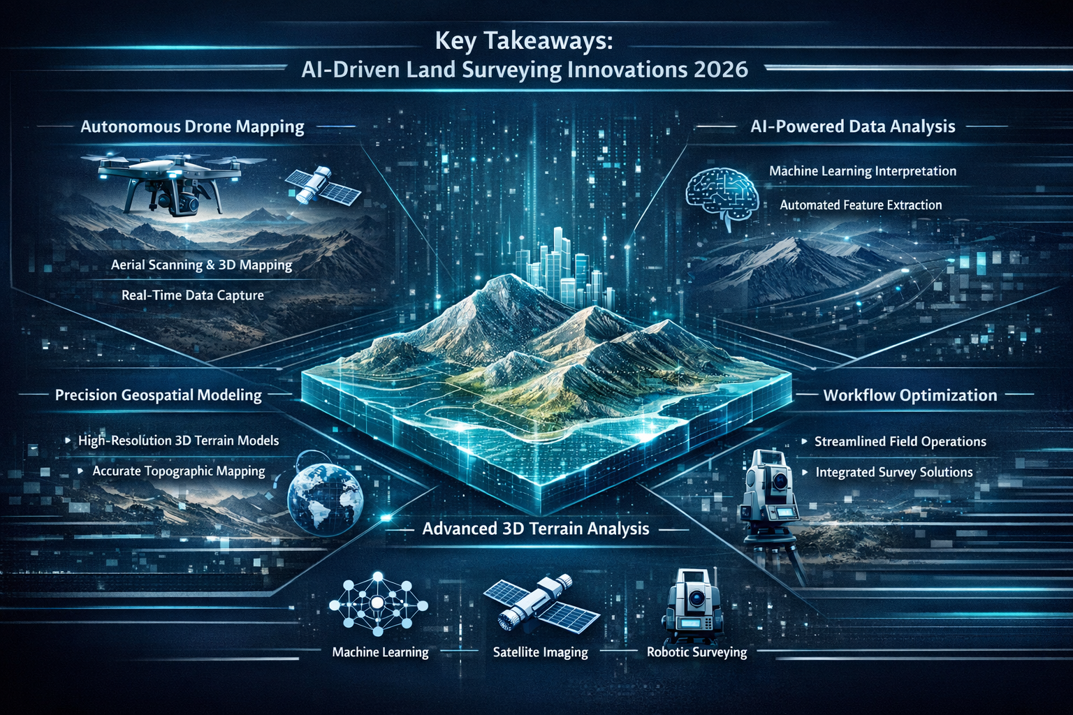
Key Takeaways
🎯 Embedded AI systems now automate core surveying operations including terrain classification, marker identification, and quality checks, reducing manual data processing time by up to 80%[1]
🚁 Autonomous drone swarms with multi-sensor platforms (LiDAR, photogrammetry, multispectral, thermal) can survey hundreds of acres in a single flight, replacing multiple traditional site visits[1][3]
🔮 Predictive AI models analyze historical survey data combined with environmental factors to forecast geological changes, soil erosion, landslides, and infrastructure risks before they occur[2]
📊 Real-time 3D digital twins have replaced static plats as primary deliverables, providing interactive models for slope analysis, water flow simulation, and infrastructure stress testing[1]
☁️ Cloud-based collaboration platforms enable instant file sharing, browser-based visualization, and real-time revision syncing among surveyors, engineers, and architects[1]
Understanding AI-Driven Precision in Land Surveying Workflows
The integration of artificial intelligence into land surveying represents a paradigm shift from data collection to intelligent data interpretation. In 2026, AI systems function as embedded assistants throughout the entire surveying workflow, fundamentally changing how professionals approach each project phase.
From Manual Processing to Automated Intelligence
Traditional surveying workflows followed a linear, labor-intensive pattern. Surveyors collected raw data in the field, transported it back to the office, manually processed measurements, created preliminary models, checked for errors, and finally produced deliverables. Each step required significant human intervention and expertise.
Modern AI-enhanced workflows operate differently. Embedded AI systems process data as it's collected, automatically classifying terrain features, identifying survey markers, and flagging potential anomalies in real time.[1] This immediate processing provides several critical advantages:
- Instant quality assurance during data collection rather than discovering errors days later
- Reduced field time because surveyors know immediately if additional measurements are needed
- Elimination of data transcription errors through automated digital workflows
- Faster project turnaround with preliminary models generated automatically
The shift from manual to automated processing doesn't eliminate the surveyor's role—it elevates it. Professionals now spend less time on repetitive data manipulation and more time applying their expertise to complex interpretation, client consultation, and strategic planning.
Self-Calibrating Instruments and Error Reduction
Human error has historically been one of the most significant challenges in land surveying. Incorrect instrument calibration, measurement mistakes, and data entry errors could compromise entire projects. AI-powered self-calibrating instruments have dramatically reduced these risks in 2026.[2]
Modern surveying equipment incorporates machine learning algorithms that:
✅ Automatically detect and correct data anomalies in real time
✅ Continuously calibrate sensors based on environmental conditions
✅ Cross-reference measurements across multiple data sources
✅ Flag inconsistencies before they propagate through the workflow
✅ Maintain consistent mapping quality across varying conditions
These self-calibrating systems represent a significant advancement over traditional equipment. Where surveyors previously needed to manually check and adjust instruments multiple times daily, AI systems now monitor calibration continuously, making micro-adjustments that ensure optimal accuracy throughout data collection.
The impact on project quality is measurable. AI-assisted quality checks have become standard safeguards, with systems flagging inconsistencies before projects reach the drafting stage.[1] This proactive approach to quality assurance prevents costly rework and ensures clients receive accurate deliverables on the first submission.
For professionals conducting structural surveys or stock condition surveys, this level of automated precision provides confidence that underlying spatial data meets the highest accuracy standards.
Real-Time Data Processing Replaces Multi-Week Cycles
Perhaps the most dramatic workflow transformation in 2026 is the shift from delayed batch processing to instant real-time analysis. Traditional surveying required days or weeks to gather sufficient project data, followed by additional processing time before any insights became available.[2]
AI-enhanced sensors and drones now capture and process survey data simultaneously, delivering actionable insights immediately. This real-time capability fundamentally changes project timelines:
| Traditional Workflow | AI-Enhanced Workflow |
|---|---|
| 5-7 days field data collection | 1-2 days automated capture |
| 7-14 days data processing | Real-time processing |
| 3-5 days quality checking | Automated instant QA |
| 5-7 days model creation | Automated generation |
| Total: 20-33 days | Total: 2-4 days |
This acceleration doesn't come at the expense of quality. In fact, real-time processing often improves accuracy because surveyors can identify and address issues immediately rather than discovering problems weeks after leaving the site.
For construction companies, public infrastructure projects, and commercial developers, this speed represents significant cost savings. Projects can move from planning to execution faster, reducing carrying costs and accelerating revenue realization. The ability to receive surveyor reports in days rather than weeks provides competitive advantages in fast-moving real estate markets.
How Autonomous Systems Are Transforming AI-Driven Precision in Land Surveying
The emergence of autonomous surveying systems represents one of the most visible manifestations of AI transformation in 2026. These systems combine advanced hardware with sophisticated AI algorithms to conduct surveys with minimal human supervision, dramatically expanding what's possible in terms of coverage, speed, and data richness.
Multi-Sensor Autonomous UAV Platforms
Multi-sensor autonomous UAV systems have become standard equipment for modern surveying firms in 2026.[1] These platforms integrate multiple data capture technologies on single aircraft, eliminating the need for separate flights with different equipment.
A typical autonomous surveying drone in 2026 carries:
🛸 LiDAR sensors for precise elevation and terrain mapping
📷 Photogrammetry cameras for high-resolution visual documentation
🌈 Multispectral sensors for vegetation and land cover analysis
🌡️ Thermal imaging for infrastructure assessment and moisture detection
This multi-sensor approach provides comprehensive data capture that would have previously required multiple site visits with different equipment. What once took a week of fieldwork can now be accomplished in a single detailed flight.[1]
The AI component extends beyond simple data capture. These systems use predictive modeling to plan optimal flight paths, automatically adjusting altitude, angle, and sensor selection for optimal readings based on terrain characteristics and project requirements.[1][3] The drones don't simply follow pre-programmed routes—they make intelligent decisions about how to capture the best possible data.
For large-scale properties, commercial developments, and infrastructure projects, this capability represents transformative efficiency. A single autonomous flight can capture more comprehensive data than traditional ground-based surveys conducted over multiple days.
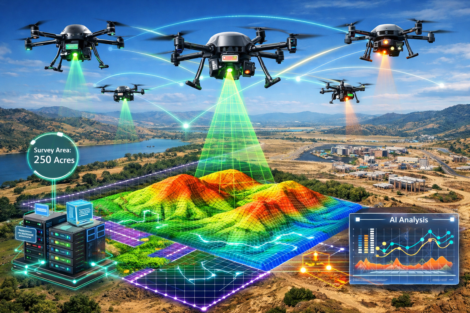
Coordinated Drone Swarms with Minimal Supervision
Beyond individual autonomous drones, 2026 has seen the emergence of coordinated drone swarms capable of working together with minimal human intervention.[3] These swarms represent a quantum leap in surveying capability, enabling coverage of vast areas with unprecedented speed and detail.
Swarm technology operates on several key principles:
Distributed intelligence: Each drone in the swarm makes independent decisions while coordinating with other units to optimize overall coverage
Dynamic task allocation: The swarm automatically distributes survey responsibilities based on terrain complexity, battery levels, and data requirements
Redundant data capture: Multiple drones capture overlapping data to ensure comprehensive coverage and enable cross-validation
Adaptive coordination: Swarms adjust their formation and approach in response to obstacles, weather conditions, and emerging data needs
The practical implications are remarkable. A coordinated swarm can survey hundreds of acres in a single deployment, generating instant topographic data that would have required weeks of traditional fieldwork.[2] This capability provides:
- Faster turnaround for time-sensitive construction projects
- Cost savings for public infrastructure assessments
- Comprehensive coverage of difficult-to-access terrain
- Reduced safety risks by minimizing human exposure to hazardous areas
For surveyors conducting drainage surveys or roof surveys across large properties, drone swarms provide access to areas that would be dangerous or impossible to reach with traditional methods.
Single-Flight Comprehensive Data Capture
The combination of multi-sensor platforms and intelligent flight planning enables single-flight comprehensive data capture that addresses multiple project requirements simultaneously. In 2026, a well-planned autonomous survey flight can gather:
✈️ Topographic data for elevation models and contour mapping
✈️ Visual documentation for boundary identification and feature recognition
✈️ Vegetation analysis for environmental assessment and land use planning
✈️ Thermal signatures for infrastructure condition assessment
✈️ Volumetric measurements for earthwork calculations
✈️ Drainage patterns for water management planning
This comprehensive approach eliminates the traditional need for multiple specialized surveys. Instead of scheduling separate visits for topographic surveying, vegetation assessment, and infrastructure inspection, a single autonomous flight captures all required data simultaneously.
The efficiency gains extend beyond field time. Because all data is captured in a single session under consistent conditions, integration and analysis become simpler. There's no need to reconcile measurements taken on different days under varying weather conditions or with different equipment calibrations.
For clients, this translates to faster project initiation, reduced surveying costs, and more comprehensive baseline data for decision-making. Commercial developers increasingly receive these multi-faceted datasets as standard deliverables, providing richer information for property analysis and planning.[1]
Advanced Applications of AI-Driven Precision in Land Surveying Technology
Beyond automating existing workflows, AI is enabling entirely new capabilities that were impossible with traditional surveying methods. These advanced applications are transforming surveying from a documentation service into a predictive and analytical discipline.
Real-Time 3D Digital Twins and Interactive Modeling
Real-time 3D digital twins represent one of the most significant innovations in surveying deliverables. These high-fidelity interactive models go far beyond traditional static plats or even basic 3D visualizations.[1]
A comprehensive digital twin in 2026 provides:
🏗️ Interactive terrain modeling with precise elevation data and surface characteristics
💧 Simulation capabilities for water flow, drainage patterns, and flood risk assessment
🌱 Vegetation analysis showing current plant coverage and projected growth patterns
🏢 Infrastructure integration allowing placement and stress-testing of proposed structures
⚠️ Risk visualization highlighting areas prone to erosion, subsidence, or other geological concerns
📊 Temporal analysis showing how the land has changed over time and predicting future changes
These digital twins update continuously as new data is collected, providing living documents that evolve with the property. When surveyors conduct follow-up assessments or monitoring surveys, the new data integrates seamlessly into the existing model, showing changes and trends over time.
The interactive nature of these models enables sophisticated analysis that was previously impossible. Stakeholders can:
- Test different development scenarios to see how proposed changes would affect drainage, erosion, and environmental impact
- Simulate seasonal variations to understand how the property behaves under different weather conditions
- Assess infrastructure placement by virtually positioning buildings, roads, or utilities and analyzing impacts
- Identify optimal development zones based on slope, soil conditions, drainage, and access
For commercial developers, these digital-twin deliverables provide significantly deeper decision-making tools than traditional plats alone.[1] The ability to interact with and simulate various scenarios before committing to expensive physical changes reduces risk and improves planning outcomes.
Professionals conducting homebuyer surveys or specific defect reports can leverage digital twin technology to provide clients with comprehensive visualizations of property conditions and potential concerns.
Predictive Modeling for Geological Changes and Risk Assessment
One of the most valuable applications of AI-Driven Precision in Land Surveying: How Artificial Intelligence is Revolutionizing Workflows in 2026 is the ability to predict future conditions rather than simply documenting current states. AI models analyze historical survey data combined with environmental factors to forecast geological changes and infrastructure risks.[2]
These predictive capabilities include:
Soil erosion forecasting: AI algorithms analyze slope angles, soil composition, vegetation coverage, and rainfall patterns to predict where and when erosion is likely to occur
Landslide risk assessment: Machine learning models identify terrain characteristics associated with landslide susceptibility and calculate probability scores for different areas
Ground subsidence prediction: Systems analyze soil conditions, groundwater levels, and historical settlement patterns to forecast future subsidence risks
Infrastructure stress modeling: AI simulates how proposed or existing structures will respond to geological conditions over time
The predictive approach represents a fundamental shift in surveying's value proposition. Rather than simply telling clients what exists today, surveyors can now provide insights about what's likely to happen tomorrow, next year, or over the next decade.
This capability has profound implications for:
- Development planning: Avoiding high-risk areas before investing in construction
- Infrastructure maintenance: Predicting when and where problems will emerge
- Environmental protection: Identifying areas vulnerable to degradation before damage occurs
- Insurance assessment: Providing data-driven risk evaluations for property underwriting
For properties requiring subsidence surveys or soil and water contamination analysis, predictive AI modeling provides forward-looking insights that complement traditional assessment methods.
Remote Sensing and Advanced Terrain Classification
Remote sensing combined with AI algorithms has reached new levels of sophistication in 2026, enabling advanced terrain and land cover classification that enhances the accuracy of geospatial data used in environmental planning, urban development, and infrastructure projects.[2]
Modern remote sensing systems integrate:
🛰️ Satellite imagery providing broad-area coverage and temporal analysis
✈️ Aerial photography delivering high-resolution visual documentation
📡 LiDAR data offering precise elevation and structural information
🌈 Multispectral analysis revealing vegetation health, soil moisture, and land use patterns
AI algorithms process these multiple data sources simultaneously, automatically classifying terrain features with accuracy that exceeds manual interpretation. The systems can distinguish between:
- Different vegetation types and health conditions
- Various soil compositions and moisture levels
- Natural versus artificial surfaces
- Stable versus unstable geological formations
- Active versus dormant drainage patterns
This automated classification dramatically accelerates land use analysis and environmental assessment. What previously required extensive fieldwork and manual interpretation can now be accomplished through AI analysis of remotely sensed data.
The accuracy of these classifications continues to improve as machine learning models are trained on larger datasets. In 2026, AI terrain classification systems achieve accuracy rates exceeding 95% for most common land cover types, with performance continuing to improve as more training data becomes available.
For large-scale infrastructure planning, environmental impact assessments, and regional development projects, this remote sensing capability provides comprehensive baseline data without requiring extensive ground-based surveys across vast areas.
Cloud-Based Collaboration and Instant Deliverable Sharing
The workflow revolution extends beyond data capture and processing to how survey results are shared and utilized. Cloud-based platforms have transformed surveying from a static document delivery model to a dynamic collaborative process.[1]
Modern cloud surveying platforms enable:
📤 Instant file sharing with clients, engineers, architects, and other stakeholders
🖥️ Browser-based 3D visualization requiring no specialized software installation
🔄 Real-time revision syncing ensuring everyone works from current data
💬 Integrated communication allowing questions and annotations directly on survey models
📱 Mobile access enabling field teams to reference survey data on tablets and smartphones
🔐 Secure access control managing who can view, edit, or download specific project data
This collaborative approach fundamentally changes project workflows. Instead of surveyors completing all work in isolation before delivering final documents, stakeholders can now engage with survey data as it's being collected and processed.
The benefits include:
- Earlier issue identification: Engineers and architects can spot potential concerns while surveyors are still on-site
- Faster decision-making: Clients can review preliminary data and provide direction without waiting for final deliverables
- Reduced rework: Real-time collaboration catches misunderstandings before extensive work is completed
- Better integration: Survey data flows seamlessly into design and construction workflows
For firms offering project management services alongside surveying, these cloud-based platforms provide the infrastructure for truly integrated project delivery where surveying, design, and construction occur in coordinated parallel rather than sequential phases.
Real-World Applications and Case Studies
The theoretical benefits of AI-Driven Precision in Land Surveying: How Artificial Intelligence is Revolutionizing Workflows in 2026 are compelling, but practical implementation provides the most convincing evidence of transformation. Across various project types and scales, AI-enhanced surveying is delivering measurable improvements in speed, accuracy, and cost-effectiveness.
Large-Scale Commercial Development Projects
Commercial developers have been among the earliest and most enthusiastic adopters of AI-enhanced surveying technology. The scale and complexity of large development projects make them ideal candidates for automated workflows and advanced analytics.
Case Example: Mixed-Use Development Site Assessment
A 200-acre mixed-use development project in 2026 demonstrates the practical advantages of AI-driven surveying. Traditional approaches would have required:
- 2-3 weeks of field surveying with multiple crews
- Separate visits for topographic, environmental, and infrastructure assessments
- 3-4 weeks of data processing and model creation
- Multiple revision cycles as different consultants identified issues
- Total timeline: 8-12 weeks from initiation to final deliverables
The AI-enhanced approach delivered:
✅ Single-day autonomous drone swarm survey capturing comprehensive multi-sensor data
✅ Real-time processing generating preliminary 3D digital twin during flight
✅ Automated terrain classification identifying soil types, vegetation, and drainage patterns
✅ Predictive erosion modeling highlighting areas requiring special foundation consideration
✅ Cloud-based collaboration allowing architects and engineers immediate access to data
✅ Total timeline: 5 days from initiation to final interactive digital twin deliverable
The time savings translated directly to cost reduction—the developer saved approximately 60% on surveying costs while receiving more comprehensive data than traditional methods would have provided. More importantly, the predictive modeling identified potential foundation challenges in specific areas, allowing the design team to adjust building placement before investing in detailed architectural work.
Public Infrastructure and Transportation Projects
Government infrastructure projects benefit significantly from AI-driven surveying's ability to assess large areas quickly and predict long-term conditions.
Case Example: Regional Highway Expansion Planning
A state transportation department planning a 50-mile highway expansion used AI-enhanced surveying to evaluate multiple potential route corridors. The project required:
- Comprehensive topographic data across 500+ square miles
- Environmental impact assessment for sensitive habitats
- Geological stability analysis for bridge and overpass placement
- Long-term erosion and subsidence prediction for maintenance planning
Traditional surveying would have required months of fieldwork and cost millions of dollars. The AI-enhanced approach used:
🛰️ Satellite remote sensing with AI terrain classification for initial broad-area analysis
🚁 Autonomous drone surveys of promising corridor options for detailed assessment
🔮 Predictive geological modeling forecasting 20-year stability and maintenance requirements
📊 Comparative digital twins allowing side-by-side evaluation of route alternatives
The comprehensive assessment was completed in six weeks at approximately 40% of the estimated cost for traditional surveying. The predictive modeling proved particularly valuable, identifying one proposed corridor that showed high long-term subsidence risk—a concern that wouldn't have been apparent from traditional surveying but would have resulted in expensive ongoing maintenance.
Environmental Monitoring and Conservation Projects
Environmental applications showcase AI surveying's ability to detect subtle changes and predict future conditions—capabilities essential for conservation and resource management.
Case Example: Coastal Erosion Monitoring Program
A coastal conservation authority implemented an AI-enhanced monitoring program to track erosion along 100 miles of shoreline. The program uses:
- Quarterly autonomous drone surveys capturing topographic and visual data
- AI analysis comparing current conditions to historical baselines
- Predictive modeling forecasting erosion rates under various climate scenarios
- Automated alerting when erosion exceeds threshold rates in specific areas
The system has identified erosion acceleration in several locations, triggering early intervention that prevented significant habitat loss. The predictive modeling helps prioritize limited conservation resources by identifying areas at highest long-term risk.
The monitoring program operates at approximately one-third the cost of traditional quarterly surveys while providing significantly more comprehensive data and predictive insights.
Residential Property Assessment and Development
While large-scale projects demonstrate AI surveying's capabilities, the technology is increasingly accessible for smaller residential applications as well.
Homeowners and residential developers benefit from:
- Faster turnaround on property surveys for purchase or development planning
- More comprehensive data including drainage analysis and erosion risk assessment
- Lower costs as automation reduces labor requirements
- Better visualization through 3D models that non-technical clients can easily understand
For residential properties requiring detailed assessment, AI-enhanced surveying provides the same level of precision previously available only for large commercial projects. Homeowners can receive comprehensive surveys that include predictive analysis of drainage issues, foundation stability, and long-term property conditions.
Challenges and Considerations for Implementation
Despite the compelling benefits of AI-Driven Precision in Land Surveying: How Artificial Intelligence is Revolutionizing Workflows in 2026, implementation isn't without challenges. Understanding these obstacles and how to address them is essential for successful adoption.
Technology Investment and Training Requirements
The transition to AI-enhanced surveying requires significant upfront investment in both equipment and training. Autonomous drone systems, AI processing software, and cloud collaboration platforms represent substantial capital expenditures.
Investment considerations include:
💰 Hardware costs: Multi-sensor autonomous drones range from $15,000 to $100,000+ depending on capabilities
💻 Software licensing: AI processing platforms typically require subscription fees of $500-$5,000 monthly
☁️ Cloud infrastructure: Storage and computing resources for processing large datasets
📚 Training expenses: Staff education on new systems and workflows
🔧 Ongoing maintenance: Equipment servicing and software updates
For smaller surveying firms, these costs can seem prohibitive. However, the return on investment typically materializes quickly through:
- Reduced field time and labor costs
- Ability to complete more projects with existing staff
- Premium pricing for advanced deliverables like digital twins
- Competitive advantages in winning larger projects
Many firms adopt a phased implementation approach, starting with core AI processing software and gradually adding autonomous hardware as project volume justifies the investment.
Data Management and Processing Infrastructure
AI-enhanced surveying generates enormous volumes of data—a single drone survey can produce hundreds of gigabytes of raw sensor information. Managing, processing, and storing this data requires robust infrastructure.
Key infrastructure considerations:
- Processing power: AI algorithms require significant computing resources, often necessitating cloud-based processing or on-premise GPU servers
- Storage capacity: Long-term project archives can quickly consume terabytes of storage
- Network bandwidth: Uploading and sharing large datasets requires high-speed internet connectivity
- Backup systems: Critical project data requires redundant backup to prevent catastrophic loss
Many surveying firms partner with specialized cloud service providers who offer surveying-optimized infrastructure, eliminating the need to build and maintain complex systems in-house.
Regulatory Compliance and Professional Standards
The surveying profession operates under strict regulatory frameworks that vary by jurisdiction. Ensuring AI-enhanced methods meet professional standards and legal requirements is essential.
Regulatory considerations include:
📋 Professional licensing: Ensuring AI-assisted work meets requirements for licensed surveyor oversight
⚖️ Legal defensibility: Establishing that AI-generated data meets evidentiary standards for boundary disputes and legal proceedings
🎯 Accuracy standards: Demonstrating that automated methods achieve required precision levels
✅ Quality assurance: Implementing verification procedures that satisfy professional standards
🔒 Data security: Protecting sensitive property information in cloud-based systems
In 2026, professional surveying organizations have developed guidelines for AI-enhanced workflows, but surveyors must stay current with evolving standards and ensure their implementations remain compliant.
Balancing Automation with Professional Judgment
Perhaps the most nuanced challenge is determining the appropriate balance between AI automation and human professional judgment. While AI excels at data processing and pattern recognition, surveyors bring contextual understanding, ethical judgment, and professional responsibility that algorithms cannot replicate.
Best practices for balanced implementation:
✓ Use AI for data capture, processing, and preliminary analysis
✓ Reserve professional judgment for interpreting complex situations
✓ Implement human review checkpoints for critical decisions
✓ Maintain surveyor oversight of all client deliverables
✓ Clearly communicate to clients which elements are AI-generated versus professionally reviewed
The goal is not to replace surveyors with AI but to augment their capabilities, allowing them to focus expertise where it provides the most value while automating repetitive tasks that don't require professional judgment.
The Future Trajectory of AI in Land Surveying
As we progress through 2026, the trajectory of AI integration in land surveying continues to accelerate. Understanding emerging trends helps professionals prepare for the next phase of technological evolution.
Increasing Accessibility and Democratization
AI surveying technology is becoming more accessible to smaller firms and even individual practitioners. Cloud-based processing platforms eliminate the need for expensive local computing infrastructure, while drone costs continue to decline as the technology matures.
This democratization means that advanced capabilities once available only to large firms with significant capital resources are now accessible to surveyors of all scales. The competitive landscape is shifting from technology access to expertise in applying these tools effectively.
Integration with Building Information Modeling (BIM)
The integration between AI-enhanced surveying and Building Information Modeling (BIM) workflows is deepening. Survey data now flows seamlessly into design software, with 3D digital twins serving as the foundation for architectural and engineering models.
This integration creates continuous digital workflows from initial site survey through design, construction, and ongoing facility management. The survey data remains a living component of the project, updating as conditions change and informing decisions throughout the building lifecycle.
Enhanced Predictive Capabilities
Machine learning models continue to improve as they're trained on larger datasets. Predictive capabilities that seemed remarkable in 2024 are becoming standard expectations in 2026, with accuracy and sophistication continuing to advance.
Future developments will likely include:
- More precise long-term geological change forecasting
- Better integration of climate change scenarios into predictive models
- Improved ability to predict infrastructure performance under various conditions
- Enhanced risk assessment for insurance and development planning
Artificial Intelligence and Sustainability
AI-enhanced surveying is playing an increasingly important role in sustainability and environmental protection. The ability to monitor changes over time, predict environmental impacts, and optimize land use for minimal ecological disruption aligns with growing emphasis on sustainable development.
Applications include:
🌍 Carbon sequestration monitoring tracking vegetation changes and soil carbon storage
💧 Water resource management optimizing irrigation and preventing overuse
🏞️ Habitat preservation identifying and protecting sensitive ecological areas
♻️ Sustainable development planning minimizing environmental impact of construction projects
Conclusion: Embracing the AI-Driven Future of Land Surveying

AI-Driven Precision in Land Surveying: How Artificial Intelligence is Revolutionizing Workflows in 2026 represents far more than technological novelty—it marks a fundamental evolution in how surveyors work, what they deliver, and the value they provide to clients. The transformation from manual data processing to intelligent automation, from static documentation to predictive modeling, and from isolated deliverables to collaborative digital twins has redefined the profession's capabilities and potential.
The evidence is compelling: AI-enhanced surveying delivers faster turnaround times, more comprehensive data, improved accuracy, and entirely new capabilities like geological change prediction and interactive modeling. These aren't incremental improvements—they represent order-of-magnitude advances in what's possible within surveying workflows.
Yet technology alone doesn't create value. The most successful implementations combine advanced AI capabilities with deep professional expertise, using automation to handle repetitive tasks while focusing human judgment on complex interpretation, client consultation, and strategic guidance. The surveyor's role hasn't diminished—it has evolved and elevated.
Actionable Next Steps for Surveying Professionals
For surveyors looking to embrace AI-driven precision in their workflows:
1. Assess Current Capabilities and Gaps
- Evaluate existing workflows to identify bottlenecks and inefficiencies
- Determine which AI technologies would provide the greatest immediate impact
- Calculate potential return on investment for various implementation options
2. Start with Focused Implementation
- Begin with AI processing software before investing in expensive autonomous hardware
- Choose one or two project types as initial testing grounds for new workflows
- Build expertise gradually rather than attempting complete transformation immediately
3. Invest in Training and Education
- Ensure staff understand both capabilities and limitations of AI tools
- Develop protocols for quality assurance and professional oversight
- Stay current with evolving professional standards and regulatory requirements
4. Build Strategic Partnerships
- Connect with cloud platform providers offering surveying-optimized infrastructure
- Collaborate with other firms to share implementation experiences and best practices
- Engage with professional organizations developing AI-enhanced surveying standards
5. Communicate Value to Clients
- Educate clients about benefits of AI-enhanced deliverables
- Demonstrate how digital twins and predictive modeling provide decision-making advantages
- Develop pricing structures that reflect the increased value of advanced capabilities
The surveying profession stands at a pivotal moment. Those who embrace AI-driven precision and integrate it thoughtfully into their workflows will find themselves well-positioned to deliver unprecedented value to clients while building more efficient, profitable practices. Those who resist the transformation risk being left behind as client expectations evolve and competitors leverage technology to deliver superior results.
The revolution in land surveying isn't coming—it's here. The question isn't whether to adopt AI-enhanced workflows but how quickly and effectively to implement them. For professionals committed to delivering the highest quality service to their clients, the path forward is clear: embrace the technology, maintain professional standards, and leverage AI to augment human expertise rather than replace it.
Whether you're conducting building surveys, commercial property assessments, or large-scale infrastructure projects, AI-driven precision offers tools to work smarter, faster, and more accurately than ever before. The future of land surveying is intelligent, automated, and remarkably precise—and that future is now.
References
[1] Future Land Surveying 2026 – https://haller-blanchard.com/future-land-surveying-2026/
[2] Ai Impact Analysis On Land Survey Equipment Industry – https://www.marketsandmarkets.com/ResearchInsight/ai-impact-analysis-on-land-survey-equipment-industry.asp
[3] How Technology Is Revolutionizing Land Surveys – https://www.firstchoicesurveying.com/blog/how-technology-is-revolutionizing-land-surveys