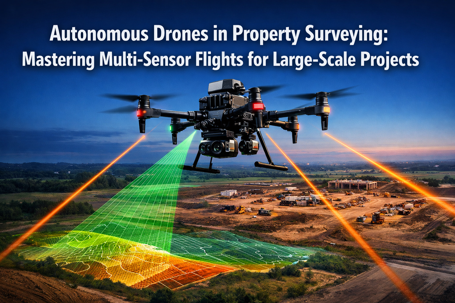
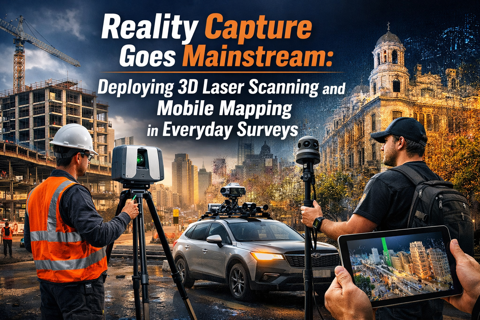
{"cover":"Professional landscape format (1536×1024) hero image featuring bold text overlay 'Reality Capture Goes Mainstream: Deploying 3D Laser Scanning and Mobile Mapping in Everyday Surveys' in extra large 70pt white sans-serif font with dark gradient shadow, positioned in upper third. Background shows surveyor using handheld SLAM scanner in modern construction site with colorful point cloud data overlay visible on holographic display, NavVis VLX device visible, hard hat, safety vest, digital twin visualization floating in air. Color scheme: deep blue, electric cyan, white, orange accents. High contrast, magazine cover quality, editorial style, futuristic yet accessible technology aesthetic, small firm empowerment theme","content":["Landscape format (1536×1024) editorial image showing side-by-side comparison of traditional surveying equipment versus modern reality capture tools. Left side: tripod-mounted total station with surveyor taking manual measurements, clipboard, slow process. Right side: surveyor with backpack-mounted SLAM scanner walking through building interior, real-time point cloud appearing on tablet screen, confidence map display, speed lines indicating rapid capture. Split composition with '10-15x Faster' text overlay in bold typography, hybrid workflow diagram arrows, accuracy specifications callouts (2mm vs 5-20mm), professional construction environment, safety equipment visible, accessible technology theme","Landscape format (1536×1024) infographic-style image depicting hybrid workflow integration for small surveying firms in 2026. Central element: precision backbone concept with static TLS scanner establishing control points (shown as glowing nodes), mobile SLAM paths weaving between them (illustrated as flowing cyan light trails), automated registration software interface visible on laptop screen. Surrounding elements: cost breakdown chart, ROI timeline, training duration icons, safety improvement statistics, telecom infrastructure mapping example with utility poles and fiber cables, drone-mounted LiDAR scanning building facade. Color-coded workflow stages, professional business aesthetic, accessibility icons, small team collaboration visual","Landscape format (1536×1024) image showing real-world 2026 adoption success story scene. Small surveying firm team (3-4 professionals) reviewing large-format point cloud visualization on office wall screen, showing commercial building survey with precise measurements, structural defect identification highlighted in red, dilapidations documentation overlays. Foreground: handheld NavVis device on desk, safety certifications visible, project timeline showing reduced survey duration. Background: before/after comparison of survey reports (traditional vs reality capture), client satisfaction metrics, integration with existing workflows diagram, professional office environment, collaborative atmosphere, technology democratization theme, precision and safety enhancement visual cues"]

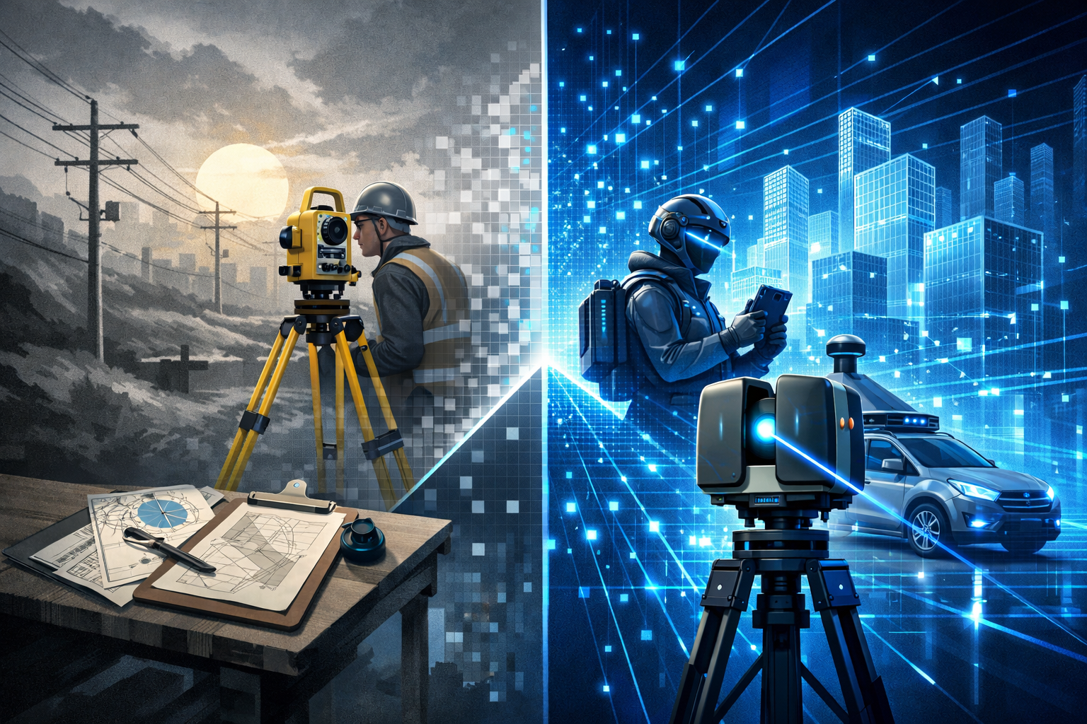
The surveying industry has reached a pivotal moment in 2026. Reality capture technology—once reserved for large engineering firms with deep pockets—has become an accessible, everyday tool for surveyors of all sizes. The transformation of 3D laser scanning and mobile mapping from specialized equipment into user-friendly, cost-effective solutions is revolutionizing how professionals approach building surveys, infrastructure assessments, and commercial property evaluations. Reality Capture Goes Mainstream: Deploying 3D Laser Scanning and Mobile Mapping in Everyday Surveys represents more than a technological shift; it signals a fundamental change in how accuracy, safety, and efficiency intersect in modern surveying practice.
Small and medium-sized surveying firms that once relied exclusively on traditional measurement methods now deploy handheld SLAM devices and hybrid scanning workflows to deliver millimeter-accurate data in a fraction of the time. The barriers that prevented widespread adoption—prohibitive costs, complex software, and steep learning curves—have largely dissolved, replaced by intuitive interfaces, automated processing, and flexible rental options that make reality capture financially viable for routine projects.
Key Takeaways
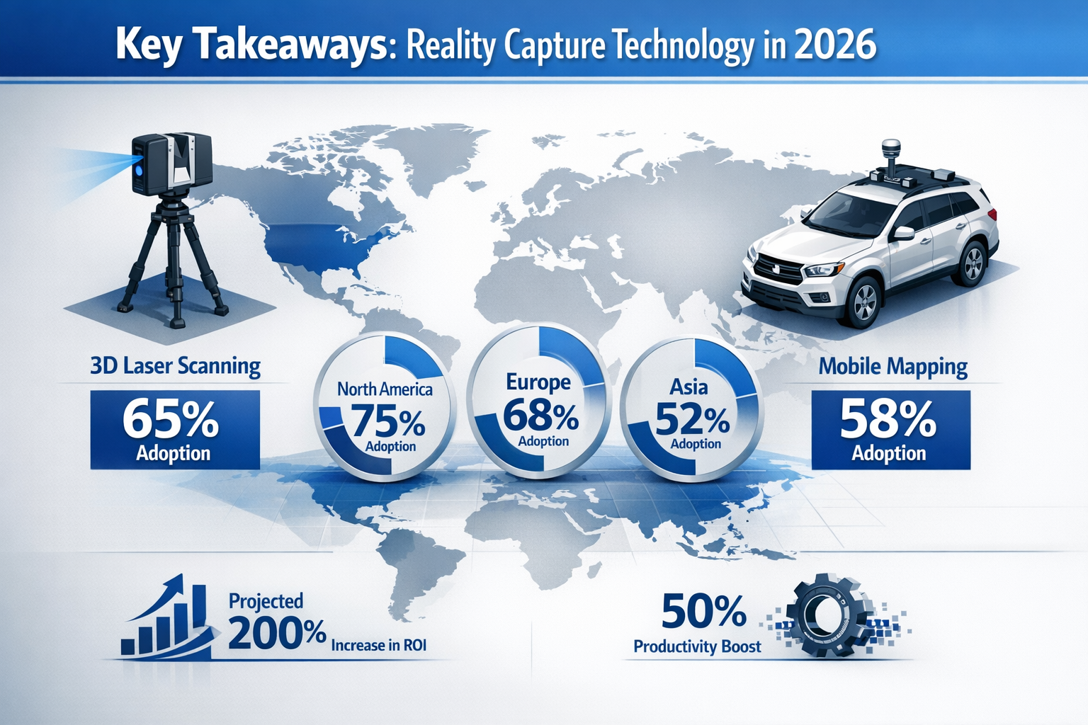
- Hybrid workflows combining static and mobile scanning have become the industry standard in 2026, delivering 3–5 mm accuracy while achieving 10–15 times faster coverage than traditional methods[2]
- User-friendly SLAM technology now enables small firms to deploy handheld and backpack-mounted scanners without extensive training, democratizing access to precision reality capture[3]
- Real-time operational intelligence through confidence mapping and automated processing reduces errors, enhances safety, and eliminates costly re-surveys[2]
- The 3D laser scanning market is projected to grow by USD 1,545.92 million through 2032, driven by infrastructure complexity and digital twin demands[3]
- GPS-denied environments like underground utilities, tunnels, and disaster zones are now reliably mapped using autonomous SLAM navigation[1]
Understanding the Reality Capture Revolution in 2026
What Makes Reality Capture "Mainstream" Today?
The term "mainstream" in surveying context means that reality capture technologies have transitioned from specialized applications to standard operating procedures across the profession. In 2026, the question is no longer "Should we use 3D scanning?" but rather "Which capture strategy optimizes this specific project?"
Miniaturization has played a crucial role in this democratization. Solid-state LiDAR integration and miniaturized laser modules have enabled handheld, backpack-mounted, and drone-mounted scanning configurations that were previously impractical[3]. These compact devices fit into standard survey kits, eliminating the logistical challenges that once limited deployment.
The "static versus mobile" debate that dominated the early 2020s has effectively collapsed. Leading surveying and engineering firms now deploy a tiered capture strategy that combines terrestrial laser scanning (TLS) for geometric control with mobile SLAM for rapid volumetric coverage[2]. This hybrid approach represents the industry's recognition that different project phases demand different tools.
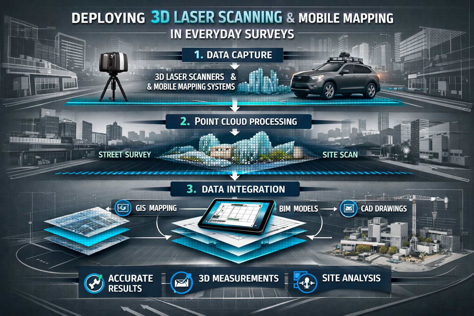
The Technology Stack Behind Modern Reality Capture
Modern reality capture systems integrate multiple sensor technologies:
| Component | Function | 2026 Capabilities |
|---|---|---|
| Multi-layer LiDAR | Point cloud generation | Millions of points per second with dual/quad sensors[2] |
| Panoramic cameras | Visual texture mapping | High-resolution color overlay for photorealistic models |
| IMU sensors | Motion tracking | Precise orientation data for SLAM positioning |
| Edge processors | Real-time computation | Instant confidence mapping and drift detection[2] |
| Cloud connectivity | Data synchronization | Automated upload and collaborative access |
These integrated systems enable surveyors conducting structural surveys to capture comprehensive building data while simultaneously assessing structural integrity through precise geometric analysis.
Breaking Down the Accuracy Hierarchy
Understanding accuracy specifications has become clearly defined in 2026, allowing firms to select appropriate tools for each task:
- Static TLS: Achieves local accuracy below 2 mm, ideal for precision engineering and commercial building surveys requiring exact measurements[2]
- Mobile SLAM: Ranges from 5–20 mm accuracy, suitable for rapid volumetric capture and general documentation[2]
- Hybrid workflows: Optimize to approximately 3–5 mm when datasets are fused through automated registration software[2]
This hierarchy enables cost-effective decision-making. A small firm surveying a residential property for dilapidations might deploy mobile SLAM for rapid coverage, while a precision engineering project demands static TLS control networks.
How Reality Capture Goes Mainstream: Deploying 3D Laser Scanning and Mobile Mapping in Everyday Surveys Enhances Precision and Safety
The Precision Backbone Approach
The "Precision Backbone" methodology has been standardized across the industry in 2026. Static TLS instruments from manufacturers including Leica, Trimble, and FARO establish rigid control networks with sub-millimeter accuracy, while mobile SLAM devices—such as the NavVis VLX 3 and Emesent Hovermap ST-X—then rapidly fill data gaps without drift accumulation[2].
This approach addresses the fundamental limitation of mobile scanning: positioning drift. While mobile SLAM scanning is 10–15 times faster than static scanning for general coverage, without a static control backbone, mobile data can accumulate positioning errors over time and distance[2].
The workflow proceeds in three stages:
- Control establishment: Static scanners placed at strategic intervals create a georeferenced framework
- Volumetric capture: Mobile operators traverse the site, collecting millions of points while the system references back to control points
- Automated registration: Software fuses datasets, correcting drift and producing unified point clouds
This methodology proves particularly valuable for chartered surveyors managing complex commercial properties where both speed and precision are non-negotiable.
Real-Time Operational Intelligence Prevents Costly Errors
Flagship mobile scanners in 2026, including the NavVis VLX 3, feature integrated screens displaying real-time confidence maps that alert operators to feature-poor environments (such as smooth tunnels) where drift is likely[2]. This immediate feedback enables operators to close loops or adjust movement speed proactively, preventing data quality issues that would otherwise require expensive re-surveys.
The confidence mapping system uses color-coded overlays:
- 🟢 Green zones: High feature density, reliable positioning
- 🟡 Yellow zones: Moderate features, acceptable but monitor closely
- 🔴 Red zones: Feature-poor areas, high drift risk, immediate action required
Operators receive audible alerts when entering red zones, prompting them to either slow their walking speed to allow more sensor overlap or create a closed loop by returning to a previously scanned area. This real-time guidance transforms scanning from a skill-intensive task into a guided process accessible to technicians with minimal training.
Safety Improvements Through Remote and Rapid Capture
Reality capture technology fundamentally enhances surveyor safety by reducing exposure to hazardous environments. SLAM technology now operates reliably in GPS-denied environments, with SLAM-based robots autonomously navigating underground tunnels without GPS signals to create high-resolution maps[1].
For surveyors conducting roof surveys, drone-mounted LiDAR systems eliminate the need for personnel to access unstable or deteriorated structures. The surveyor operates from ground level while the autonomous drone captures complete roof geometry, identifying structural defects and measuring dimensions with millimeter precision.
Similarly, when assessing disaster zones or structurally compromised buildings, handheld SLAM devices collect spatial data from safe distances, creating comprehensive 3D models that enable structural engineers to evaluate stability without physical entry.
The speed advantage of mobile scanning also reduces time spent in hazardous environments. A traditional survey of an active construction site might require hours of exposure to moving equipment and overhead work; a mobile SLAM operator completes the same documentation in 15–20 minutes, dramatically reducing risk exposure.
Reality Capture Goes Mainstream: Deploying 3D Laser Scanning and Mobile Mapping for Small Firms—2026 Adoption Stories
Case Study: Regional Surveying Practice Transforms Operations
A five-person surveying practice based in the Southeast of England made the strategic decision to invest in reality capture technology in early 2025. The firm, which primarily conducted building surveys and property valuations, faced increasing competition from larger practices and client demands for faster turnaround times.
Investment breakdown:
- Leica BLK360 static scanner (entry-level): £12,000
- GeoSLAM ZEB Horizon handheld SLAM: £28,000
- Cyclone REGISTER 360 software: £3,500 annual subscription
- Two-day training course: £1,200
- Total initial investment: £44,700
Within six months, the firm reported:
- Survey time reduced by 65% for typical residential properties
- Client acquisition increased by 40% due to differentiated service offerings
- Accuracy-related callbacks eliminated (previously 2–3 per quarter)
- New service lines established: Digital twin creation for commercial clients, as-built documentation for renovations
- ROI achieved in 11 months through increased project volume and premium pricing
The practice manager noted: "The confidence mapping feature on our handheld scanner meant our junior surveyor could conduct complex scans independently after just three days of practice. We're not spending weeks training staff—they're productive almost immediately."
Telecom Infrastructure Mapping: A Primary Use Case for Small Operators
Telecom infrastructure mapping has become a primary use case for reality capture in 2026. Mobile mapping vehicles equipped with LiDAR and GPS rapidly capture buried fiber cables, utility poles, conduits, vaults, clearances, and distance measurements in dense urban and remote environments[4].
Small surveying firms have discovered lucrative opportunities in this sector, addressing traditional challenges in tracking and validating field assets during network expansions and outage response. A three-person survey team in Hampshire secured a contract with a regional telecommunications provider to document 150 kilometers of fiber infrastructure.
Project specifications:
- Equipment: Vehicle-mounted mobile mapping system (rental: £800/day)
- Duration: 12 working days for field capture
- Processing: 4 days automated classification and feature extraction
- Deliverables: Georeferenced point cloud, CAD drawings, asset database with 47,000 individual features
- Traditional method estimate: 8–10 weeks with total station and manual measurement
- Cost savings for client: Approximately £65,000 compared to traditional approach
The automated data processing capabilities powered by edge computing and AI-driven point cloud classification transformed what would have been a labor-intensive post-processing task into an automated, near-instantaneous workflow[3]. The survey team used machine learning algorithms trained to identify utility poles, transformers, cable attachments, and vegetation encroachment, automatically populating asset databases without manual digitization.
Accessibility for Specialized Survey Types
Reality capture has proven particularly transformative for specialized survey types that demand both precision and comprehensive documentation. Firms conducting specific defect reports now use reality capture to create irrefutable visual evidence of property conditions, complete with precise measurements and time-stamped documentation.
A surveyor specializing in drainage surveys integrated handheld SLAM with robotic crawlers to map underground drainage networks. The combined system created complete 3D models of pipe networks, identifying blockages, structural defects, and gradient issues with millimeter precision—data impossible to obtain through traditional inspection methods.
For stock condition surveys of large residential portfolios, housing associations now require reality capture documentation as standard. One surveying practice reported completing condition assessments of 200 properties in a month—a task that previously required an entire quarter using traditional methods.
Integration Tips: Deploying Reality Capture in Existing Workflows
Selecting the Right Equipment Configuration
The product segmentation in 2026 reflects diverse deployment strategies suitable for different firm sizes and specializations[3]:
Handheld laser scanners provide portability and user-friendly interfaces for rapid indoor and small-area scans. These devices, typically priced between £15,000–£35,000, represent the entry point for most small practices. They excel at:
- Residential property surveys
- Interior documentation
- Small commercial spaces
- Confined or complex geometries
Mobile laser scanners mounted on vehicles or drones enable corridor and landscape mapping at scale. Vehicle-mounted systems (£80,000–£150,000 purchase; £600–£1,200/day rental) suit firms with regular large-scale projects:
- Infrastructure corridors
- Highway surveys
- Campus or estate mapping
- Utility network documentation
Static scanners remain indispensable for high-precision, long-range tasks requiring submillimeter accuracy. Entry-level models (£8,000–£15,000) provide excellent value for firms requiring control networks, while professional-grade instruments (£40,000–£80,000) deliver extended range and enhanced accuracy.
The Rental-to-Ownership Pathway
Many successful small firms in 2026 followed a rental-to-ownership pathway that minimized financial risk while building expertise:
Phase 1 (Months 1–3): Rent equipment for specific projects, assess client demand and operational fit
Phase 2 (Months 4–6): Establish regular rental schedule for recurring projects, develop in-house expertise
Phase 3 (Months 7–9): Analyze utilization rates and ROI projections
Phase 4 (Month 10+): Purchase equipment when rental costs approach 40–50% of purchase price
This approach allows firms to generate revenue and validate market demand before committing capital, while building the technical competency necessary to maximize equipment value.
Software Integration and Data Management
The reality capture workflow extends beyond field acquisition to encompass processing, analysis, and deliverable creation. Successful integration requires attention to the complete data pipeline:
Capture software (typically bundled with hardware) handles field data collection and real-time quality control. Modern systems provide intuitive interfaces that guide operators through scan planning, execution, and preliminary quality checks.
Registration and processing software (£2,000–£8,000 annually) automates point cloud alignment, noise filtering, and dataset fusion. Cloud-based options like Autodesk ReCap and Leica Cyclone REGISTER 360 enable collaborative workflows and eliminate local processing hardware requirements.
Analysis and modeling software transforms point clouds into actionable deliverables. Integration with existing CAD platforms (AutoCAD, Revit, ArchiCAD) allows surveyors to extract floor plans, elevations, and sections directly from reality capture data. Specialized applications enable structural analysis, volume calculations, and change detection.
Data management becomes critical as point cloud files regularly exceed 5–10 GB per project. Successful firms implement:
- Cloud storage with automated backup (minimum 2 TB allocation)
- Project naming conventions that enable rapid retrieval
- Metadata tagging for searchability and audit trails
- Client portals for deliverable sharing and collaborative review
- Archival protocols meeting professional indemnity requirements
Training and Competency Development
The learning curve for reality capture technology has flattened significantly, but structured training remains essential for optimal results. The typical competency development timeline in 2026:
Week 1: Equipment familiarization and basic operation (manufacturer-provided training)
Week 2–3: Supervised field deployment on low-risk projects
Week 4–6: Independent operation with quality review
Month 2–3: Advanced techniques (loop closure, hybrid workflows, challenging environments)
Month 4+: Specialized applications and workflow optimization
Professional organizations now offer reality capture certifications that provide structured learning paths and market differentiation. The RICS Certified Reality Capture Surveyor designation, introduced in 2025, has been adopted by over 2,000 practitioners and is increasingly referenced in tender requirements.
Quality Assurance Protocols
Implementing robust quality assurance prevents costly errors and builds client confidence. Successful firms adopt multi-stage verification:
Field QA:
- Real-time confidence monitoring during capture
- Immediate scan registration checks before leaving site
- Photographic documentation of scan positions
- Redundant coverage of critical features
Processing QA:
- Automated registration error reports (target: <5 mm)
- Visual inspection of point cloud completeness
- Comparison against control measurements
- Noise and artifact filtering verification
Deliverable QA:
- Dimensional accuracy checks against known measurements
- Peer review of extracted drawings and models
- Client review and approval workflows
- Version control and change tracking
Overcoming Common Implementation Challenges
Managing Client Expectations and Education
Many clients in 2026 remain unfamiliar with reality capture capabilities and limitations. Successful firms proactively manage expectations through:
Visual demonstrations: Before-and-after comparisons, interactive point cloud viewers, and sample deliverables that illustrate value propositions more effectively than technical specifications.
Transparent communication about accuracy specifications, appropriate applications, and deliverable formats prevents misunderstandings. A surveyor conducting a Level 2 survey should clearly explain how reality capture enhances traditional methodologies rather than replacing professional judgment.
Pricing strategies that demonstrate value require careful positioning. While reality capture reduces field time, the technology investment and processing requirements may not immediately translate to lower fees. Instead, firms emphasize:
- Enhanced accuracy and reduced risk
- Comprehensive documentation for future reference
- Faster project delivery
- Digital deliverables enabling client-side analysis
Addressing Data Privacy and Security Concerns
The comprehensive nature of reality capture data raises legitimate privacy and security considerations. Point clouds capture detailed building interiors, security systems, and potentially sensitive information.
Best practices adopted by leading firms include:
- Client data agreements specifying storage duration, access controls, and deletion protocols
- Secure data transfer using encrypted connections and password-protected deliverables
- Selective processing that excludes sensitive areas from final deliverables
- Compliance documentation demonstrating GDPR adherence and professional standards
For commercial properties, reality capture data represents valuable intellectual property. Firms establish clear ownership terms and implement watermarking and access controls that prevent unauthorized distribution while enabling legitimate client use.
Navigating Regulatory and Professional Standards
Professional surveying standards continue evolving to address reality capture methodologies. In 2026, RICS guidance provides clear frameworks for:
- Appropriate use cases and methodology selection
- Accuracy specifications and verification requirements
- Professional competence and training standards
- Record-keeping and documentation protocols
Firms must ensure their reality capture workflows align with professional indemnity insurance requirements. Many insurers now request specific information about:
- Equipment calibration and maintenance records
- Operator training and certification
- Quality assurance protocols
- Data management and retention policies
Proactive engagement with insurers and professional bodies prevents coverage gaps and demonstrates commitment to professional standards.
The Future Trajectory: Where Reality Capture Goes Next
Market Growth and Technology Evolution
The 3D Laser Scanning for Metrology market is projected to grow by USD 1,545.92 million at a compound annual growth rate (CAGR) of 7.51% through 2032, driven by demands for digital twins and infrastructure complexity[3]. This sustained growth indicates that reality capture will become increasingly central to surveying practice rather than a specialized niche.
Emerging technologies on the 2026–2028 horizon include:
- AI-powered automated defect detection that identifies structural issues, moisture intrusion, and material degradation directly from point cloud data
- Real-time digital twin synchronization enabling continuous facility monitoring through periodic scanning
- Augmented reality integration allowing surveyors to visualize hidden building systems and historical data overlaid on physical environments
- Miniaturization continuation with smartphone-integrated LiDAR achieving survey-grade accuracy
- Quantum sensing potentially revolutionizing accuracy and penetration capabilities
Sustainability and Environmental Applications
Reality capture technology increasingly supports sustainability initiatives and environmental monitoring. Applications gaining traction include:
- Energy efficiency assessments using thermal imaging integrated with 3D geometry to identify heat loss and optimize insulation
- Solar panel installation planning with precise roof geometry and shading analysis
- Vegetation monitoring and carbon sequestration measurement for environmental impact assessments
- Heritage conservation creating detailed records of historic structures for preservation and restoration
These applications expand the addressable market for surveying firms while contributing to broader societal goals.
Democratization and Accessibility Trends
The trajectory toward greater accessibility continues. Subscription-based equipment access, similar to software-as-a-service models, is emerging as an alternative to capital purchase. Firms pay monthly fees (£500–£2,000) for equipment access, training, software, and support—eliminating upfront investment barriers.
Collaborative platforms enable multiple firms to share equipment and expertise, particularly valuable for specialized applications requiring expensive sensors. Regional surveying cooperatives report successful equipment-sharing arrangements that provide access to £200,000+ reality capture systems for firms with annual revenues under £500,000.
Practical Next Steps for Firms Considering Reality Capture Adoption
Assessment and Planning Framework
Firms evaluating reality capture adoption should follow a structured assessment process:
Step 1: Demand Analysis
- Survey existing clients about interest in reality capture deliverables
- Identify project types where speed or accuracy constraints create problems
- Research competitor offerings and market positioning
- Estimate potential project volume and pricing premiums
Step 2: Financial Modeling
- Calculate total cost of ownership (equipment, software, training, overhead)
- Project revenue impact (new clients, premium pricing, increased volume)
- Determine break-even timeline and ROI expectations
- Explore financing options (purchase, lease, rental, subscription)
Step 3: Capability Development
- Identify staff members for training and specialization
- Establish relationships with equipment vendors and training providers
- Develop quality assurance protocols and workflow documentation
- Plan marketing and client education initiatives
Step 4: Pilot Implementation
- Begin with rental equipment on suitable projects
- Document lessons learned and workflow refinements
- Gather client feedback and testimonials
- Refine business case based on actual performance
Building Strategic Partnerships
Successful reality capture adoption often involves strategic partnerships that accelerate capability development:
- Equipment vendors provide training, technical support, and demonstration opportunities
- Software developers offer trial periods and implementation assistance
- Specialist consultants help establish workflows and quality standards
- Complementary firms create referral networks and collaborative project opportunities
These relationships reduce implementation risk and provide ongoing support as technology and best practices evolve.
Marketing Reality Capture Capabilities
Firms that successfully integrate reality capture must effectively communicate new capabilities to existing and prospective clients. Effective strategies include:
Portfolio development: Create case studies with before-and-after comparisons, client testimonials, and quantified benefits (time savings, accuracy improvements, cost reductions).
Educational content: Publish articles, videos, and guides explaining reality capture applications and benefits in client-accessible language.
Demonstration offers: Provide complimentary reality capture documentation for select projects, allowing clients to experience value firsthand.
Visual differentiation: Use point cloud visualizations, 3D models, and interactive viewers in proposals and presentations to stand apart from traditional approaches.
Professional credentials: Highlight certifications, training, and professional affiliations that demonstrate competence and commitment to quality.
Conclusion: Embracing the Mainstream Reality Capture Revolution
Reality Capture Goes Mainstream: Deploying 3D Laser Scanning and Mobile Mapping in Everyday Surveys represents a fundamental transformation in how surveying professionals approach their work in 2026. The convergence of user-friendly technology, accessible pricing, and proven workflows has eliminated the barriers that once confined reality capture to specialized applications and large firms.
Small and medium-sized practices now possess the tools to deliver millimeter-accurate documentation with unprecedented speed and safety. The hybrid workflows combining static precision with mobile efficiency provide optimal solutions for diverse project types, from residential building surveys to complex infrastructure mapping.
The democratization of reality capture extends beyond equipment accessibility to encompass training, software, and support ecosystems that enable rapid competency development. Firms that embrace these technologies position themselves for sustained competitive advantage in an increasingly digital profession.
Actionable Next Steps
For surveying professionals ready to deploy reality capture in everyday practice:
-
Conduct a focused demand assessment by surveying three existing clients about their interest in reality capture deliverables and documenting specific project types where current methods create constraints
-
Arrange equipment demonstrations with at least two vendors, bringing real project scenarios to evaluate practical suitability and user-friendliness
-
Execute a pilot project using rental equipment on a low-risk assignment, documenting time savings, accuracy results, and client feedback
-
Develop a 12-month implementation roadmap with specific milestones for equipment acquisition, staff training, workflow integration, and marketing initiatives
-
Establish quality assurance protocols before scaling deployment, ensuring consistent deliverable quality and professional standards compliance
-
Build strategic partnerships with equipment vendors, software providers, and complementary firms to accelerate capability development and market access
The surveying profession stands at an inflection point where reality capture transitions from competitive advantage to baseline expectation. Firms that act decisively to integrate these technologies will lead the profession forward, delivering superior value while building sustainable, future-ready practices. The tools are accessible, the workflows are proven, and the market demand is established—the only remaining question is when, not if, to begin the journey toward mainstream reality capture deployment.
References
[1] What Is The Future Of 3d Laser Scanning – https://www.gp-radar.com/article/what-is-the-future-of-3d-laser-scanning
[2] 3d Laser Scanning In 2026 Major Technology And Workflow Shifts – https://www.enginyring.com/en/blog/3d-laser-scanning-in-2026-major-technology-and-workflow-shifts
[3] 3d Laser Scanning For Metrology – https://www.360iresearch.com/library/intelligence/3d-laser-scanning-for-metrology
[4] Benefits Of 3d Laser Scanning – https://eagle-eac.com/benefits-of-3d-laser-scanning/