{"cover":"Professional landscape format (1536×1024) hero image featuring bold text overlay 'Mobile 3D Mapping on the Move: Creating Instant Digital Replicas for Indoor and Outdoor Property Surveys' in extra large 70pt white sans-serif font with dark gradient shadow, centered in upper third. Background shows vehicle-mounted LiDAR scanning system capturing 3D point cloud data of urban street with buildings, real-time digital wireframe overlay showing property reconstruction, split-screen showing physical property and digital twin replica. Color scheme: deep blue, electric cyan, white accents. High contrast, magazine cover quality, editorial style, futuristic technology aesthetic with professional surveying equipment visible.","content":["Detailed landscape format (1536×1024) image showing vehicle-mounted mobile mapping system with multiple cameras and LiDAR sensors attached to car roof, capturing 3D data while driving through residential neighborhood. Split-screen composition: left side shows physical street view with properties, right side displays real-time point cloud visualization with colorful 3D mesh reconstruction. Dashboard interface overlay showing data capture metrics, GPS coordinates, scan density statistics. Modern technology aesthetic with blue and green color coding, professional surveying equipment detail, cloud upload icons indicating real-time data transmission to cloud servers.","Detailed landscape format (1536×1024) infographic showing evolution timeline of mobile 3D mapping technology from 2021 to 2026. Visual comparison of bulky traditional surveying equipment versus compact modern solid-state LiDAR systems. Bar chart displaying market growth from USD 27.3 billion to USD 66.7 billion with upward trend arrows. Icons representing key applications: smart cities, autonomous vehicles, infrastructure inspection, property surveys. Side-by-side comparison showing 60% reduction in post-processing time with AI-powered feature extraction. Clean professional design with blue, white, and orange accent colors, technical specifications overlaid.","Detailed landscape format (1536×1024) conceptual illustration showing cloud-based mobile mapping workflow for property surveys. Central cloud server icon with bidirectional data streams connecting to vehicle-mounted scanner, tablet devices showing real-time 3D models, and desktop workstation with detailed property analysis. Split view showing indoor property scan (room interior with furniture) and outdoor property scan (building facade and grounds) being merged into single comprehensive digital twin. Real-time monitoring dashboard displaying project progress, data quality metrics, team collaboration features. Modern interface design with transparent overlays, connectivity lines, professional surveying context, blue and white color scheme."]
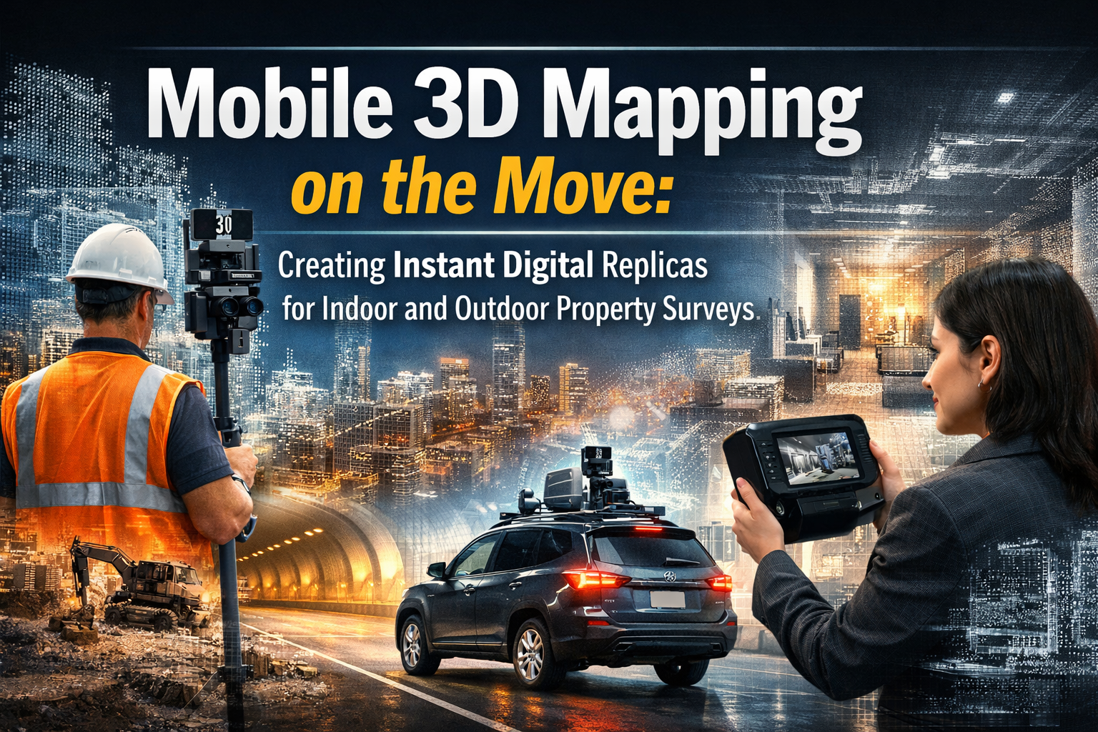
The property surveying industry is experiencing a revolutionary transformation. Imagine driving past a building and capturing every measurement, detail, and structural feature in stunning 3D accuracy—all without stepping out of your vehicle. Mobile 3D Mapping on the Move: Creating Instant Digital Replicas for Indoor and Outdoor Property Surveys represents the cutting edge of surveying technology in 2026, where compact vehicle-mounted systems generate comprehensive digital twins faster and more affordably than ever before.
This technological leap forward eliminates the need for bulky equipment, lengthy setup times, and multiple site visits. Modern mobile mapping systems combine advanced sensors, artificial intelligence, and cloud computing to deliver real-time property data that transforms how professionals approach structural surveys and property assessments. The result? Survey teams can now cover entire neighborhoods in the time it once took to document a single building.
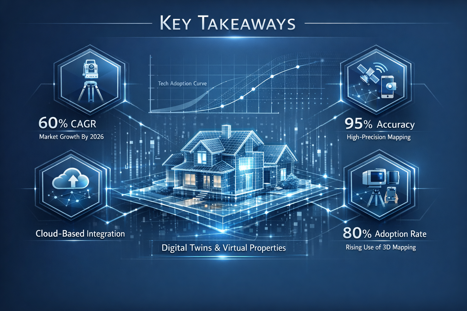
Key Takeaways
✅ Market Explosion: The global mobile mapping market reached USD 51.19 billion in 2026 and is projected to grow at 17.95% annually, reaching USD 116.86 billion by 2031, driven by smart city projects and infrastructure needs.
✅ Compact Technology: Solid-state LiDAR costs have dropped below USD 200 per unit, making multi-sensor vehicle-mounted systems accessible to smaller surveying firms and expanding market adoption.
✅ AI-Powered Efficiency: Advanced neural-network models now automate feature extraction, reducing post-processing time by 60% and enabling survey teams to redeploy within 24 hours instead of weeks.
✅ Real-Time Cloud Integration: Modern mobile mapping platforms transmit data instantly to cloud servers, enabling remote teams to access, analyze, and share 3D property models from any location.
✅ Comprehensive Coverage: Today's systems simultaneously capture indoor and outdoor environments, creating unified digital replicas that support everything from RICS building surveys to complex infrastructure assessments.
Understanding Mobile 3D Mapping Technology in 2026
What Is Mobile 3D Mapping?
Mobile 3D mapping refers to the process of capturing three-dimensional spatial data while in motion, typically using vehicle-mounted sensor arrays. Unlike traditional stationary scanning methods, these systems collect point cloud data—millions of precise measurements representing surfaces, structures, and features—as the vehicle travels through indoor corridors or outdoor streets.
The technology combines several key components:
- LiDAR (Light Detection and Ranging) sensors that emit laser pulses and measure return times to calculate distances
- High-resolution cameras capturing visual imagery synchronized with spatial data
- GPS and inertial measurement units (IMUs) providing precise positioning and orientation
- Onboard processing units managing data collection and preliminary analysis
- Cloud connectivity enabling real-time data transmission and storage
The Evolution from Bulky to Compact Systems
The transformation in mobile mapping equipment has been dramatic. Early systems required:
- Heavy laser scanners weighing over 50 pounds
- Extensive mounting frameworks and stabilization equipment
- Dedicated survey vehicles with specialized modifications
- Large power supplies and cooling systems
- Teams of specialists for operation and maintenance
Today's solid-state LiDAR technology has revolutionized the field. These compact units have no moving parts, making them:
🔹 Lighter – Often weighing less than 5 pounds
🔹 More durable – Resistant to vibration and environmental conditions
🔹 More affordable – Unit costs below USD 200 enable multi-sensor deployments
🔹 Easier to install – Magnetic mounts and quick-release systems allow rapid setup
🔹 More versatile – Suitable for cars, drones, backpacks, and handheld devices
This miniaturization means that standard vehicles can now be transformed into mobile mapping platforms within minutes, democratizing access to technology that was once reserved for large surveying firms with substantial capital investments.
How Mobile Mapping Creates Digital Replicas
The process of generating digital property replicas involves several sophisticated steps:
1. Data Capture Phase
As the vehicle moves through the survey area, LiDAR sensors emit thousands of laser pulses per second. Each pulse bounces off surfaces—walls, roofs, trees, pavement—and returns to the sensor. By measuring the time delay, the system calculates precise distances. Simultaneously, cameras capture high-resolution imagery, creating a visual record synchronized with the spatial measurements.
2. Point Cloud Generation
The collected distance measurements create a point cloud—a massive dataset of XYZ coordinates representing every surface encountered. A single pass down a residential street might generate millions of individual points, creating a detailed three-dimensional representation of the environment.
3. Data Processing and Feature Extraction
Modern AI-powered algorithms analyze the point cloud to identify and classify features automatically. The system can distinguish:
- Building facades and structural elements
- Road surfaces and pavement markings
- Vegetation and landscape features
- Utility infrastructure (poles, signs, hydrants)
- Interior room dimensions and architectural details
4. Digital Twin Creation
The processed data transforms into a navigable 3D model—a digital twin of the physical property. Users can measure distances, calculate volumes, assess conditions, and extract detailed information without returning to the site.
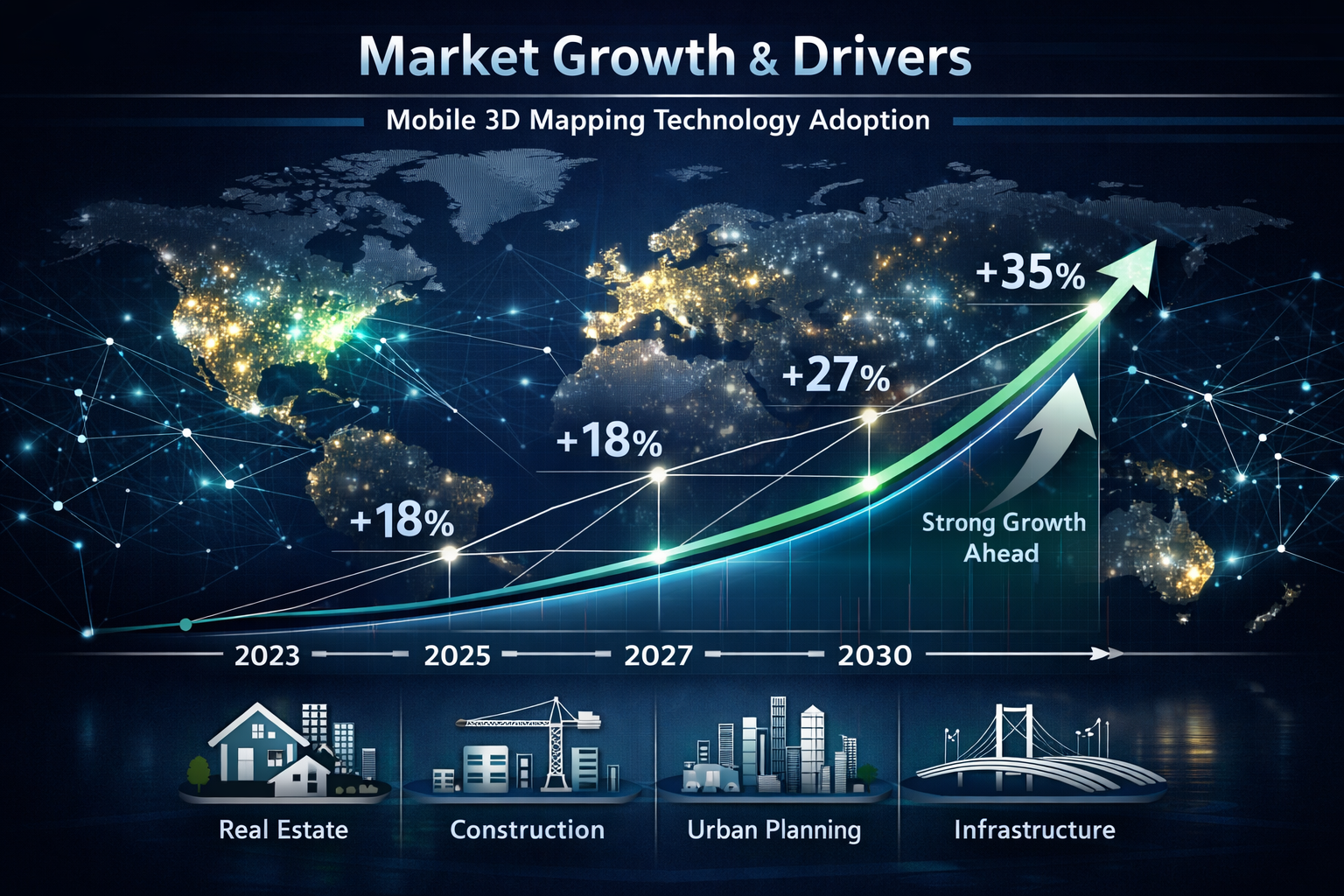
Mobile 3D Mapping on the Move: Creating Instant Digital Replicas for Indoor and Outdoor Property Surveys – Market Growth and Drivers
Explosive Market Expansion
The mobile mapping sector is experiencing unprecedented growth. According to industry analysis, the global market reached USD 51.19 billion in 2026, with projections indicating it will expand at a compound annual growth rate of 17.95% to reach USD 116.86 billion by 2031[2]. Alternative market assessments project the sector growing from USD 27.3 billion in 2021 to USD 66.7 billion by 2026[4].
This rapid expansion reflects fundamental shifts in how organizations approach spatial data collection and property documentation. The technology has moved from niche applications to mainstream adoption across multiple sectors.
Key Market Drivers
Smart City Initiatives
Municipalities worldwide are investing heavily in digital infrastructure. Smart city projects require comprehensive 3D models of urban environments to support:
- Traffic flow optimization and transportation planning
- Infrastructure maintenance and asset management
- Emergency response planning and simulation
- Urban development and zoning decisions
- Environmental monitoring and sustainability initiatives
Mobile mapping provides the foundational spatial data these initiatives require, enabling cities to create detailed digital twins of entire urban areas efficiently and cost-effectively.
Autonomous Vehicle Development
The autonomous vehicle industry depends on highly accurate 3D maps for navigation and decision-making. Mobile mapping systems create the high-definition maps that self-driving vehicles use to understand their environment, identify obstacles, and plan safe routes[4].
Infrastructure Inspection and Asset Management
Organizations managing extensive infrastructure networks—utilities, transportation departments, telecommunications providers—face constant pressure to assess conditions, plan maintenance, and optimize operations. Mobile mapping enables rapid, comprehensive surveys that would be impractical using traditional methods.
For property professionals conducting choosing the right property survey, mobile 3D mapping offers unprecedented detail and efficiency.
Geospatial Data Adoption
Industries across the spectrum increasingly recognize the value of accurate spatial information. Construction firms, insurance companies, real estate developers, and facility managers all benefit from detailed 3D property models that support better decision-making and risk assessment[4].
Technological Innovations Driving Adoption
Drone-Based Mobile Mapping
While vehicle-mounted systems excel in accessible areas, drone-based mobile mapping payloads are expanding at a 21.10% compound annual growth rate[2]. Lightweight solid-state LiDAR and improved battery endurance enable drones to capture data in previously inaccessible locations:
- Vertical mine faces and quarries
- Cliff faces and steep terrain
- Disaster zones unsafe for human access
- Building rooftops and complex architectural features
- Large agricultural or forestry areas
This versatility makes mobile mapping suitable for virtually any property survey scenario, from drone surveys of expansive estates to detailed roof surveys of commercial buildings.
Artificial Intelligence Integration
AI-powered automatic feature extraction is contributing 3.2% to market expansion in North America, Europe, and advanced Asia-Pacific regions[2]. Machine learning algorithms trained on millions of scans can now:
- Automatically detect and classify pavement defects
- Identify lane markings and road signs
- Recognize structural elements and building components
- Flag potential safety hazards or maintenance needs
- Generate measurements and reports with minimal human intervention
Trimble's TBC 2024.10 release in March 2025 integrated trainable neural-network models for automated lane-marking and pavement-defect detection, reducing post-processing time by 60%[2]. This efficiency gain enables field crews to be redeployed within 24 hours instead of waiting weeks for data processing.
Cost Reduction Through Technology
The dramatic decrease in sensor costs has fundamentally altered market dynamics. With solid-state LiDAR units available for under USD 200[2], organizations can deploy multiple sensors to:
- Capture data from different angles simultaneously
- Provide redundancy for quality assurance
- Reduce project costs through faster data collection
- Expand services to smaller projects previously considered uneconomical
This democratization of technology parallels trends in other survey specializations, making comprehensive assessments more accessible to property owners seeking homebuyer surveys or specialized investigations.
Advanced Mobile Mapping Systems and Real-World Applications
Cutting-Edge Platform Innovations
The mobile mapping industry continues to introduce increasingly sophisticated systems designed for specific applications and environments.
Seeing Machines 3D Cabin Perception Mapping
On January 13, 2026, Seeing Machines announced its groundbreaking 3D Cabin Perception Mapping platform, demonstrated live at CES 2026[1]. While initially designed for automotive applications, this technology represents a fundamental shift in how mobile mapping approaches interior spaces.
The system delivers real-time, holistic reconstruction of enclosed environments rather than analyzing individual features separately. During demonstrations, it simultaneously monitored up to 7 vehicle occupants across 3 rows of seating using just 3 cameras[1], showcasing capabilities including:
- Full 3D pose estimation of all occupants
- Body size and shape classification
- Object detection and classification
- Spatial relationship analysis
- Out-of-position detection
This "clean-sheet" architecture has applications extending beyond automotive contexts to robotics, human-machine interaction environments, and—critically for property professionals—indoor property surveys[1]. The ability to create comprehensive 3D reconstructions of interior spaces using minimal equipment represents a significant advancement for residential and commercial property assessments.
Leica Geosystems Pegasus TRK300
Introduced in May 2025, the Pegasus TRK300 represents the latest evolution in adaptable mobile mapping systems[2]. Its dual-head multi-beam scanner features an impressive 300-meter range, making it ideal for:
- Smart city mapping projects covering extensive urban areas
- Infrastructure corridor surveys along highways and railways
- Large commercial property complexes
- Industrial facilities and campuses
- Mixed-use developments requiring both indoor and outdoor coverage
The system's modular design allows surveyors to configure sensor arrays based on specific project requirements, balancing data quality, coverage area, and collection speed.
Trimble MX90 Mobile Mapping System
Launched in February 2025, the Trimble MX90 exemplifies the vehicle-independent approach to mobile mapping[2]. This system can be quickly mounted on various vehicles, capturing:
- Laser scans at highway speeds without compromising accuracy
- High-resolution imagery synchronized with point cloud data
- Detailed crack detection for pavement assessment
- Asset inventories for infrastructure management
- Comprehensive property documentation for multiple survey types
The MX90's flexibility makes it particularly valuable for surveying firms serving diverse clients, from transportation departments to property owners requiring structural surveys of extensive holdings.
Exyn Technologies Nexys Platform
Unveiled in February 2024, Nexys addresses a critical gap in mobile mapping: confined and challenging environments[2]. This modular autonomous survey platform excels in:
- Underground facilities and basements
- Parking structures and tunnels
- Industrial plants with complex piping and equipment
- Historic buildings with narrow corridors
- Construction sites with limited access
The system's autonomous navigation capabilities enable data capture in environments where GPS signals are unavailable and human access is difficult or dangerous, expanding the scope of what's possible in comprehensive property documentation.
Indoor vs. Outdoor Survey Applications
Modern mobile mapping systems excel in both interior and exterior environments, though each presents unique challenges and opportunities.
Outdoor Property Surveys
For outdoor applications, mobile mapping provides:
✅ Rapid site coverage – Survey teams can document entire neighborhoods, commercial districts, or industrial parks in hours rather than days
✅ Comprehensive asset inventories – Capture not just buildings but surrounding infrastructure, landscaping, parking areas, and site features
✅ Elevation and terrain data – Generate accurate digital elevation models supporting drainage analysis, grading plans, and development feasibility studies
✅ Facade documentation – Record building exteriors in detail sufficient for condition assessment, renovation planning, and historic preservation
✅ Change detection – Repeated surveys enable monitoring of settlement, structural movement, or unauthorized modifications
Indoor Property Surveys
Interior applications leverage mobile mapping's ability to navigate complex spaces:
✅ As-built documentation – Create accurate floor plans, ceiling heights, and spatial relationships for existing buildings
✅ Space utilization analysis – Measure room dimensions, door widths, and circulation patterns for facility planning
✅ Renovation planning – Provide contractors with precise measurements reducing field verification time and estimation errors
✅ Condition assessment – Document wall surfaces, floor levelness, and structural elements for specific defect reports
✅ Compliance verification – Verify accessibility features, egress paths, and building code compliance
The integration of indoor and outdoor data creates unified digital twins that represent entire properties comprehensively, supporting holistic analysis impossible with traditional survey methods.
Specialized Survey Applications
Mobile 3D mapping technology supports numerous specialized survey types:
Dilapidation Surveys
For dilapidation surveys documenting property conditions before construction or lease termination, mobile mapping provides:
- Objective baseline documentation with millimeter-level accuracy
- Time-stamped evidence defensible in disputes
- Comprehensive coverage reducing claims of incomplete documentation
- Comparative analysis capabilities for before-and-after assessments
Stock Condition Surveys
Property portfolios requiring stock condition surveys benefit from:
- Rapid data collection across multiple properties
- Consistent methodology ensuring comparable results
- Detailed asset registers supporting maintenance planning
- Predictive analytics identifying emerging maintenance needs
Monitoring Surveys
For properties requiring ongoing monitoring surveys to track movement or deterioration:
- Precise measurements enabling detection of millimeter-scale changes
- Regular automated surveys reducing monitoring costs
- Trend analysis identifying acceleration or deceleration of problems
- Early warning systems triggering alerts when thresholds are exceeded
Cloud Integration and Real-Time Project Monitoring

The Shift to Cloud-Based Workflows
One of the most transformative aspects of modern mobile 3D mapping is seamless integration with cloud computing infrastructure. This integration fundamentally changes how survey data is collected, processed, shared, and utilized.
Traditional Workflow Limitations
Legacy surveying workflows involved:
- Field data collection with portable storage
- Physical return to office
- Data transfer to workstations
- Processing on local computers
- Report generation and distribution
- Client review and feedback
- Revision cycles requiring data reprocessing
This linear process created bottlenecks, delays, and limited collaboration opportunities. Data remained siloed on individual computers, making team coordination difficult and version control challenging.
Cloud-Enabled Transformation
Modern mobile mapping systems transmit data directly to cloud servers during or immediately after collection, enabling:
📡 Real-time data availability – Stakeholders access survey data while field crews are still on-site
📡 Distributed processing – Cloud servers with massive computational power process data far faster than local workstations
📡 Collaborative workflows – Multiple team members work simultaneously on different aspects of the same dataset
📡 Automatic backups – Data security through redundant cloud storage eliminates risk of loss
📡 Version control – Centralized data management tracks changes and maintains audit trails
📡 Scalable storage – Cloud infrastructure accommodates projects of any size without hardware investments
Real-Time Project Monitoring Benefits
The ability to monitor survey projects in real-time creates numerous advantages for property professionals and their clients.
Quality Assurance During Collection
Project managers can review incoming data while crews are still in the field, identifying:
- Coverage gaps requiring additional passes
- Data quality issues necessitating recalibration
- Missing features or areas overlooked
- Opportunities to capture supplementary information
This immediate feedback prevents the costly discovery of data deficiencies after crews have left the site, reducing the need for return visits.
Client Engagement and Transparency
Property owners and stakeholders appreciate the ability to:
- View preliminary results during data collection
- Provide input on areas requiring additional attention
- Understand project progress through visual dashboards
- Make informed decisions based on emerging findings
This transparency builds trust and enables collaborative problem-solving, particularly valuable for complex projects like RICS building surveys where client priorities may evolve as conditions are revealed.
Accelerated Decision-Making
Real-time access to survey data enables faster responses to time-sensitive situations:
- Emergency assessments following disasters or incidents
- Rapid feasibility studies for development opportunities
- Immediate condition evaluations for transaction due diligence
- Quick verification of contractor work quality
Multi-Stakeholder Coordination
Cloud-based platforms facilitate coordination among diverse project participants:
| Stakeholder | Real-Time Benefits |
|---|---|
| Surveyors | Coordinate multiple field teams, allocate resources dynamically |
| Architects | Begin design work using preliminary survey data |
| Engineers | Conduct structural analysis as data becomes available |
| Contractors | Plan logistics and estimate costs with accurate site information |
| Property Owners | Monitor progress and provide timely feedback |
| Regulators | Review compliance documentation without delays |
Data Security and Privacy Considerations
While cloud integration offers tremendous benefits, it also requires careful attention to security and privacy.
Encryption and Access Control
Reputable cloud platforms implement:
- End-to-end encryption during data transmission
- Encrypted storage protecting data at rest
- Role-based access controls limiting who can view or modify data
- Multi-factor authentication preventing unauthorized access
- Audit logs tracking all data access and modifications
Compliance with Regulations
Survey data often includes sensitive information requiring compliance with:
- Data protection regulations (GDPR, CCPA, etc.)
- Industry-specific privacy requirements
- Client confidentiality agreements
- Professional liability standards
Cloud service providers serving the surveying industry typically maintain certifications demonstrating compliance with relevant standards and regulations.
Data Sovereignty
For projects involving government properties or sensitive facilities, data sovereignty requirements may dictate:
- Storage within specific geographic jurisdictions
- Use of government-certified cloud providers
- Air-gapped systems without internet connectivity
- On-premises processing for classified information
Modern mobile mapping platforms offer flexible deployment options accommodating various security requirements while still providing many benefits of cloud integration.
From Big Data to Trusted Data: Quality and Accuracy
The Data Deluge Challenge
Advanced mobile mapping sensors generate unprecedented volumes of data. A single day of urban surveying can produce:
- Billions of individual point measurements
- Thousands of high-resolution images
- Gigabytes or terabytes of raw data
- Multiple sensor streams requiring synchronization
- Metadata describing collection parameters and conditions
As industry experts note, the challenge has shifted from collecting data to converting raw information into trustworthy, actionable intelligence[3]. The industry is moving "from Big Data to Trusted Data," recognizing that volume alone provides little value without quality, accuracy, and reliability.
Ensuring Data Quality and Accuracy
Sensor Calibration and Validation
Modern mobile mapping systems incorporate sophisticated calibration procedures:
🔧 Factory calibration – Manufacturers calibrate sensors under controlled conditions before delivery
🔧 Field calibration – Regular on-site calibration using known reference targets ensures continued accuracy
🔧 Cross-validation – Multiple sensors capturing the same features enable automatic error detection
🔧 Ground control points – Surveyed reference locations verify absolute positioning accuracy
🔧 Quality metrics – Automated analysis generates statistics describing data precision and completeness
AI-Powered Quality Control
Machine learning algorithms trained on millions of scans can identify:
- Systematic errors indicating calibration drift
- Anomalous measurements suggesting sensor malfunctions
- Coverage gaps requiring additional data collection
- Inconsistencies between overlapping scans
- Environmental factors affecting data quality (rain, fog, vibration)
These automated quality checks occur during data collection, enabling immediate corrective action rather than discovering problems during post-processing.
Accuracy Standards and Specifications
Professional surveying organizations establish accuracy standards for various applications:
| Survey Type | Typical Accuracy Requirement | Mobile Mapping Capability |
|---|---|---|
| Topographic Survey | ±50mm horizontal, ±100mm vertical | Exceeds requirements |
| Building Facade | ±10-20mm | Meets requirements |
| Interior As-Built | ±25mm | Meets requirements |
| Infrastructure Corridor | ±30mm horizontal, ±50mm vertical | Exceeds requirements |
| Volume Calculations | ±2-5% of total volume | Meets requirements |
Modern mobile mapping systems routinely achieve accuracies sufficient for most property survey applications, though specialized requirements may necessitate supplementary measurements using traditional techniques.
Converting Data to Actionable Information
Automated Feature Extraction
AI-powered algorithms transform point clouds into useful information products:
- Building Information Models (BIM) – Parametric 3D models supporting design and analysis
- Floor plans and elevations – Traditional 2D drawings extracted from 3D data
- Asset inventories – Databases of building components, infrastructure elements, or site features
- Condition reports – Automated identification of defects, damage, or maintenance needs
- Measurement tables – Quantities, areas, volumes, and dimensions for estimation
The 60% reduction in post-processing time achieved by modern AI systems[2] dramatically improves project economics, making comprehensive surveys viable for smaller properties and tighter budgets.
Visualization and Communication
Effective communication of survey findings requires more than raw data. Modern platforms provide:
📊 Interactive 3D viewers – Stakeholders explore digital twins using web browsers without specialized software
📊 Annotated deliverables – Survey findings highlighted directly on 3D models with photos and descriptions
📊 Comparative visualizations – Side-by-side displays showing conditions at different times or proposed changes
📊 Virtual reality experiences – Immersive walkthroughs enabling remote site visits and design reviews
📊 Customized reports – Automated generation of documentation tailored to specific stakeholder needs
These communication tools make survey findings accessible to clients regardless of technical expertise, supporting informed decision-making about property transactions, renovations, or maintenance priorities.
Practical Implementation for Property Professionals
Getting Started with Mobile 3D Mapping
For surveying firms and property professionals considering mobile 3D mapping adoption, several pathways offer different balances of investment, capability, and flexibility.
Equipment Purchase
Direct equipment ownership provides maximum control and long-term cost efficiency:
Entry-Level Systems (USD 5,000-15,000)
- Handheld or backpack-mounted scanners
- Suitable for small properties and interior surveys
- Limited range and accuracy compared to vehicle systems
- Good for firms testing technology before major investment
Mid-Range Vehicle Systems (USD 30,000-75,000)
- Vehicle-mountable systems with solid-state LiDAR
- Appropriate for most property survey applications
- Balance of capability, portability, and cost
- Typical choice for established surveying practices
Professional-Grade Platforms (USD 100,000-250,000+)
- High-accuracy multi-sensor arrays
- Extended range and specialized capabilities
- Suitable for large infrastructure projects
- Investment for firms specializing in mobile mapping
Service Partnerships
Many firms access mobile mapping capabilities through partnerships:
- Data collection services – Specialized providers capture data on behalf of surveying firms
- Equipment rental – Short-term access for specific projects without capital investment
- Hybrid models – Own basic equipment while renting specialized systems as needed
- Subcontracting – Partner with mobile mapping specialists for portions of larger projects
These approaches allow firms to offer mobile mapping services while minimizing financial risk and maintaining focus on core competencies.
Integration with Existing Survey Services
Mobile 3D mapping complements rather than replaces traditional survey methods. Successful integration involves:
Identifying Optimal Applications
Mobile mapping excels for:
✓ Large properties requiring extensive documentation
✓ Time-sensitive projects with tight deadlines
✓ Repeat surveys for monitoring or change detection
✓ Projects requiring comprehensive visual documentation
✓ Situations where traditional access is difficult or dangerous
Traditional methods remain preferable for:
✓ Small properties where setup time exceeds collection time
✓ Projects requiring extreme precision (sub-millimeter accuracy)
✓ Specialized measurements (property boundaries, elevation certificates)
✓ Situations where client preferences or regulations mandate traditional approaches
Complementary Workflows
Many projects benefit from combining approaches:
- Mobile mapping for overall documentation plus traditional surveys for critical details
- Rapid mobile scanning to identify areas requiring detailed investigation
- Mobile data providing context for specialized testing (damp surveys, subsidence investigations)
- Traditional boundary surveys supplemented by mobile mapping for improvements and features
Training and Skill Development
Effective mobile mapping requires new competencies beyond traditional surveying skills:
Technical Skills
- Sensor operation and calibration procedures
- Data collection planning and optimization
- Quality control and validation techniques
- Point cloud processing and analysis software
- 3D modeling and visualization tools
Analytical Skills
- Interpreting point cloud data for feature identification
- Recognizing data quality issues and artifacts
- Understanding sensor limitations and appropriate applications
- Integrating multiple data sources effectively
Communication Skills
- Explaining technology capabilities and limitations to clients
- Presenting 3D data to non-technical stakeholders
- Managing client expectations regarding deliverables and timelines
- Collaborating with multidisciplinary teams using shared data
Professional development resources include:
- Manufacturer training programs for specific equipment
- Industry conferences and workshops
- Online courses and certification programs
- Peer learning through professional associations
- Hands-on experience with progressively complex projects
Future Trends and Emerging Opportunities
Technological Advancements on the Horizon
The mobile mapping industry continues to evolve rapidly, with several emerging trends poised to further transform property surveying.
Enhanced Sensor Integration
Next-generation systems will incorporate:
- Thermal imaging – Simultaneous capture of surface temperatures for energy audits and moisture detection
- Hyperspectral sensors – Material identification and condition assessment through spectral analysis
- Ground-penetrating radar – Subsurface feature detection during mobile surveys
- Gas detection sensors – Environmental monitoring integrated with spatial documentation
These multi-modal sensors will enable comprehensive property assessments capturing information far beyond geometric measurements.
Artificial Intelligence Advancement
AI capabilities will expand to include:
- Automated defect classification and severity assessment
- Predictive maintenance recommendations based on condition trends
- Regulatory compliance verification against building codes
- Cost estimation for repairs or renovations
- Risk assessment for insurance or lending purposes
Augmented Reality Integration
Mobile mapping data will increasingly support augmented reality applications:
- On-site visualization of hidden infrastructure (utilities, structural elements)
- Real-time comparison of as-built conditions versus design intent
- Interactive guidance for inspection or maintenance procedures
- Virtual staging for property marketing
- Design visualization overlaid on existing conditions
Miniaturization and Democratization
Continued sensor miniaturization will enable:
- Smartphone-based scanning with near-professional accuracy
- Wearable sensors for hands-free data collection
- Drone swarms collaborating to survey large areas rapidly
- Consumer-grade tools for homeowner self-assessment
This democratization will expand the market while creating opportunities for professionals to provide value-added analysis and interpretation services.
Expanding Market Applications
Digital Twin Ecosystems
Properties will increasingly exist as persistent digital twins that:
- Update automatically through regular mobile mapping surveys
- Integrate with building management systems for real-time monitoring
- Support virtual inspections and remote property management
- Provide historical records tracking changes over time
- Enable predictive analytics for maintenance and operations
Regulatory and Compliance Applications
Government agencies will increasingly leverage mobile mapping for:
- Automated building permit compliance verification
- Property tax assessment based on actual conditions
- Infrastructure asset management and maintenance planning
- Emergency response planning and simulation
- Environmental monitoring and enforcement
Insurance and Risk Management
The insurance industry will adopt mobile mapping for:
- Accurate property valuations for coverage determination
- Risk assessment based on actual conditions rather than assumptions
- Claims documentation and fraud prevention
- Disaster response and damage assessment
- Premium adjustments reflecting property improvements or deterioration
Sustainability and Environmental Benefits
Mobile 3D mapping supports environmental sustainability through:
🌱 Reduced site visits – Fewer trips mean lower fuel consumption and emissions
🌱 Optimized renovations – Accurate measurements reduce material waste from estimation errors
🌱 Energy efficiency – Thermal integration identifies heat loss for targeted improvements
🌱 Preservation – Detailed documentation supports restoration of historic buildings
🌱 Green infrastructure – Vegetation mapping and analysis for urban forestry and stormwater management
As organizations prioritize environmental responsibility, these sustainability benefits will increasingly influence technology adoption decisions.
Conclusion: Embracing the Mobile Mapping Revolution
Mobile 3D Mapping on the Move: Creating Instant Digital Replicas for Indoor and Outdoor Property Surveys represents far more than incremental improvement—it's a fundamental transformation in how property professionals document, analyze, and communicate spatial information. The convergence of affordable sensors, powerful AI, and cloud computing has created capabilities that seemed futuristic just a few years ago.
The market data speaks clearly: with the global mobile mapping sector reaching USD 51.19 billion in 2026 and projected to exceed USD 116 billion by 2031[2], this technology has moved from experimental to essential. Property professionals who embrace these tools position themselves to deliver faster, more comprehensive, and more cost-effective services than competitors relying solely on traditional methods.
The benefits extend across the entire property lifecycle:
✅ For buyers – Comprehensive property documentation supporting informed purchase decisions
✅ For sellers – Objective condition documentation facilitating transparent transactions
✅ For owners – Detailed records supporting maintenance planning and renovation projects
✅ For managers – Efficient portfolio documentation enabling data-driven asset management
✅ For developers – Accurate site information reducing design risks and construction surprises
Actionable Next Steps
For Property Professionals:
- Assess your current survey portfolio – Identify projects that would benefit from mobile mapping capabilities
- Research available systems – Evaluate equipment options matching your typical project requirements and budget
- Develop partnerships – Connect with mobile mapping service providers to test capabilities on pilot projects
- Invest in training – Build internal expertise through manufacturer training and industry education programs
- Start small and scale – Begin with straightforward projects to develop workflows before tackling complex applications
For Property Owners:
- Request mobile mapping options – Ask surveyors about 3D documentation capabilities when choosing the right property survey
- Understand deliverable options – Discuss how 3D data can support your specific needs and decisions
- Consider long-term value – Evaluate the benefits of comprehensive digital documentation for future projects
- Explore cloud access – Inquire about platforms enabling remote access to survey data
- Plan for updates – Consider periodic re-surveys to track property conditions over time
For Industry Stakeholders:
- Establish standards – Support development of industry standards for mobile mapping accuracy and deliverables
- Promote education – Encourage professional development programs addressing mobile mapping competencies
- Foster collaboration – Create opportunities for knowledge sharing among early adopters
- Address challenges – Work collectively to resolve regulatory, liability, and professional practice issues
- Communicate value – Educate clients and the public about mobile mapping benefits and appropriate applications
The mobile 3D mapping revolution is well underway, transforming property surveys from time-consuming, labor-intensive processes into efficient, comprehensive digital documentation exercises. Organizations that recognize this transformation and adapt accordingly will thrive in an increasingly data-driven property industry. Those that resist risk obsolescence as clients increasingly expect the speed, detail, and accessibility that modern mobile mapping provides.
The technology is mature, affordable, and proven. The market is growing rapidly. The competitive advantages are clear. The question is no longer whether to adopt mobile 3D mapping, but how quickly to integrate it into your property survey practice. The future of property documentation is mobile, digital, and three-dimensional—and that future is now.
References
[1] Seeing Machines Breaks New Ground At Ces 2026 With 3d Cabin Perception Mapping 302659625 – https://www.prnewswire.com/news-releases/seeing-machines-breaks-new-ground-at-ces-2026-with-3d-cabin-perception-mapping-302659625.html
[2] Mobile Mapping System Market Industry – https://www.mordorintelligence.com/industry-reports/mobile-mapping-system-market-industry
[3] Mapping The Future Critical Geospatial Trends For 2026 – https://woolpert.com/mapping-the-future-critical-geospatial-trends-for-2026/
[4] Mobile Mapping – https://www.marketsandmarkets.com/PressReleases/mobile-mapping.asp