The surveying industry stands at a critical juncture as the February 23, 2026 deadline approaches for implementing the latest ALTA/NSPS Land Title Survey standards. For surveyors, title companies, lenders, and commercial real estate professionals, understanding these changes isn't just about compliance—it's about maintaining professional credibility and avoiding costly errors in an increasingly complex regulatory environment. The 2026 ALTA/NSPS Land Title Survey Updates: Essential Changes and Compliance Guide for Surveyors provides the roadmap for navigating this transition successfully.
The shift from the 2021 standards represents more than minor technical adjustments. These updates introduce enhanced transparency requirements, expanded use of aerial and satellite imagery, refined Relative Positional Precision (RPP) standards, and strengthened documentation protocols that fundamentally change how surveyors approach their work[1][5]. With every survey begun on or after February 23, 2026 required to comply with the new standards, the time for preparation is now.
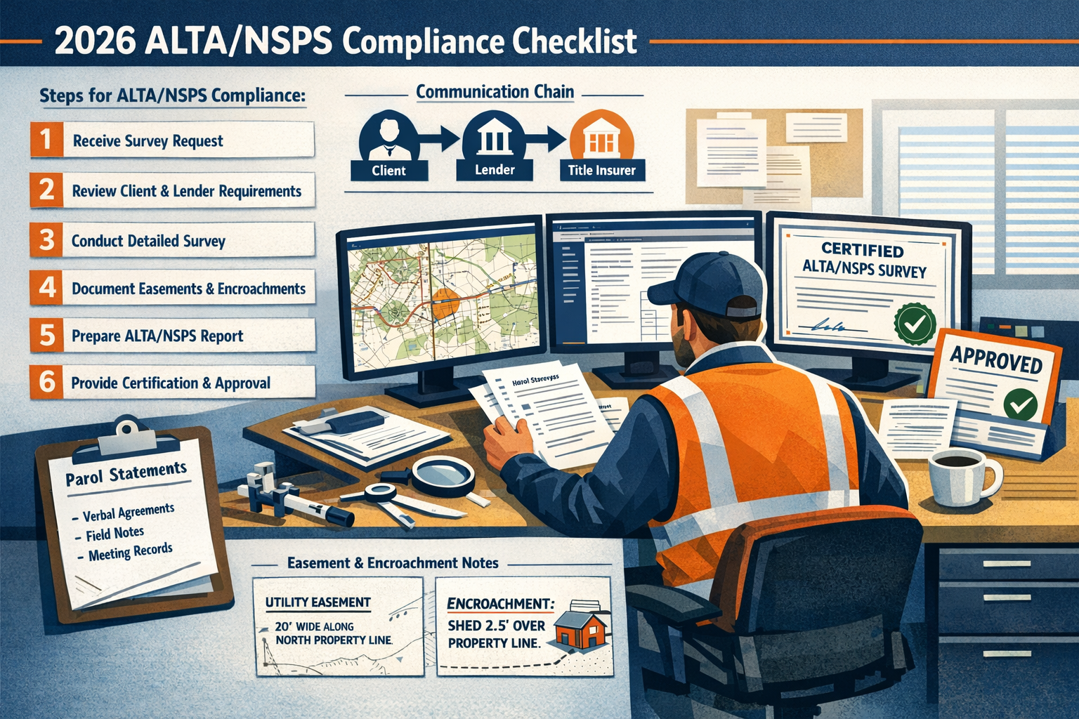
Key Takeaways
- ⏰ All surveys begun on or after February 23, 2026 must comply with the new ALTA/NSPS standards, with no grandfathering of projects under the 2021 requirements[1][2]
- 📋 Enhanced transparency mandates require surveyors to provide explicit explanations for decisions previously left implied, including new legal descriptions, measurement discrepancies, and access limitations[5]
- 🛰️ Expanded aerial/satellite imagery acceptance allows greater use of remote sensing technology for certain features, reducing field time while maintaining accuracy standards[3][4]
- 📊 Refined RPP (Relative Positional Precision) standards emphasize that precision measurements alone don't guarantee correctness—proper boundary interpretation remains critical[5]
- 📝 Strengthened documentation requirements for easements, utilities, access rights, and encroachments demand more detailed notes and clearer distinctions between recorded information and physical evidence[5]
Understanding the February 23, 2026 Compliance Deadline
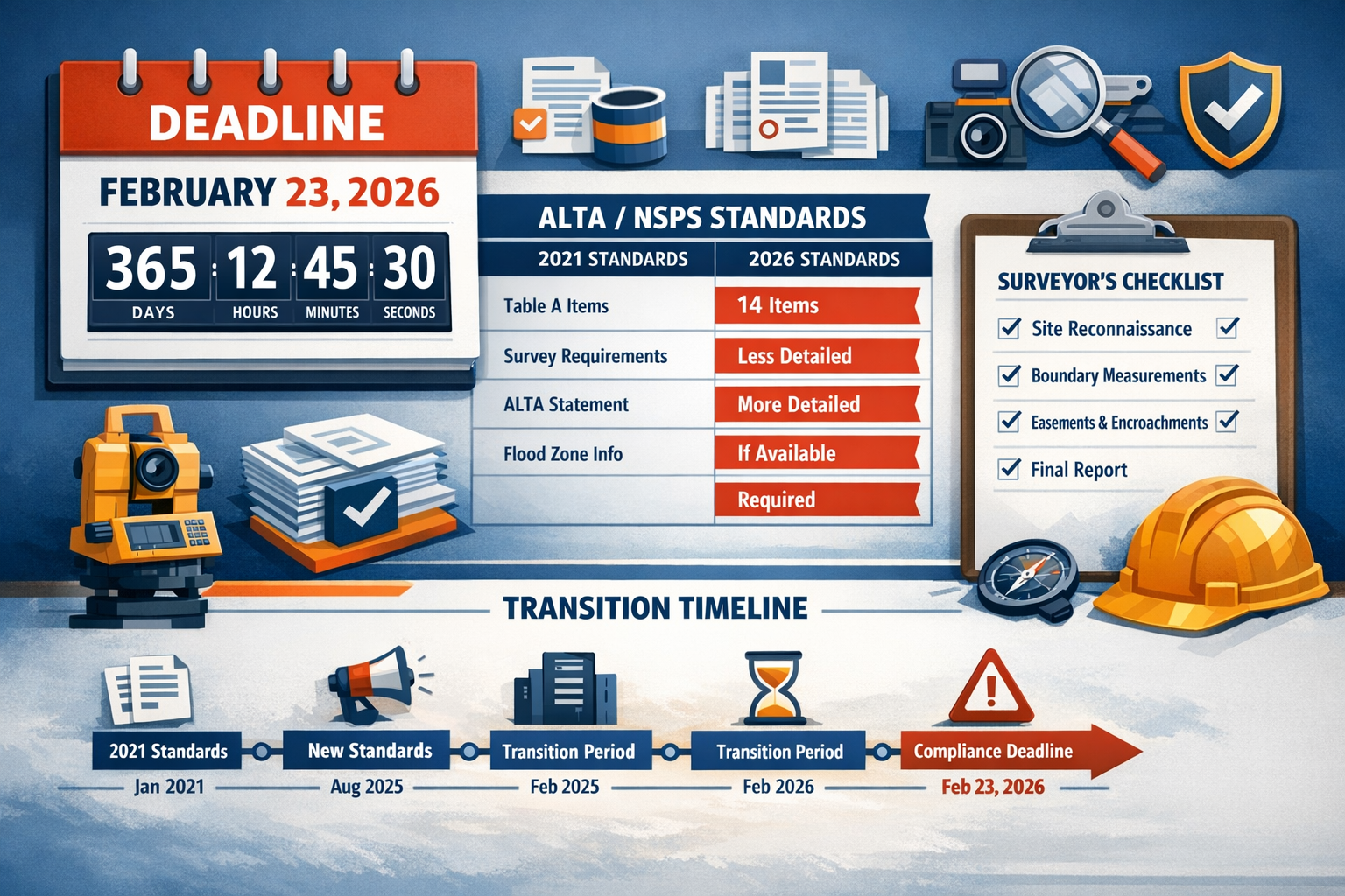
The Hard Deadline Approach
Unlike some regulatory updates that allow phased implementation or grandfather existing projects, the 2026 ALTA/NSPS standards take a firm stance on compliance timing. Any survey work that begins on or after February 23, 2026 must adhere to the new standards, regardless of when preliminary discussions or contracts were initiated[1][3].
This approach eliminates confusion but creates urgency for surveying firms. If a contract to perform a Land Title Survey is executed on or after the February 23, 2026 deadline, the survey must be performed pursuant to the 2026 Standards[4]. There are no exceptions for projects "in the pipeline" or contracts negotiated under the 2021 framework.
What "Survey Begun" Actually Means
The critical question for many practitioners centers on defining when a survey is "begun." According to the standards, this refers to the commencement of actual survey work—not preliminary consultations, proposal submissions, or contract negotiations. The key trigger is when field work or substantive technical analysis begins[2][4].
For commercial property surveyors managing multiple projects simultaneously, this creates a clear dividing line. Projects with field work initiated before February 23, 2026 may continue under the 2021 standards, while those beginning field operations on or after that date must immediately adopt the 2026 requirements.
The "No True Update" Principle
One of the most significant conceptual shifts in the 2026 standards involves how the industry approaches survey updates. The new framework explicitly states that there is no such thing as a true "update" under the standards—any update is considered a new survey because the surveyor certifies current conditions and compliance with current requirements[4].
This principle has profound implications for ongoing projects and properties requiring periodic resurveys. A survey completed under the 2021 standards cannot simply be "updated" with minor revisions after February 23, 2026. Instead, any new certification requires full compliance with the 2026 standards, effectively treating it as an entirely new survey product.
Transition Planning Checklist
To ensure seamless compliance with the February 23, 2026 deadline, surveying firms should implement the following transition steps:
✅ Inventory all active projects and determine which will begin field work before vs. after the deadline
✅ Update standard operating procedures to reflect new transparency and documentation requirements
✅ Train all field and office staff on the specific changes in the 2026 standards
✅ Revise client communication templates to explain new requirements and potential impacts on deliverables
✅ Update proposal and contract language to reference the 2026 standards for applicable projects
✅ Review technology capabilities for aerial/satellite imagery integration and RPP calculations
✅ Establish quality control protocols specific to the enhanced documentation requirements
Key Changes in the 2026 ALTA/NSPS Land Title Survey Updates
Enhanced Transparency Requirements 📋
Perhaps the most pervasive change throughout the 2026 standards involves mandatory explanations for professional decisions that were previously left to implied understanding. Surveyors must now provide explicit documentation for several categories of decisions[5]:
New Legal Description Creation: When a surveyor creates a new legal description rather than relying on existing record descriptions, the survey must now include a clear explanation of why this was necessary. This might involve inadequacies in the original description, conflicts with physical evidence, or ambiguities that required resolution.
Measurement Discrepancies: When field measurements differ from record dimensions, surveyors must document not only the discrepancy but also the likely causes and their professional interpretation of which measurements should control.
Access Limitations: If certain portions of the property couldn't be physically accessed during the survey, the 2026 standards require explicit notation of what areas were inaccessible, why access was denied or impractical, and what alternative methods were used to survey those areas.
This enhanced transparency serves multiple purposes. It protects surveyors by creating a clear record of professional judgment, assists title companies in identifying potential issues, and helps lenders understand the limitations and assumptions underlying the survey certification.
Expanded Use of Aerial and Satellite Imagery 🛰️
The 2026 standards represent a significant modernization in their acceptance of remote sensing technology as a supplement to traditional ground surveying methods. The new framework provides greater acceptance of using aerial or satellite imagery instead of ground surveying for certain features, with specific limitations and written agreement requirements[3][4].
Permitted Applications: Aerial and satellite imagery may now be used for:
- Identifying improvements on adjacent properties
- Locating certain easements and rights-of-way
- Mapping topographic features in inaccessible areas
- Documenting site conditions in environmentally sensitive zones
Required Safeguards: However, this expanded acceptance comes with important limitations:
- Written agreement from the client, lender, and title insurer is required before relying on aerial/satellite imagery for critical features
- The surveyor must document the resolution and date of the imagery used
- Ground control verification is still required for boundary-critical features
- The survey must clearly distinguish between features located through traditional methods versus remote sensing
For structural surveys and other specialized applications, this technology integration can significantly reduce field time while maintaining accuracy standards, particularly for large commercial properties or sites with access challenges.
Lender Certification Expansion
The 2026 standards introduce an important change in how surveys can be certified to lending institutions. Surveys may now be certified to a lender's successors and assigns if requested, broadening the chain of reliance beyond the original commissioning lender[3].
This change reflects the modern reality of commercial real estate financing, where loans are frequently sold, securitized, or transferred among financial institutions. Under the 2021 standards, such transfers often required new survey certifications or endorsements. The 2026 framework streamlines this process by allowing the original certification to extend to subsequent holders of the loan, provided this was specified in the initial engagement.
Practical Implications:
- Reduces the need for recertification when loans are sold or transferred
- Provides greater certainty for secondary market transactions
- May increase surveyor liability exposure to unknown future parties
- Requires careful consideration of professional liability insurance coverage
Deletion of Adjoining Deed Requirement
In a practical acknowledgment of market realities, the 2026 standards have removed the former requirement to provide copies of adjoining deeds. This requirement proved impractical in many markets where accessing neighboring property deeds was difficult, time-consuming, or impossible[3].
The deletion recognizes that:
- Many jurisdictions have limited public access to deed records
- The requirement created significant delays in survey completion
- The value provided often didn't justify the effort required
- Modern title insurance practices had evolved beyond this need
However, surveyors should note that while providing adjoining deeds is no longer mandatory, investigating adjoining property boundaries and potential conflicts remains a critical component of professional practice.
Parol Statement Documentation
The 2026 standards introduce a new requirement for surveyors to document parol statements made by interested landowners or occupants regarding title or boundary issues relating to the property[3]. This represents a significant expansion of the surveyor's role in gathering and preserving evidence that might affect property rights.
What Constitutes a Parol Statement: Oral assertions by property owners, tenants, or other interested parties regarding:
- Claimed boundary locations different from record or physical evidence
- Assertions of prescriptive rights or adverse possession
- Claims of easements or access rights not shown in title records
- Disputes with neighboring property owners
- Historical use patterns affecting property rights
Documentation Requirements: When such statements are made, the surveyor must:
- Record the statement in the survey notes
- Identify the person making the statement and their relationship to the property
- Note the date and context of the statement
- Indicate whether the statement conflicts with physical or record evidence
- Refrain from legal conclusions about the validity of the claim
This requirement protects all parties by creating a contemporaneous record of potential title issues that might not appear in formal records. For local chartered surveyors familiar with their market areas, this documentation may capture valuable local knowledge about property disputes or historical use patterns.
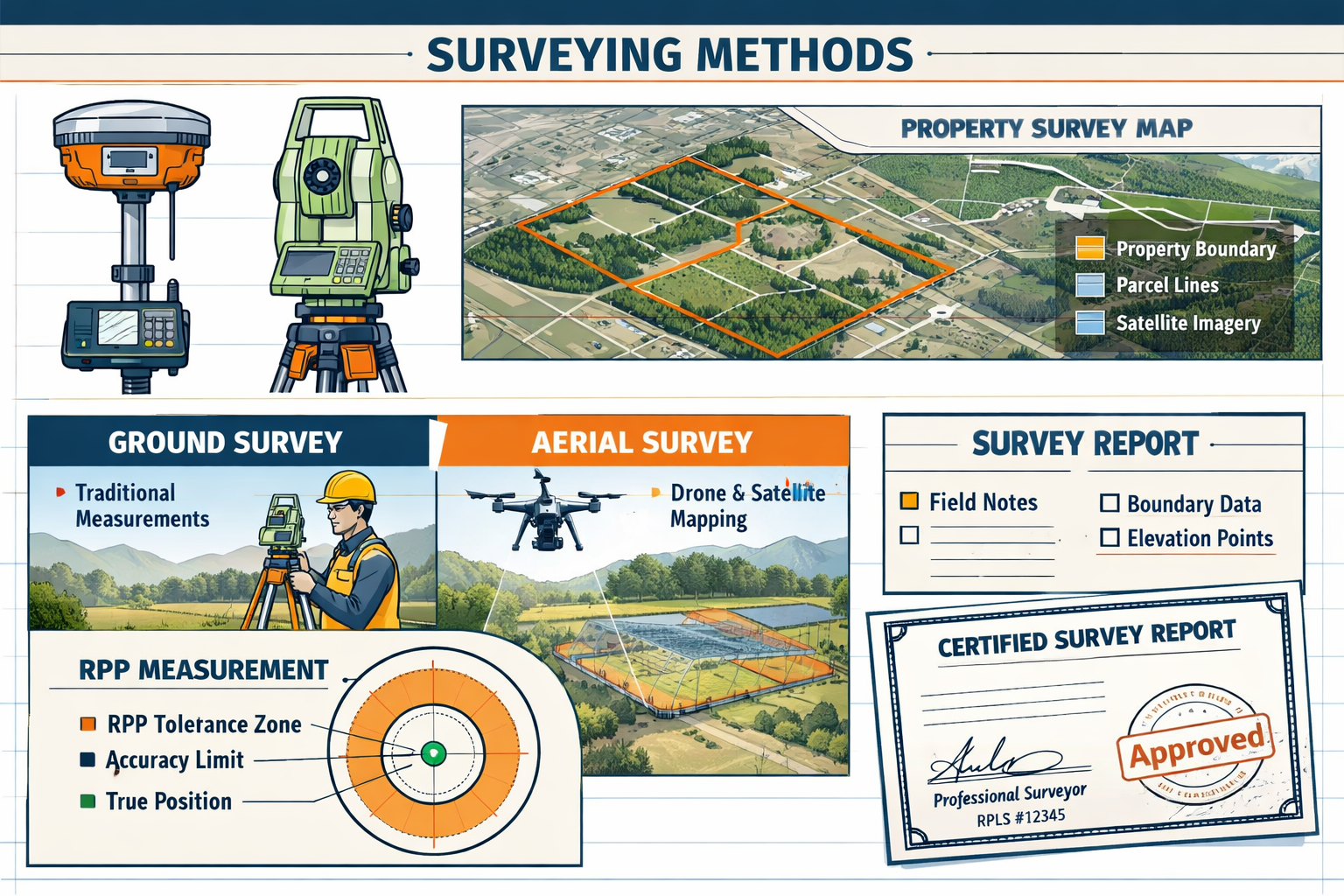
Relative Positional Precision (RPP) Refinements and Technical Standards
Understanding RPP in the 2026 Framework
The 2026 update significantly expands the explanation of Relative Positional Precision (RPP), providing clearer guidance on how this critical measurement standard should be calculated and applied[5]. RPP represents the uncertainty in the position of one point relative to another point on a survey, expressed as a distance at a 95% confidence level.
Key RPP Principles in 2026:
| Aspect | 2021 Standard | 2026 Enhancement |
|---|---|---|
| Calculation Method | Basic guidance provided | Detailed methodology with examples |
| Reporting Requirements | RPP value stated | RPP value plus explanation of how achieved |
| Boundary Corners | Standard precision required | Precision requirements with context for interpretation |
| Equipment Standards | Implied capabilities | Explicit equipment and methodology documentation |
Precision vs. Accuracy: A Critical Distinction
One of the most important clarifications in the 2026 standards emphasizes that precision alone doesn't guarantee correctness—proper boundary interpretation remains critical[5]. A survey can achieve excellent RPP values (high precision) while still incorrectly locating property boundaries if the surveyor misinterprets legal descriptions, overlooks senior rights, or fails to properly analyze conflicting evidence.
This distinction matters because:
- Precision measures the consistency and repeatability of measurements
- Accuracy measures how close measurements are to the true value
- Correctness requires proper legal interpretation combined with precise measurements
The 2026 standards explicitly acknowledge that a surveyor might achieve 0.07-foot RPP (very high precision) while still placing a boundary monument in the wrong location due to legal interpretation errors. The enhanced standards require surveyors to document not just their measurement precision but also their interpretive process.
Strengthened Legal Defensibility
Enhanced precision standards help ensure measurements are accurate and legally defensible if boundary locations are contested[5]. This legal defensibility stems from several factors:
📊 Documented Methodology: The 2026 standards require clearer documentation of how measurements were obtained, what equipment was used, and how uncertainties were calculated.
⚖️ Transparent Assumptions: Surveyors must now explicitly state assumptions made during boundary interpretation, making it easier for courts or arbitrators to evaluate the surveyor's reasoning.
🔍 Traceable Evidence: The enhanced documentation requirements create a clear chain of evidence from field measurements through final boundary determinations.
For professionals involved in commercial building surveys or complex property transactions, this legal defensibility provides crucial protection when boundary disputes arise years after the original survey.
Practical RPP Implementation
Achieving compliance with the refined RPP standards requires attention to several practical elements:
Equipment Calibration: Regular calibration and documentation of all surveying instruments, with records maintained as part of the survey file.
Methodology Selection: Choosing appropriate surveying methods for the required precision level, whether GPS, total station, or other technologies.
Error Budget Analysis: Calculating how various error sources (instrument error, centering error, atmospheric conditions, etc.) combine to affect overall precision.
Quality Control Checks: Implementing redundant measurements and independent verification of critical points to confirm precision targets are met.
Documentation, Easements, and Encroachment Requirements
More Robust Documentation Standards
The 2026 update significantly strengthens how surveys handle easements, utilities, access, and encroachments, requiring more notes, more observations, and greater distinctions between documented information and physical evidence found on site[5]. This enhanced documentation serves multiple stakeholders:
For Title Companies: Clearer identification of potential title issues and encumbrances that might affect insurability.
For Lenders: Better understanding of property access, utility availability, and potential encroachment risks that could affect collateral value.
For Property Owners: Comprehensive documentation of all rights, restrictions, and physical conditions affecting property use.
Easement Documentation Requirements
The 2026 standards require surveyors to provide much more detailed information about easements affecting the surveyed property:
Recorded Easements:
- Complete legal description of the easement area
- Recording information (book, page, instrument number)
- Purpose of the easement (utility, access, drainage, etc.)
- Benefited and burdened properties
- Width and location relative to property boundaries
- Any restrictions or limitations in the easement grant
Physical Evidence of Easements:
- Visible utility lines, pipes, or infrastructure within easement areas
- Access roads or driveways serving easement purposes
- Discrepancies between recorded easement locations and physical improvements
- Evidence of easement use beyond recorded rights
Unrecorded Easements or Apparent Rights:
- Visible access routes across the property
- Utility infrastructure without corresponding recorded easements
- Evidence of prescriptive use by neighboring properties
- Parol claims of easement rights by interested parties
This comprehensive approach helps identify potential conflicts before they become legal disputes. For instance, a drainage survey might reveal utility infrastructure that doesn't match recorded easement locations, alerting the title company to a potential gap in coverage.
Utility Location and Documentation
The 2026 standards place greater emphasis on documenting the location and nature of utilities affecting the property:
🔌 Above-Ground Utilities:
- Overhead power lines and support structures
- Telecommunications cables and equipment
- Transformers, junction boxes, and other apparatus
- Clearance measurements to structures
🔧 Underground Utilities:
- Results of utility locate services
- Visible evidence of underground infrastructure (manholes, valve boxes, meters)
- Notation of utilities that couldn't be located
- Disclaimers regarding unmarked or unknown underground features
⚠️ Utility Conflicts:
- Utilities crossing property boundaries
- Utilities located outside recorded easement areas
- Utilities that may interfere with proposed development
- Access limitations created by utility infrastructure
Encroachment Identification and Reporting
Encroachments—where improvements cross property boundaries—represent one of the most common and consequential issues identified in land title surveys. The 2026 standards require more detailed documentation of encroachments in both directions:
Encroachments onto the Surveyed Property:
- Precise measurements of the encroaching improvement
- Type of improvement (fence, building, driveway, landscaping, etc.)
- Estimated age and permanence of the encroachment
- Whether the encroachment appears to be intentional or inadvertent
- Potential for prescriptive rights based on visible evidence
Encroachments from the Surveyed Property:
- Improvements on the surveyed property that extend beyond boundary lines
- Measurements showing the extent of the encroachment
- Affected neighboring properties
- Potential title or use implications
Documentation Best Practices:
- Photographs of significant encroachments
- Measurements from multiple reference points
- Notes regarding discussions with property owners about encroachments
- Recommendations for legal resolution (easement agreements, boundary adjustments, etc.)
For specific defect reports and other specialized surveys, this level of encroachment documentation helps property owners understand and address potential legal issues before they escalate.
Access Rights and Limitations
The 2026 standards require explicit documentation of property access conditions:
Legal Access:
- Deeded access rights from public roads
- Recorded easements providing access
- Adequacy of legal access for intended property use
- Restrictions or limitations on access rights
Physical Access:
- Actual routes used to access the property
- Condition and adequacy of access routes
- Discrepancies between legal and physical access
- Seasonal or weather-related access limitations
Access Deficiencies:
- Properties lacking adequate legal access (landlocked parcels)
- Access routes crossing third-party properties without recorded easements
- Physical barriers preventing use of legal access rights
- Recommendations for obtaining or improving access
Compliance Implementation: Practical Steps for Surveyors
Updating Standard Operating Procedures
Successful compliance with the 2026 ALTA/NSPS Land Title Survey Updates: Essential Changes and Compliance Guide for Surveyors requires systematic updates to firm-wide procedures. These updates should address every phase of the survey process:
Pre-Survey Phase:
- Client intake forms updated to address aerial/satellite imagery authorization
- Engagement letters revised to reference 2026 standards
- Scope of work templates modified to reflect enhanced documentation requirements
- Fee structures adjusted to account for increased documentation time
Field Work Phase:
- Field note templates expanded to capture parol statements
- Equipment calibration logs enhanced for RPP documentation
- Photography protocols updated for encroachment and easement documentation
- Utility locate procedures strengthened with clearer documentation requirements
Office Processing Phase:
- CAD standards updated to distinguish recorded vs. observed features
- Quality control checklists expanded to verify all 2026 requirements
- Legal description review procedures enhanced for transparency requirements
- Certification language updated to reflect new lender succession provisions
Delivery Phase:
- Cover letter templates revised to explain new documentation elements
- Client education materials created to address 2026 changes
- Follow-up procedures established for addressing client questions
- Archive protocols updated to maintain 2026-compliant records
Staff Training and Education
Implementing the 2026 standards successfully requires comprehensive staff training at all levels:
Field Crew Training:
- Recognition and documentation of parol statements
- Enhanced note-taking for easement and encroachment observations
- Proper use of aerial/satellite imagery in field verification
- Understanding of access limitation documentation requirements
Office Staff Training:
- Interpretation of enhanced field documentation
- Proper CAD representation of recorded vs. observed features
- Calculation and reporting of RPP values
- Quality control procedures for 2026 compliance verification
Professional Surveyor Training:
- Legal implications of enhanced transparency requirements
- Risk management considerations in expanded lender certifications
- Professional judgment documentation best practices
- Boundary interpretation in the context of precision vs. accuracy
Many professional organizations offer continuing education courses specifically addressing the 2026 updates. Firms should budget for both initial training and ongoing education as interpretation of the standards evolves through practice.
Technology and Software Updates
Compliance with the 2026 standards may require technology investments in several areas:
Survey Software: CAD and survey processing software must be updated or configured to:
- Generate proper symbology for recorded vs. observed features
- Calculate and report RPP values according to 2026 methodology
- Produce compliant certification language with lender succession provisions
- Create comprehensive notes and legends meeting documentation requirements
Aerial/Satellite Imagery: Firms choosing to utilize expanded remote sensing capabilities need:
- Access to high-resolution aerial and satellite imagery sources
- Software for georeferencing and integrating imagery with survey data
- Protocols for documenting imagery resolution, date, and source
- Client authorization tracking systems for imagery use
Data Management: Enhanced documentation requirements demand:
- Robust file management systems for maintaining comprehensive project records
- Secure storage for parol statement documentation and client communications
- Version control systems to track changes and maintain compliance documentation
- Long-term archive solutions meeting professional liability requirements
Quality Control and Peer Review
The enhanced complexity of the 2026 standards makes quality control more critical than ever:
Multi-Level Review Process:
- Field crew self-check: Verification that all required observations were made and documented
- Office processing review: Confirmation that field data was properly interpreted and represented
- Professional surveyor review: Evaluation of legal interpretations and professional judgments
- Final quality control: Independent verification of 2026 compliance before delivery
Compliance Checklists: Firms should develop detailed checklists addressing each element of the 2026 standards:
✅ All boundary corners have documented RPP values
✅ Methodology for achieving RPP is explained
✅ Any new legal description includes explanation of why created
✅ Measurement discrepancies are documented with explanations
✅ Access limitations are explicitly noted
✅ Parol statements are properly documented
✅ Easements show both recorded information and physical evidence
✅ Utilities are documented with appropriate disclaimers
✅ Encroachments are measured and described in detail
✅ Aerial/satellite imagery use has required authorizations
✅ Certification language is appropriate for 2026 standards
Client Communication Strategies
Effective communication with clients about the 2026 changes helps manage expectations and avoid disputes:
Initial Engagement:
- Explain how 2026 standards differ from previous surveys client may have received
- Discuss potential impacts on timeline and cost
- Obtain necessary authorizations for aerial/satellite imagery use
- Set expectations for enhanced documentation in deliverables
During Survey Process:
- Promptly communicate any parol statements or unexpected findings
- Discuss access limitations and alternative approaches
- Explain significant measurement discrepancies or interpretation challenges
- Coordinate with title companies and lenders on emerging issues
Delivery and Follow-Up:
- Provide clear explanations of new documentation elements
- Offer to discuss findings with client, lender, and title company together
- Address questions about enhanced transparency disclosures
- Maintain open communication for any post-delivery issues
For professionals seeking to understand how these changes affect overall project costs, reviewing surveyor pricing guides can provide helpful context for budgeting 2026-compliant surveys.
Risk Management and Professional Liability Considerations
Expanded Liability Exposure
The 2026 standards create both opportunities and risks for surveying professionals:
Increased Protection Through Documentation: Enhanced transparency and documentation requirements create clearer records of professional judgment, potentially making it easier to defend decisions if challenged.
Broader Certification Scope: The ability to certify to lenders' successors and assigns expands the pool of potential claimants who might rely on the survey, increasing liability exposure.
Higher Expectations: More detailed standards may create higher expectations for survey thoroughness, making it more difficult to defend omissions or oversights.
Parol Statement Risks: Documenting parol statements creates a record that might be used in future litigation, requiring careful attention to how such statements are characterized.
Professional Liability Insurance Review
Surveyors should review their professional liability insurance in light of the 2026 changes:
Coverage Adequacy: Ensure policy limits are sufficient given expanded certification scope and increased documentation requirements.
Policy Exclusions: Verify that coverage extends to claims arising from:
- Aerial/satellite imagery interpretation
- Parol statement documentation
- Certifications to lender successors and assigns
- Enhanced transparency disclosures
Retroactive Date: Understand how the policy handles surveys completed under different standards over time.
Claims Reporting: Clarify procedures for reporting potential claims arising from 2026-compliant surveys.
Best Practices for Risk Mitigation
Implementing these risk management practices helps protect surveyors under the 2026 framework:
🛡️ Clear Engagement Letters: Explicitly define scope, limitations, and applicable standards in every engagement letter.
🛡️ Thorough Documentation: Maintain comprehensive records of all field observations, client communications, and professional judgments.
🛡️ Appropriate Disclaimers: Use clear, specific disclaimers for areas of uncertainty while avoiding overly broad disclaimers that might undermine the survey's value.
🛡️ Timely Communication: Promptly notify clients, lenders, and title companies of significant findings or limitations.
🛡️ Continuing Education: Stay current on evolving interpretations of the 2026 standards through professional development.
🛡️ Peer Consultation: Seek input from experienced colleagues on challenging interpretations or unusual situations.
Impact on Commercial Real Estate Transactions
Title Insurance Implications
The 2026 standards significantly affect how title insurance companies evaluate and underwrite policies:
Enhanced Due Diligence: More detailed survey documentation provides title companies with better information for identifying potential exceptions and exclusions.
Encroachment Coverage: Clearer encroachment documentation helps title insurers assess risk and determine appropriate coverage or exceptions.
Easement Analysis: Detailed easement documentation, including physical evidence, helps identify potential gaps between recorded rights and actual use.
Access Issues: Explicit documentation of access rights and limitations allows title companies to properly evaluate and disclose access risks.
Lender Requirements and Underwriting
Commercial lenders benefit from the 2026 standards through improved risk assessment:
Collateral Evaluation: Enhanced documentation of encroachments, easements, and access provides better understanding of collateral value and marketability.
Environmental Considerations: More detailed site documentation may reveal environmental concerns affecting property value or use.
Development Feasibility: Comprehensive utility and easement documentation helps assess feasibility of proposed improvements.
Successor Protection: The ability to certify to successors and assigns provides greater certainty for loan sales and securitization.
Transaction Timeline Considerations
The enhanced requirements of the 2026 standards may affect transaction timelines:
Longer Survey Periods: Increased documentation requirements may extend the time needed to complete surveys, particularly for complex commercial properties.
Additional Coordination: Requirements for aerial/satellite imagery authorization and parol statement documentation may require additional coordination among transaction parties.
Quality Control Time: Enhanced quality control procedures to ensure 2026 compliance may add time to the survey process.
Resolution of Issues: More detailed documentation may identify issues requiring resolution before closing, potentially extending transaction timelines.
Transaction participants should account for these potential timeline impacts when structuring deal schedules and contingency periods. Understanding how long surveys take helps set realistic expectations.
Frequently Asked Questions About the 2026 Updates
Can surveys started under 2021 standards be completed under those standards after February 23, 2026?
Yes, if the survey work was actually begun before February 23, 2026, it may be completed under the 2021 standards. The key factor is when field work commenced, not when the contract was signed or when the survey is delivered[1][4].
Do existing surveys need to be redone to comply with 2026 standards?
No, surveys completed under previous standards remain valid for their original purpose. However, if a new certification is required or the survey needs to be "updated," the 2026 standards treat this as a new survey requiring full compliance with current requirements[4].
How do the 2026 standards affect survey costs?
Enhanced documentation requirements, expanded quality control procedures, and additional coordination for aerial/satellite imagery authorization may increase survey costs compared to 2021-compliant surveys. However, the expanded use of remote sensing technology may reduce costs for certain property types. For detailed cost information, consult structural survey pricing guides.
What happens if aerial/satellite imagery reveals discrepancies with ground conditions?
When aerial or satellite imagery shows features that differ from ground observations, the surveyor must document the discrepancy and explain which source was relied upon for the final survey. Ground verification typically controls for boundary-critical features[3][4].
Are there penalties for non-compliance with the 2026 standards?
While there are no statutory penalties, professional liability for non-compliance could include negligence claims, professional discipline, title insurance claims, and lender disputes. Compliance is essential for maintaining professional standards and avoiding liability.
How should surveyors handle parol statements that conflict with record evidence?
Parol statements should be documented without legal conclusions. The surveyor notes what was said, by whom, and when, while indicating whether it conflicts with physical or record evidence. The surveyor should not opine on the legal validity of the claim[3].
Conclusion: Preparing for Success Under the 2026 Standards
The 2026 ALTA/NSPS Land Title Survey Updates: Essential Changes and Compliance Guide for Surveyors represents a significant evolution in professional standards, emphasizing transparency, precision, and comprehensive documentation. While these enhanced requirements demand adjustments to established practices, they ultimately strengthen the profession by providing clearer guidance, better protecting surveyors through thorough documentation, and delivering more valuable information to clients, lenders, and title companies.
The February 23, 2026 deadline is not merely a compliance milestone—it's an opportunity for surveying professionals to demonstrate their commitment to excellence and adapt to the evolving needs of commercial real estate transactions. Success requires proactive preparation across multiple dimensions: updating standard operating procedures, training staff, investing in appropriate technology, refining quality control processes, and communicating effectively with clients and transaction partners.
Actionable Next Steps for Surveyors
To ensure seamless compliance with the 2026 standards, take these immediate actions:
1️⃣ Conduct a comprehensive gap analysis comparing your current procedures against the 2026 requirements to identify areas needing adjustment
2️⃣ Develop and implement updated standard operating procedures addressing all phases of the survey process from client intake through delivery
3️⃣ Schedule comprehensive staff training for field crews, office personnel, and professional surveyors on the specific changes in the 2026 standards
4️⃣ Review and update technology infrastructure to support aerial/satellite imagery integration, RPP calculations, and enhanced documentation requirements
5️⃣ Revise all client-facing documents including engagement letters, proposals, and delivery templates to reference the 2026 standards
6️⃣ Establish enhanced quality control protocols with detailed checklists ensuring every 2026 requirement is addressed before survey delivery
7️⃣ Consult with professional liability insurance providers to ensure adequate coverage for expanded certification scope and new documentation requirements
8️⃣ Create client education materials explaining how the 2026 standards enhance survey value and may affect timelines and costs
The surveying profession has successfully navigated previous standard updates, and the 2026 changes continue the industry's evolution toward greater precision, transparency, and professional excellence. By embracing these updates and implementing them thoughtfully, surveyors position themselves as trusted advisors in increasingly complex commercial real estate transactions.
For additional guidance on implementing these changes or assistance with complex survey projects, consider consulting with choosing the right property survey professionals who understand both the technical and practical implications of the 2026 standards.
The future of land title surveying is built on the foundation of these enhanced standards. Those who invest in compliance today will be best positioned to serve clients effectively and maintain professional excellence for years to come.
References
[1] 20251125 Key Updates To The 2026 Altansps Land Title Survey Standards – https://www.alta.org/news-and-publications/news/20251125-Key-Updates-to-the-2026-ALTANSPS-Land-Title-Survey-Standards
[2] New 2026 Minimum Standard Detail 3684174 – https://www.jdsupra.com/legalnews/new-2026-minimum-standard-detail-3684174/
[3] Nsps Land Title – https://www.parkerpoe.com/news/2026/02/key-takeaways-from-the-2026-alta/nsps-land-title
[4] The 2026 Minimum Standard Detail Requirements For Alta Nsps Land Title Surveys – https://amerisurv.com/2026/02/01/the-2026-minimum-standard-detail-requirements-for-alta-nsps-land-title-surveys/
[5] Understanding The 2026 Alta Nsps Land Survey Standards Whats New And Why It Matters – https://millmanland.com/company-news/understanding-the-2026-alta-nsps-land-survey-standards-whats-new-and-why-it-matters/
[6] What 2026 Alta Nsps Updates Mean For Cre Professionals – https://www.partneresi.com/resources/articles/what-2026-alta-nsps-updates-mean-for-cre-professionals/
[7] Alta Standards Updated – https://cretelligent.com/alta-standards-updated/
[8] What The 2026 Altansps Updates Mean For Cre Professionals – https://www.globest.com/2025/12/22/what-the-2026-altansps-updates-mean-for-cre-professionals/